

Radar and Satellite showing system(s)
If you head over to the Satellites page you’ll find links to the updated Satellite and Radar pictures. They’ll be good ones to watch over the next 48 hours as these two events unfold. Here’s the picture as of now (5:24PM PST) as moisture starts to reach the Island.
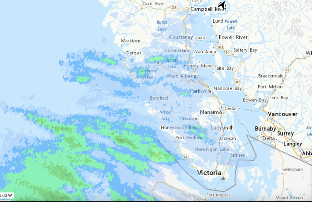
I wouldn’t be surprised if even Tofino and Ucluelet see some snow later tonight as precipitation rates pick up but we should see it across the rest of the Island from the outset. It should be snowing across the entire Island by 9PM.
Model Picture for Wednesday
Today’s UWash model was snowier than the rest for both Wednesday and Thursday. First, Wednesday.
Here is the Acculumated snowfall prediction from now until Wednesday night.


- Tofino/Ucluelet/Bamfield: 1-2cm
- Port Alberni: 5-10cm
- Nanaimo/Parksvile: 10cm
- Cowichan: 10-20cm
- Lake Cowichan/Shawnigan Lake: 20cm
- Victoria: 5-10cm
Considering this first storm is the weaker of the two, those are some pretty good totals. We’ll see what we end up with tomorrow night. Then… there is Thursday!
Thursday Storm
Timing seems to have gotten a little later with the storm reaching most of the Island by 1PM on Thursday afternoon.
It also seems to be predicting more snow than rain compared to previous runs. Notice in the picture below the rain (grey) remains quite far off the coast of the Island with snow (green) falling over the Ocean and entire Island as the storm makes landfall with strong winds. That Arctic airmass is strong.

There is a chance of Snow and Rain and Freezing Rain all mixed together between Thursday afternoon and Friday afternoon. The strongest precipitation looks to be Friday morning around 4-7AM as the switchover to rain is complete for all areas except the mountains as you can see below.

Watch for updated Warnings – Stay off the roads
Especially with the risk of Freezing Rain, please think twice before travelling over the next two days. Keep an eye on Environment Canada for updated warnings. I would not be surprised if we saw a Freezing Rain or Winter Storm warning emerge out of one or both of these storms.
The current Snowfall Warning is here or on the sidebar of this page and also on the front page.
Why the Polar Vortex
If you have questions on why we got this cold snap, check out my recent podcast. The first portion is all about our recent record breaking (or not) weather and how the jet stream can make both Heat Domes and Polar Vortex’s.
Please do like the video and subscribe to the channel!

If you want to chat with other Vancouver Island/Port Alberni weather nerds, there is also a Signal channel where a few of us hang out. Please do come and chat about the storm!
Sorry about the downtime — Mostly fixed.
Sorry about all the ups and downs on the website yesterday and today. I was having some major issues with my webhost that first killed the Data View and then caused a bunch of instability on the whole website. Things are better now but it might go down if it becomes super busy. Please refrain from using the refresh button on your browser. Most of the data will refresh automatically on its own including the Environment Canada forecasts.
Thanks, stay safe, and enjoy the white stuff! 🙂