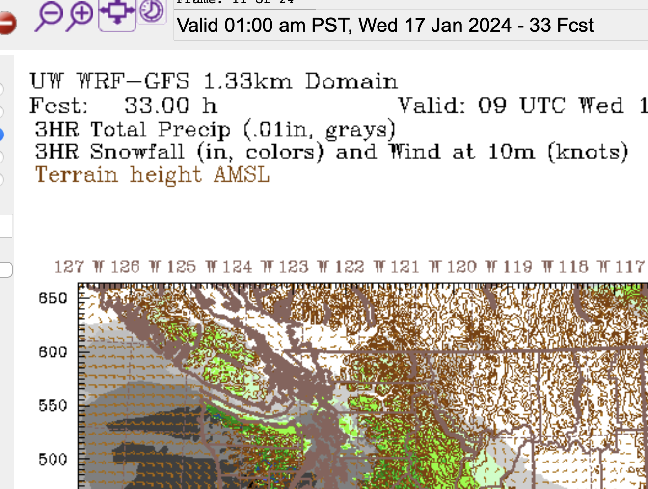
Warnings up. (Updated 12:30PM)
EC has posted warnings for most of the South Coast this morning. You can see ours for Inland sections or check out the entire range of them.
Here is the text for Inland Vancouver Island:
https://weather.gc.ca/warnings/report_e.html?bc45=Current details:
A snow storm is expected to arrive tonight.
When: Tonight to Wednesday afternoon or early evening.
Where: Metro Vancouver, Greater Victoria, Howe Sound, Whistler, Sunshine Coast, Southern Gulf Islands, East Vancouver Island, Inland Vancouver Island, Sea to Sky – Squamish to Whistler, Malahat Highway – Goldstream to Mill Bay.
Snowfall accumulations: Approximately 10 to 20 cm on the mainland side and southern Sunshine Coast and 10 cm for the Vancouver Island side and northern Sunshine Coast.
Remarks: A Pacific low pressure system is expected to bring widespread snow to the south coast tonight into Wednesday. Snow may become mixed with rain over Greater Victoria on Wednesday afternoon before easing late in the afternoon or early evening.In addition, there is a risk of freezing rain tonight in southern sections near the United States border.
Visibility may be suddenly reduced at times in heavy snow. Surfaces such as highways, roads, walkways and parking lots may become difficult to navigate due to accumulating snow.
Be prepared to adjust your driving with changing road conditions.
I still expect Port Alberni to get more snow out of the 2nd system on Thursday than the 1st on Wednesday but it looks like we’re going to get some from both for sure.
I’ll post another update this afternoon/evening when today’s model run is complete as that should give us our first high resolution look at what is to come for Thursday as well as our last look at Wednesday before the snow starts (mostly on the East cost) tonight.
Expect snow to start across most of the Island around midnight tonight.

Wednesday morning could be a very messy drive. Be safe!
