Skip to content

Alberniweather

Watching the Port Alberni Weather since 2005

Primary Menu

Alberniweather

  • Home
    • Home
    • Blog
    • Privacy Policy
    • Christmas Lights!
  • Data View
    • Data View
    • Experimental Data View (DivumWX)
  • Almanac View
    • Almanac View
    • NOAA Text Archives
      • Daily
      • Monthly
      • Yearly
    • ECCC CSV Archives
  • Webcams
  • Air Quality
  • Satellites
  • Reports – Links
    • Forecasts Models
      • University of Washington High Res Forecasts
      • SpotWx
    • Earthquakes
      • Tsunami Warning Centre Page
      • USGS Earthquake Maps
      • Earthquakes Canada
      • Port Alberni Tsunami Zone Map
    • Environment Canada
      • BC Warnings
      • Port Alberni
      • Tofino
      • Ucluelet
      • Nanaimo
      • Campbell River
      • Vancouver
      • Victoria
      • Port Hardy
      • Severe Weather Reporting Standards – Vancouver Island
    • Local Stations
      • Big Wave Dave Harbour Quay
      • Nick’s Weather (near Maquinna)
      • IslandWeather Map
      • Alberniweather
      • Alberni Elementary
      • Neptune Station (Canal Beach)
      • Maquinna Elementary
      • West Coast Staitons
        • Bamfield Marine Station
        • Wickininnish (Tofino) Community School
        • Ucluelet High School
        • Ucluelet Weather
    • Marine
      • Pacific EnvCan
      • Tides for Port Alberni
      • Washington State
      • Moon Phases
      • West Coast Light Station Reports
      • High Seas Text Forecast
      • Sea Surface Temperature Anomaly Map
    • Rivers – Fire – Smoke
      • BC Wildfire Site
      • Local Forest Fire Model Map
      • Local Venting Index
      • Air Quality Map
      • NOAA Smoke Map
      • Firesmoke.ca
      • River Forecast Centre (Snowpack and River Advisories)
      • Sproat River Gauge
      • Ash River Gauge
    • Alberniweather Data in the World
      • Alberniweather on Alexa Skills
      • Alberniweather Bot on Mastodon
      • APRS/CWOP
      • AWEKAS
      • Islandweather
      • MesoWest
      • PWSWeather
      • Weather Cloud
      • Weather Underground
      • Windy
    • BC Ferries
    • Road and Highway Conditions
    • Climate Change In Port Alberni
  • Tsunami
  • Mastodon
  • Home
  • Satellite, Radar and Model Imagery

Satellite, Radar and Model Imagery

Click for Current EC Satellite Image
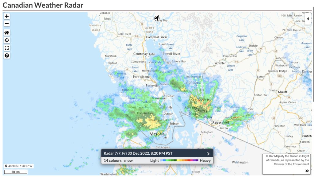
Click for Current EC Radar
(Thumbnail is not live. Placeholder with link only)
SpotWx Forecast Model
(Thumbnail is not live. Placeholder with link only)
Click for Current GOES West Satellite Loop
Click for Current GOES West Full Pacific Disk
Click for Current RGEM Model Output
(Thumbnail is not live. Placeholder with link only)

Follow Alberrniweather

Subscribe to notifications

Port Alberni Forecast

West Vancouver Island

East Vancouver Island

Current CO2 Levels

Loading @alberniweather Mastodon feed

You may have missed

  • General
  • STOD
  • Water

UPDATED 4PM – Friday – PORT ALBERNI WATER ALERT – STAGE 3 WATER RESTRICTION

March 9, 2023 Alberniweather Blog (Chris)
  • Climate Change
  • Cold
  • February
  • Fire
  • General
  • Hot
  • Snow
  • STOD
  • Storm
  • Summaries
  • Wet
  • Wind

February 2023 Summary and Winter 2022/23

March 8, 2023 Alberniweather Blog (Chris)
  • General
  • Wind

UPDATED – Back Online – Anemometer – Wind Values Offline

March 4, 2023 Alberniweather Blog (Chris)
  • Climate Change
  • Cold
  • General
  • Snow
  • Storm
  • Wet
  • Wind

“Spring” begins? Snow continues – California still the weather-bullseye.

March 2, 2023 Alberniweather Blog (Chris)
  • Cold
  • General
  • Snow
  • Storm
  • Wet
  • Wind

Windy – Snowy – Saturday and Weekend

February 24, 2023 Alberniweather Blog (Chris)
Copyright © Alberniweather All rights reserved. | CoverNews by AF themes.