
Saturday night rain may turn to snow briefly Sunday
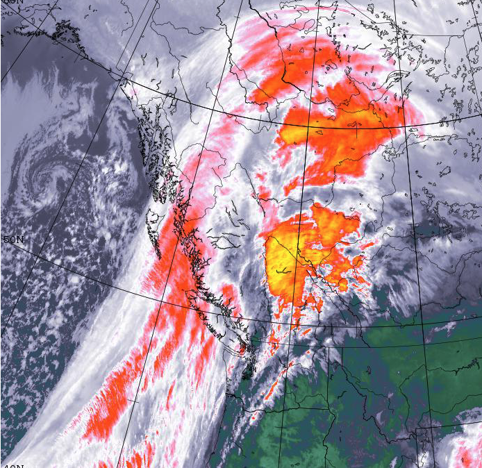
As you might have guessed from the gusty winds this afternoon, a change of weather is coming. We have a fairly strong, and strengthening front sliding down the Island from the North. Check it out on the Satellites Page.

The front is expected to push moisture down the Island. The question is how far down.
Showers, in greys and blacks below, may begin as far south as Courtenay, Port Alberni and Qualicum by 10PM tonight but it may take until early morning for them to ramp up.

The rain and showers start to really move south around sunrise Sunday morning stretching as far as Duncan.

Cooling Quickly Sunday – Possible Snow mid-morning
As the front passes, there looks to be cold air coming in quickly behind it and that is going to produce possible snow (greens and blues on the maps), again with Campbell River and Courtenay seeing it first in the morning and then it could spread as far south as Qualicum, Port Alberni and Nanaimo by noon Sunday. The progression below is from 11AM to 2PM. If you’re driving on Sunday, expect very quickly changing weather on all the highways whether you are going over the Hump, Sutton Pass, or on the Inland Island Highway especially nearly Qualicum and Buckley Bay.


Things should settle down before sundown Sunday but we might have some wet snow to deal with and it might be pretty chilly, especially if you are exposed to the Northwest breeze!
Back to warm sunny spring weather Monday
We were hoping to get up to as high as 15ºC on Monday afternoon, but that looks like it has been cut back to about 8-10ºC. Still not too bad!
Happy Daylight Saving Time, go to bed early tonight, you might need the extra sleep for a quick snowman!