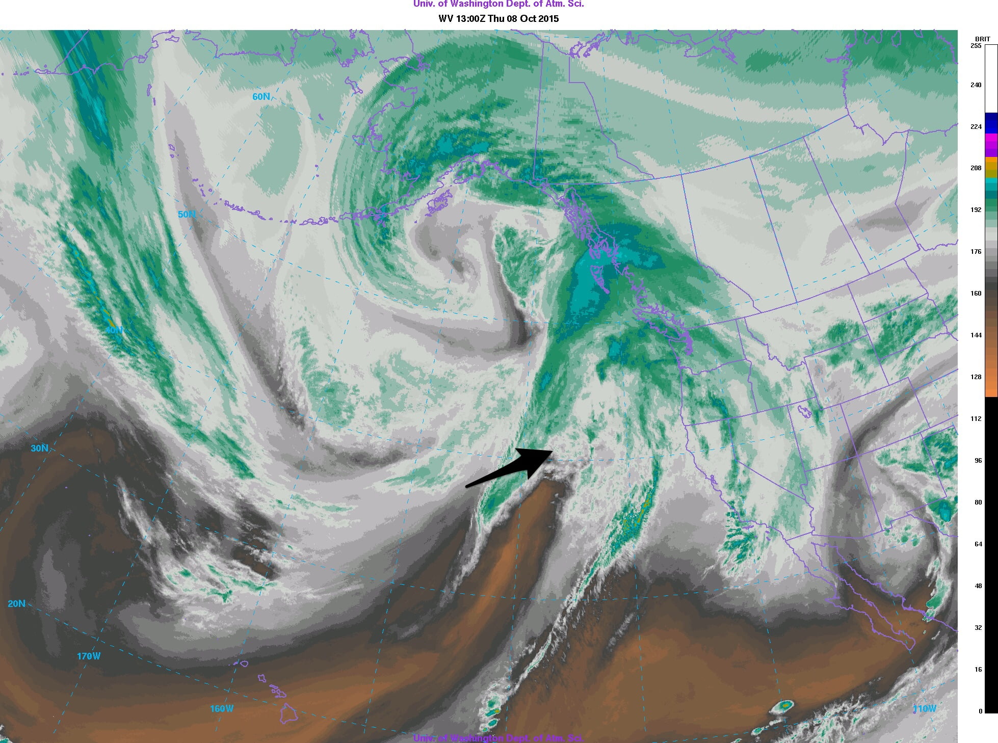
The remains of Hurricane Oho are making their way North. Judging by the latest satellite pic, I think the former “core” of the storm is currently off of northern California and heading in our general direction pretty quickly. (See the arrow) The moisture from the storm is very front end loaded and is already impacting the Central and North coast of BC. The big Gulf of Alaska low is really what is driving the bus in terms of our weather and Oho’s end of life.
The current storm track from the Central Pacific Hurricane Center for Oho below shows a more westerly and northerly route. The closest the core will come is several hundred kilometres west of the Island.
The Current Advisory states the hurricane is now transitioning from a “warm core” hurricane to a “cold core” extratropical low. However, that does not mean we will not feel some impact. That transition and its interaction with the big low in Alaska will cause the storms winds to expand in range. As a result exposed sections of northern Vancouver Island will see winds in the 90-110kph tonight and tomorrow.
We should not see anything like that, in fact UWash has the central and south Island staying dry through the day Thursday with the main force of the rain hitting north of Tofino. We might get a few showers from it.
The rain will drape south by 5AM Friday morning and be strongest in the 5-8AM period.
That will not be the end of it. The rain and showers will linger all day Friday and continue into Saturday with a stronger pulse of rain coming Saturday afternoon in the 11AM-2PM period.
That will be the last gasp for any remnants of Oho and it will dry up Saturday evening. There might be some gusty winds while that dries up,
Showers will return late Sunday and the strongest of the weekend are predicted to come Monday morning before sunrise.
This could bring us some more gusty winds but it should be very short lived as the front passes through before noon Monday. We might even see some sunny breaks in the afternoon.
Total Accumulations of rain for the Thursday to Monday afternoon period:
- UWash: 60mm
- US GFS: 65mm
- Cnd GEPS multi: 140mm
- Cdn GEM: 140mm
That is quite a split but I would personally lay my bets on the UWash/GFS predictions. I will update that list and any graphics on this page if they change significantly. Otherwise, this will be you Thanksgiving weekend forecast, hope you have a great one.


