
Category: Wind
-

SD70 and VIU Closed – Winter Storm and Freezing Rain Warnings — ENDED– Snowman Cam Live
10:15AM — ALL ADVISORIES ENDED — THE RAIN IS HERE It’s just creeping up to 1ºC (0.9ºC right now actually) but the rain has now started and is here to stay. All warnings have been lifted for the South Island. That said, the roads are still pretty messy it will take awhile for the slush…
-

UPDATED 3:30PM — Winter Storm Ongoing – New Podcast and Snowman Live Stream- Up to 20cm – Then Freezing Rain
Update 3:30PM – Alberniweather Snowman Live Stream! I just got the hardware for the 2nd webcam, so I’ve put it to immediate use in order to monitor the health of the Alberniweather Snowman. The internet is for the important things in life! 🙂 Stay safe out there. Snow will continue for many hours yet. See…
-

UPDATED 10PM WEDNESDAY — WINTER STORM WARNING
ECCC issues Winter Storm Warning I am not surprised that they have issued this for the storm on Thursday afternoon. I will have a blog Thursday morning but the main points of the warning are as I mentioned in my podcast. Significant snow 10-15cm and “an extended period of freezing rain” from Thursday night into…
-

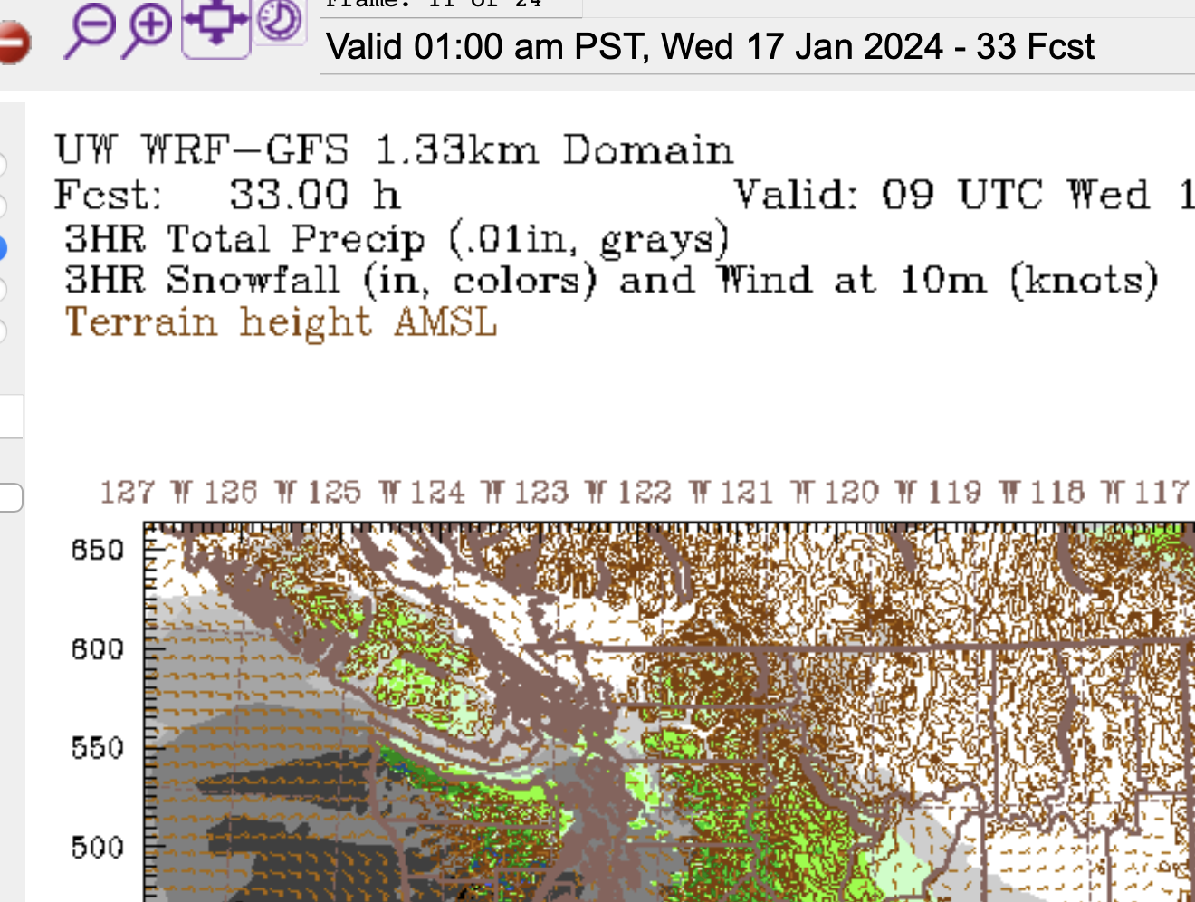
System Incoming – Heavy Snow Possible Tonight, Wednesday and Thursday Messy Mix
Radar and Satellite showing system(s) If you head over to the Satellites page you’ll find links to the updated Satellite and Radar pictures. They’ll be good ones to watch over the next 48 hours as these two events unfold. Here’s the picture as of now (5:24PM PST) as moisture starts to reach the Island. I…
-
Snowfall warnings issued – “Snow storm” expected – Freezing Rain possible as well
Warnings up. (Updated 12:30PM) EC has posted warnings for most of the South Coast this morning. You can see ours for Inland sections or check out the entire range of them. Here is the text for Inland Vancouver Island: Current details: A snow storm is expected to arrive tonight. When: Tonight to Wednesday afternoon or…