

Update 3:30PM – Alberniweather Snowman Live Stream!
I just got the hardware for the 2nd webcam, so I’ve put it to immediate use in order to monitor the health of the Alberniweather Snowman. The internet is for the important things in life! 🙂
Stay safe out there. Snow will continue for many hours yet. See the Podcast below for details and the AlberniweatherSouth Webcam for a view of the City.
Update 10:30 – It’s already been snowing for 30 minutes!
Avoid the roads after 11AM
Good morning all. If it were me, I would avoid being on the roads today. The snow and/or freezing rain will begin sometime after 11AM. It will continue for 24hrs all the way into late Friday. A Winter Storm Warning is in effect.
I will do another podcast this morning and add it to this post but I wanted to get some simple information out quickly. The Podcast is Live:
Here is the text of the Winter Storm Warning:
5:08 AM PST Thursday 18 January 2024
Winter Storm Warning in effect for:
- Inland Vancouver Island
Hazardous winter conditions are expected. Where: Inland Vancouver Island.
Time span: Near noon today through Friday morning.
Hazards: 10 to 15 cm of snow, and a prolonged period of freezing rain.
Other hazards: Gusty winds.
Remarks: A Pacific low pressure system combined with lingering cold air will produce another round of snow beginning near noon today. Snowfall amounts of 10 to 15 cm is expected before the snow transitions to freezing rain overnight. The freezing rain will continue through Friday morning and is expected to change to rain around midday Friday. Surfaces such as highways, roads, walkways and parking lots may become difficult to navigate due to accumulating snow. Surfaces such as highways, roads, walkways and parking lots may become icy and slippery. Prepare for quickly changing and deteriorating travel conditions.
Below are my predictions for when to expect the snow to start again:
Timing for start of snow (Anytime After…):
- 11AM: West Coast (Tofino-Port Renfrew)
- 12PM: The Hump, Sutton Pass, Malahat, Lake Cowichan,
- 1PM: Port Alberni, Courtenay, Cowichan, Duncan, Shawnigan Lake, Victoria
- 2PM: All Areas
Environment Canada and the UWash model are a little different on Snow. So I’m going to give my predictions based on the two.
Snow Accumulations (By Midnight Thurs/Friday):
- < 5cm: West Coast
- 5cm: Parksville, Victoria
- 15cm: Nanaimo, Saanich.
- 20cm: Port Alberni, Courtenay, Bowser, Cowichan, Shawnigan Lake
- > 20cm: Campbell River, Lake Cowichan

Switch to Freezing Rain
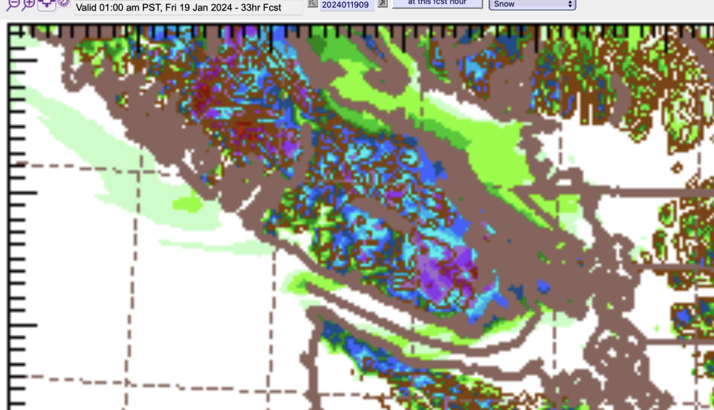
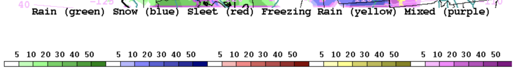
All sources are predicting Freezing Rain start immediately or at least later in the afternoon on Friday. To get an idea of that, here are some images from the UWash Model showing precipitation type. Yellow is freezing rain below, purple is mixed, green is rain and blue is snow.


I will leave it there. Stay tuned for a podcast later this morning.
Thank you for visiting!
And to keep traffic manageable on the site please remember to keep these pages open if you’d like to see the information and only hit refresh a maximum of every 5 minutes. Thanks! :+)
Here are direct links. Just leave them open in your browser or phone.
- Data View
- Almanac View
- Webcams
- Just the Alberniweather Webcam Image
- Satellites and Radar Images
- Air Quality