Category: Wet
-

Rain most likely — but watch out at higher elevation or inland — and very cold next week!?
The good news is we look to be set into long term pattern of cool, and clear, weather that is going to be quite nice… the potentially bad news is it will be punctuated every few days with a chance of rain or snow as bands of moisture invade the area periodically. The most interesting…
-

Nice sunny day gives way to fog Friday/Saturday. Sunday showers or flurries.
It was beautiful on Thursday. Alberniweather recorded a high of 12.2°C and the Airport got up to 11°C by 1PM but data after that is unavailable. The airport record for the day was 12.5°C in 1995 so there is a good chance we beat or matched that. While I am on the subject of records,…
-

January 2018 Summary – All Time High and Rain Day Records
The Summary for January 2018 Daily records set this month at the Airport* since 1995 and compared to other stations** for “All Time” since 1900. ONE new short term high temp records. FOUR new rain records.TWO All Time records, one high temp, one rain.No short term low temp records. January 17 high temp 11.2º C: NEW ALL TIME RECORDf January 21 rain 62.1 mm: NEW ALL TIME RECORDPrevious…
-

November 2017 Summary – Two All Time Rain Records!
The Summary for November 2017 Daily records set this month at the Airport* since 1995 and compared to other stations** for “All Time” since 1900. TWO new short term high temp records. FOUR new short term rain records. TWO All Time Rain records. No short term low temp records. November 1 high temp 13.1º C: #1 is 20.0º C in 1954 at Port Alberni “City”. November 13…
-

Rain Friday night. Break Saturday, then rain Sunday morning.
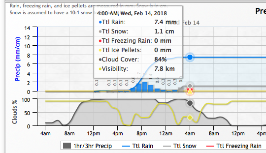
It is Groundhog day. And yes, the rain just keeps coming back. This weekend will be no different. It is going to rain overnight tonight as you can see below: However, it should dry out and maybe even clear a little Saturday morning. Rain will begin again on Saturday evening and overnight. Before clearing again…
