
Category: Storm
-
The deep freeze is about to end! But rain might be a concern.
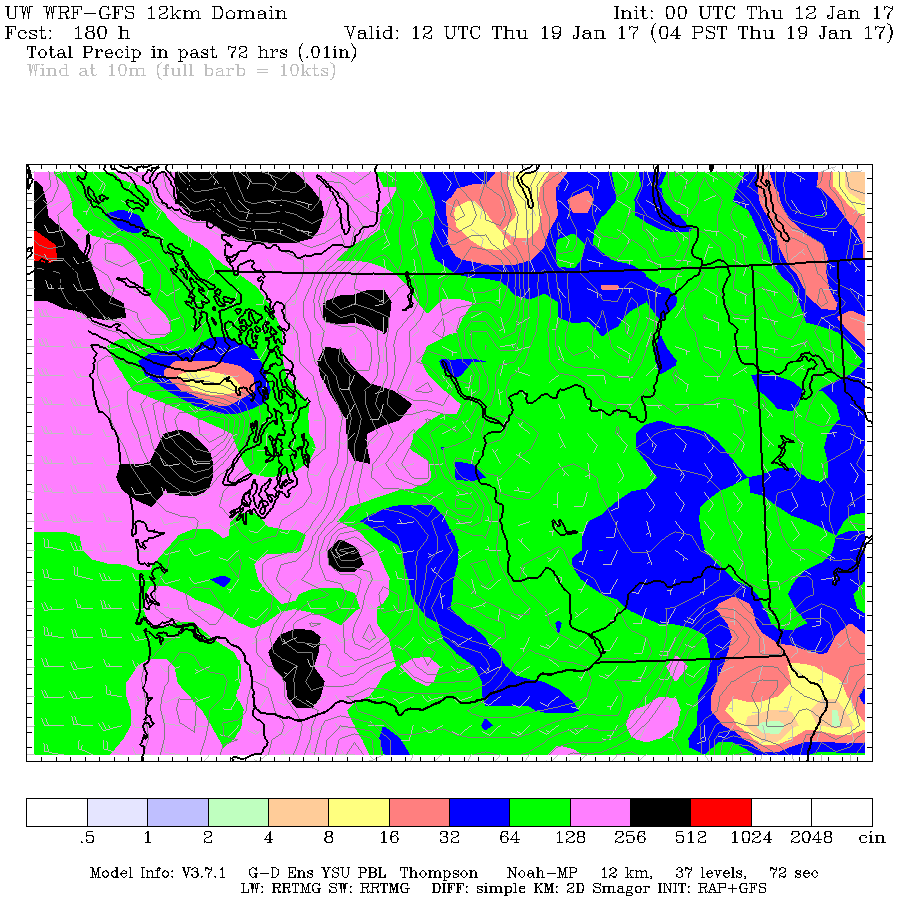
The last two days have been the coldest of the winter. We got down to -7°C earlier this morning at Alberniweather. The good news is there appears to be an end to this incredibly long cold spell. There are some minor flurries expected over the weekend. The UWash model says it is coming Saturday evening but…
-
Snowfall Warning Issued – Up to 15cm expected starting mid afternoon
Update 2PM we are now up to a moderate rain shower in town, but it is still warm. It is snowing in other parts of the Valley and especially on the East and south Island. https://twitter.com/alberniweather/status/818215822246047744 Malahat @cfax1070 @CTVNewsVI @TheQdotFM @1073KOOLFM pic.twitter.com/EHMjWmZCYb — Jason Taron (@JTaron73) January 8, 2017 Update…
-

Updated 6AM Friday — Plenty of snow in the forecast but probabilities and amounts unsure. Freezing rain possible Sunday Night.
Update 6AM Friday Update: road report: it was snowing and sticking on the west side of the hump. Snow covered. But the east side and all the way to qualicum was clear and just wet. In Parksville it is dry… 2cm on the ground and still snowing. I think EC officially wins! The heaviest precipitation…
-

Snowfall Warning Issued – 10-20cm – possible Freezing Rain
Final Update 9PM Sunday The warm winds have come. We have gone from 0°C to 4°C in less than 30 minutes and the wind has switched to the SSW. Strong winds are reported on the East side. 50-60kph at Hornby Island. Expect the Snowfall Warning to be lifted soon. Update 12PM Drizzle is starting in some…
-

Snow, Freezing Rain and Rain on the horizon plus… a surprise?
EC’s updated weather statement at 4PM Friday says As usual, snowfalls will be highly variable; current thinking is 5 to 15 cm of snow by dinner time Sunday with the higher amounts expected inland and over higher terrain. That’s up to 6 inches for the old fashioned folks! It might be very messy out there…