
Category: Cold
-
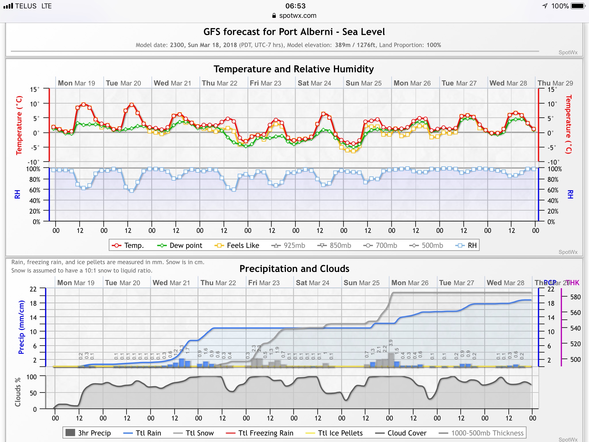
5 day Spring Break Forecast! Don’t shoot the messenger. 🙂
So I did a bit if a double take this morning when I looked at the forecast and models and saw *snow* mentioned! What I will provide below is a day by day forecast for the next 5 days so you know what might be coming. The main message though is it might not feel…
-

Light snow possible today and chance rest of week.
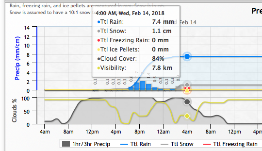
The winter weather continues. It got down to -5.3°C this morning at Alberniweather, colder at the airport. So far it has been mostly dry and quite pleasant and sunny with just a few flurries in the air, but that is changing Wednesday. All of the models predict a small amount of snow starting mid morning…
-
Ready for cold? Lows nearing -10°C Monday. Black ice likely Saturday night, East coast snow.
We have a complex weather weekend coming up as temperatures drop and moisture moves in Friday night and through Saturday. The models are in disagreement on if we get snow or rain but what they all agree on is that the cold air will drive in on Saturday evening so there is more chance for…
-
Rain most likely — but watch out at higher elevation or inland — and very cold next week!?
The good news is we look to be set into long term pattern of cool, and clear, weather that is going to be quite nice… the potentially bad news is it will be punctuated every few days with a chance of rain or snow as bands of moisture invade the area periodically. The most interesting…
-

Nice sunny day gives way to fog Friday/Saturday. Sunday showers or flurries.
It was beautiful on Thursday. Alberniweather recorded a high of 12.2°C and the Airport got up to 11°C by 1PM but data after that is unavailable. The airport record for the day was 12.5°C in 1995 so there is a good chance we beat or matched that. While I am on the subject of records,…