

CLICK HERE for Sunday Feb 13 Winter Storm 2
Roads treacherous. Snow still falling on South Island especially.
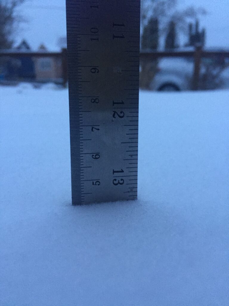
Alberniweather HQ finally woke up to real snow on the ground this morning. Light, fluffy, and even a little drifted in spots! I measured 4cm in the yard. Which is about what was predicted in the final model last night. Tweet or send your pics and I can post them here!
This snow should end for all areas by the afternoon but some places will continue into the evening. Don’t drive if you can avoid it.
Another system will come in Sunday. Whether it is is snow or rain will be the question! But for now, enjoy the winter wonderland!
previous updates below…
Snow is flying on most of the Island – Don’t Drive.
You really don’t need to go. Links to the DriveBC pages on the Webcams page.
9PM Update
UWash Model has another huge change of heart.
These two pictures are for the same time, accumulated snow, by Saturday morning but the first from the morning UWash model run and the 2nd from tonight. Wow.


Snowfall warning upgraded to Winter Storm for all areas.
Environment Canada has updated the warnings again and has now upped its snowfall totals for the South Island to as much as 30cm. Only Nanoose to Fanny Bay has only a Snowfall Warning with ‘only’ up to 20cm expected.
Here is the new warning text for all other regions of the Island.
8:11 PM PST Friday 12 February 2021
Winter storm warning in effect for:
Significant amounts of snow are expected.
Pacific moisture associated with an approaching frontal system will collide with the arctic front along Vancouver Island. Snow will be heavy at times tonight through Saturday morning and the ease Saturday afternoon.
Total snowfall accumulations of 15 to 30 cm are expected for southern Vancouver Island while Southern Gulf Islands should receive 10 to 15 cm. In addition, strong easterly winds will give areas of poor visibility in snow and blowing snow.
Surfaces such as highways, roads, walkways and parking lots may become difficult to navigate due to accumulating snow. Visibility will be suddenly reduced to near zero at times in heavy snow and blowing snow. Poor weather conditions may contribute to transportation delays.
Please continue to monitor alerts and forecasts issued by Environment Canada. To report severe weather, send an email to BCstorm@canada.ca or tweet reports using #BCStorm.
Snowfall predictions based on latest model
- Tofino: 10-15cm
- Port Alberni: 5-10cm
- Bowser/Qualicum: 10-15cm
- Courtenay/Comox, Nanaimo, Parksville, Duncan: 10-15cm
- Cowichan/Shawnigan Lake: 20-30cm
- Greater Victoria: 10-25cm
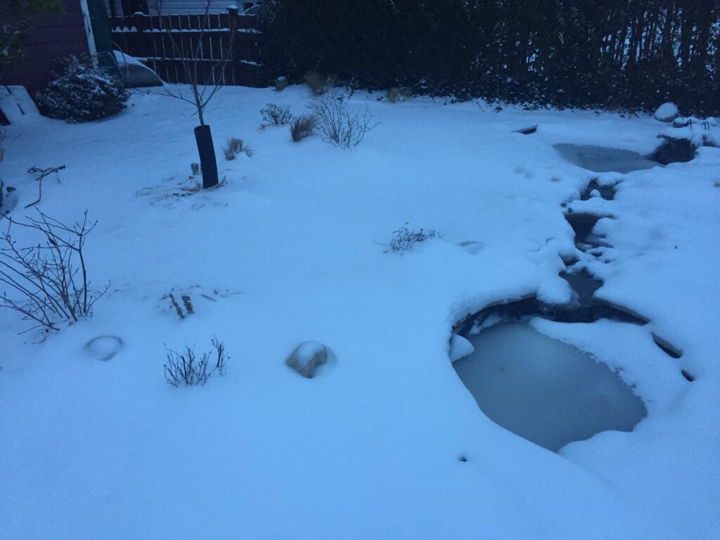
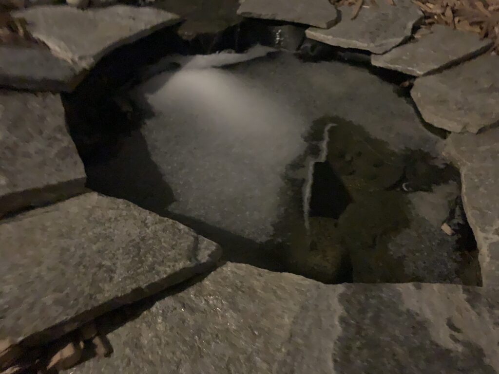
Light snow falling and sticking in Port Alberni
The ponds are the only place with snow on them at Alberniweather HQ right now. A delicate covering.
Post Update 5PM
Check the link warning image I posted at 12PM for links to all of the warnings. The last “watches” have now been pulled. There are now either Snowfall warnings, Arctic outflow warnings, or Winter Storm warnings for all areas of the Island.
You can keep an eye on the Satellites and Radar page as well as the Webcam page to see how the storm develops.
Big thanks to Rob Frolic for sending the pictures! (You can send yours by Twitter, text 250-731-7930, or email alberniweather@gmail.com)
And here’s a weather update from our neighbours to the South!
Post Update 4:30PM – Went for a Winter Bike Ride – Felt like Winter!
Post Update 12PM – Warnings issued across the Island.
All of the “Watches” – except Qualicum – that were previously on the Island have now been ended and replaced with “Warnings” of various kinds. The best thing to do is to go to the Environment Canada – BC Warnings webpage. It lists all of the warnings for all locations and you can see them all in one place.

Here is the Snowfall Warning for Port Alberni and the West Coast and South Island Winter Storm Warnings specifically:
11:33 AM PST Friday 12 February 2021
Snowfall warning in effect for:
- Inland Vancouver Island
Snowfall with total amounts of about 15 cm is expected.
Pacific moisture associated with an approaching frontal system will collide with the arctic front along Vancouver Island. Snow at times heavy will begin near midnight tonight and last through Saturday morning.
Total snowfall accumulation near 15 cm is expected over southern sections, including Lake Cowichan.
Prepare for quickly changing and deteriorating travel conditions. Rapidly accumulating snow could make travel difficult over some locations.
Please continue to monitor alerts and forecasts issued by Environment Canada. To report severe weather, send an email to BCstorm@canada.ca or tweet
11:35 AM PST Friday 12 February 2021
Winter storm warning in effect for:
- West Vancouver Island
- Malahat Highway – Goldstream to Mill Bay
- Greater Victoria
Significant amounts of snow are expected.
Pacific moisture associated with an approaching frontal system will collide with the arctic front along Vancouver Island and the Southern Gulf Islands. Snow at times heavy will begin near midnight tonight and last through Saturday morning.
Total snowfall accumulation of 10 to 25 cm are expected with the higher accumulation occurring closer to Juan De Fuca Strait. In addition, strong easterly winds will give areas of poor visibility in snow and blowing snow.
Surfaces such as highways, roads, walkways and parking lots may become difficult to navigate due to accumulating snow. Visibility will be suddenly reduced to near zero at times in heavy snow and blowing snow. Poor weather conditions may contribute to transportation delays.
Please continue to monitor alerts and forecasts issued by Environment Canada. To report severe weather, send an email to BCstorm@canada.ca or tweet reports using #BCStorm.
Post Update 11:20AM Friday – New Accumulation predictions
The new models are complete for the period of this first storm (there is another coming Sunday!).
The model has pulled back on the intensity of precipitation from last night’s forecast.
The following two images show the snow accumulation from last night’s forecast versus this morning.


Very windy and chilly
The most dangerous aspect of this storm will be the wind. Be prepared for white out conditions in some cases, especially on the South Island and on all mountain passes including the Hump and Sutton Pass. Winter Storm Warnings and Watches are still in effect. Please, only drive if you absolutely need to.
Post Update 8:00AM – Friday
I will continue updating this post with the newest information at the top so that people can share it if they want.
Snowfall amount predictions are at the very bottom of this post. I think they are still accurate and probably on the high side according to current models.
Model Video of storm.
Here is a short clip of the UWash model run from Thursday night, more details below.
West Coast, Malahat and Victoria Upgraded to Winter Storm Warning
The West Coast and southern parts of the East Island (Malahat), and Greater Victoria have all now been upgraded to a Winter Storm Warning due to the threat of both significant snow and strong winds.
A Watch remains in effect for Inland and East Vancouver Island north of the Malahat.
Below is the text of the warnings and watches:
4:37 AM PST Friday 12 February 2021
Winter storm warning in effect for:
- West Vancouver Island
- Malahat Highway – Goldstream to Mill Bay
- Greater Victoria
Significant amounts of snow are expected.
Pacific moisture associated with an approaching frontal system will collide with the arctic front along Vancouver Island. Snow at times heavy will begin by midnight tonight and last through Saturday morning.
Total snowfall amounts of 10 to 25 cm are expected with the higher amounts occurring closer to Juan De Fuca Strait. In addition, strong easterly winds will give areas of poor visibility in snow and blowing snow.
Surfaces such as highways, roads, walkways and parking lots may become difficult to navigate due to accumulating snow. Visibility will be suddenly reduced to near zero at times in heavy snow and blowing snow.
Please continue to monitor alerts and forecasts issued by Environment Canada. To report severe weather, send an email to BCstorm@canada.ca or tweet reports using #BCStorm.
6:48 AM PST Friday 12 February 2021
Winter storm watch in effect for:
- Inland Vancouver Island
- East Vancouver Island – Duncan to Nanaimo
- East Vancouver Island – Nanoose Bay to Fanny Bay
- Southern Gulf Islands
Possibility of significant snowfall overnight and Saturday morning.
Pacific moisture will begin to collide with the arctic front along Vancouver Island tonight. Snow that is forecast to start near midnight will persist through Saturday morning. Snowfall amounts of 10 to 15 cm are possible. In addition, strong easterly winds will give areas of blowing snow.
Forecast as of Thursday night – Still ugly Saturday
The models are shifting again as they have been all week but the danger for a serious snow and wind event remains. Here’s an update to this morning’s post.
Notice rain on leading and back edge.
The model has a nice ‘bright’ line for us to see the mixed precipitation that is possible on Friday night. Notice in the 7PM-10PM picture below as the front approaches we see grey rain showers in front of the system.

They are quickly followed by heavy snow in greens and blues. Notice the rain, in dark grey, behind the front. This effectively shows the barrier between the cold Arctic winds and the warm Pacific. We won’t see those warm winds or heavy rain.
Winds remain strong East at first veering to South East as the precipitation comes in. The system is still expected to make landfall in the 10PM – 1AM period Friday/Saturday. It is very strong. The model showing hard divisions between snow in green, heavy snow in blue, and heavy rain in greys out off the coast and blacks but the Arctic air holds them at bay and directs most of it south toward southern Washington and northern Oregon.

The pic below shows snow should pick up across most of the Island in the 1-4AM hour. Heavy winds are possible in some areas as well. Snow will be light in Port Alberni, heavier in Tofino, Cowichan and Victoria.
The model only shows light showers along the east side of the Island but this could also fall as light snow.

A calmer early Saturday morning
Things change a little more dramatically in the 4-7AM period.

The model has much less snow on the east side of the Island than last night’s run did. Only light showers or snow and the same in Port Alberni. The snow is focused much more on the Cowichan and Victoria areas.
The storm backs off considerably by mid-morning 7-10AM period with most of the energy headed just a little further south into Washington State.

Only light showers remain in most parts though expect this to be very variable around the mountain passes and on the highways. Winds should start to die down as well.
However, Cowichan and Victoria remain in the crosshairs for continuing snow.
Change in snow amounts
Here is the full picture so you can see the scale on the side (in inches) snowfall expected between 4PM Friday and 4PM Saturday.

The next two pictures are a comparison between last night’s prediction, and this morning.


Notice the top has more purples on the Island, over 15cm… and blues along the east as well as west and central Island.
The bottom image still has snow over the whole Island but backs off on quantity especially in Port Alberni and the East Island.
Snow predictions?
This is still open to plenty of change as we have another 24 hours to go before we see this thing for real.
- West Coast: 5-10cm
- Port Alberni, Courtenay, Nanaimo, Parksville: 1-5cm
- Cowichan: 10-15cm
- Victoria: 15cm