
Category: Cold
-

Snow, Freezing Rain and Rain on the horizon plus… a surprise?
EC’s updated weather statement at 4PM Friday says As usual, snowfalls will be highly variable; current thinking is 5 to 15 cm of snow by dinner time Sunday with the higher amounts expected inland and over higher terrain. That’s up to 6 inches for the old fashioned folks! It might be very messy out there…
-

In the Deep Freeze! And snow squalls in Parksville/Nanaimo area today
It is currently -9.9ºC out at the Airport and -4.1ºC at Alberniweather! BRRR. Thankfully, the roads are well salted. I had no issues going over the hump or driving in town this morning as long as I kept away from the frozen snow on the sides. In Coombs, Qualicum and Parksville and now Nanaimo there…
-

6:30PM – Tapeipring off but still more snow expected
Final Update 6:30PM Saturday https://twitter.com/alberniweather/status/807771485565636608 We received about 8 more cm today and I have 25cm on the ground. We may have another 5cm tonight and 5cm coming tomorrow. Today was also the warmest day. It is going to stay around freezing and starting Monday it will get down below freezing and maybe clear up…
-

UPDATED 8:45AM —- Hour by Hour Sunday/Monday snow post! Port Alberni mostly rain – East Coast Snow
Update 8:45AM — Cowichan and Courtenay still expect snow through Monday. Nanaimo late. The morning model still expects pockets of snow to develop by 10AM this morning and lasting most of the day in the Lake Cowichan area as far north as Ladysmith and in the Courtenay area. In the evening the focus might shift…
-
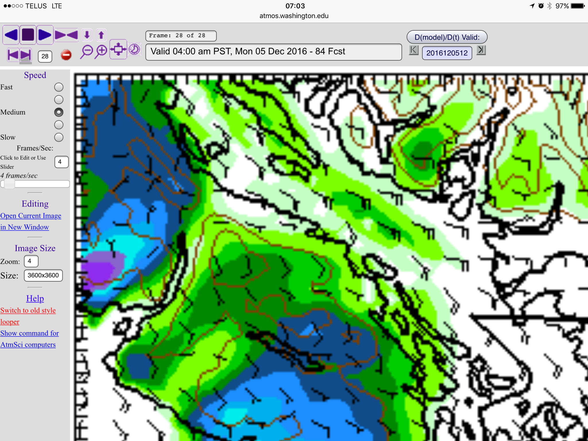
UPDATED 1PM Saturday —- Late Sunday Snow into Monday morning and evening
Update 1PM Saturday The morning high resolution models are finished and the forecast has refined a bit. Port Alberni will probably only get snow late Sunday night around midnight. After that, most of the chance focuses on the east side and will depend on the outflow winds picking up snow along the Strait and dumping…