Skip to content
Alberniweather

Alberniweather

Watching the Port Alberni Weather since 2005

  • Home
    • Home
    • Blog
    • Privacy Policy
    • Tech @ Alberniweather
    • Christmas Lights!
    • Translations
  • Data
    • Air Quality
    • Almanac View
    • Data View
    • Neo View
    • ECCC CSV Archives
    • NOAA Text Archives
  • Links
    • Forecasts Models
      • University of Washington High Res Forecasts
      • SpotWx
    • Earthquakes
      • Tsunami Warning Centre Page
      • USGS Earthquake Maps
      • Earthquakes Canada
      • Port Alberni Tsunami Zone Map
    • Environment Canada
      • BC Warnings
      • Port Alberni
      • Tofino
      • Ucluelet
      • Nanaimo
      • Campbell River
      • Vancouver
      • Victoria
      • Port Hardy
      • Severe Weather Reporting Standards – Vancouver Island
    • Local Stations
      • Big Wave Dave Harbour Quay
      • Nick’s Weather (near Maquinna)
      • IslandWeather Map
      • Alberniweather
      • Alberni Elementary
      • Neptune Station (Canal Beach)
      • Maquinna Elementary
      • West Coast Staitons
        • Bamfield Marine Station
        • Wickininnish (Tofino) Community School
        • Ucluelet High School
        • Ucluelet Weather
    • Marine
      • Pacific EnvCan
      • Tides for Port Alberni
      • Washington State
      • Moon Phases
      • West Coast Light Station Reports
      • High Seas Text Forecast
      • Sea Surface Temperature Anomaly Map
    • Rivers – Fire – Smoke
      • BC Wildfire Site
      • Local Forest Fire Model Map
      • Local Venting Index
      • Air Quality Map
      • NOAA Smoke Map
      • Firesmoke.ca
      • River Forecast Centre (Snowpack and River Advisories)
      • Sproat River Gauge
      • Ash River Gauge
    • Alberniweather Data in the World
      • Alberniweather Bot on Mastodon
      • APRS/CWOP
      • AWEKAS
      • Islandweather
      • MesoWest
      • PWSWeather
      • Weather Cloud
      • Weather Underground
      • Windy
    • BC Ferries
    • Road and Highway Conditions
    • Climate Change In Port Alberni
  • Mastodon
  • Satellites
  • Tsunami
  • Webcams
    • Webcams
    • Timelapses
  • YouTube
  • Significantly less rain total expected from UWash vs. EC

    Significantly less rain total expected from UWash vs. EC

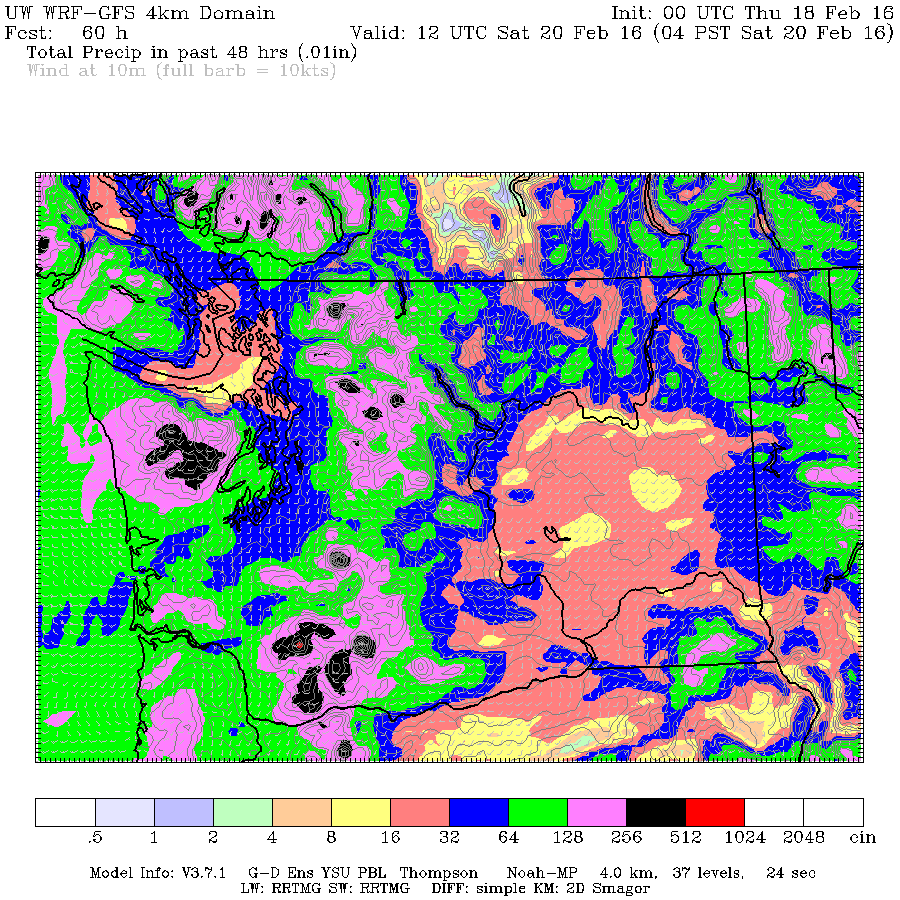
    Looking at the forecast totals for rain over the next couple days and I am seeing significantly different rain total amounts. Environment Canada is predicting 10-15mm tonight and another 20mm on Friday in their text forecasts. Compare that to the UWash WRF model that is only predicting up to 16 mm (blue) to fall in…

    February 18, 2016
  • Showers for a couple days then rain coming for weekend.

    Showers for a couple days then rain coming for weekend.

    After a pleasant Tuesday we are headed back to a showery pattern Wednesday and through the rest of the week. Showers will begin before 7AM this morning and continue on and off for the whole day and evening.  Total accumulations will be up to 16mm. Accumulations for the rest of the week are sparse in the Valley,…

    February 17, 2016
  • Heavy rain, up to 40mm to sweep through Monday Afternoon.  Nice Tuesday.

    Heavy rain, up to 40mm to sweep through Monday Afternoon. Nice Tuesday.

    We are just on the edge of the rain this morning as South Vancouver Island gets it a little more than us. Here is the radar proving out last nights UWash forecast below almost exactly. That should give pretty high confidence that what the model forecasts for the afternoon is very likely to be true,…

    February 15, 2016
  • Rain to start around noon. Not end for rest Fovember.

    Rain to start around noon. Not end for rest Fovember.

    OK not really. 🙂 A front should sweep over the Island and start to deliver showers and rain in the around noon and 1PM timeframe today as you can see below: It will intensify through the afternoon and evening with a peak around 6PM and possibly another peak around 9PM before it gradually tapers off…

    February 11, 2016
  • Tuesday could set new heat record. Rain and warmth for rest of week as East freezes.

    Tuesday could set new heat record. Rain and warmth for rest of week as East freezes.

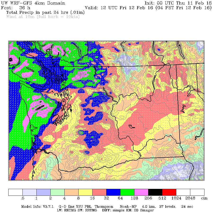
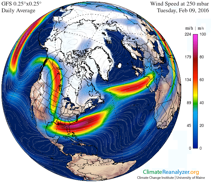
    We got up over 12°C yesterday which was near a record.  If the Airport hits the forecast high of 15°C today we will break the station record for the day.  It may be a little warmer in town. It will all depend on the fog  moving out nice and early so we get lots of sun…

    February 9, 2016
←Previous Page Next Page→

Alberniweather

Proudly powered by WordPress