
Author: Alberniweather
-

Already minor flooding from rain. Wind Warning mentions Port Alberni specifically. Ferries cancelled.
It begins The storm is here. I have already recorded 40mm of rain on my station since midnight. Maquinna elementary has recorded 55mm. For the rest of the day, the most recent information will be at the top of this page and on twitter. Send in your reports by including the #alberniwxstorm hashtag on twitter…
-

More strong Rain and Wind Coming for Thursday.
Have you had enough rain? Since last Wednesday the Alberni Airport station has reported 262mm in the 7 day period! Normal for the whole month of December (1981-2010) is 344.6mm. Environment Canada has issued a Special Weather Statement for the storm tonight. I expect we will easily beat that normal rain amount this month, if…
-
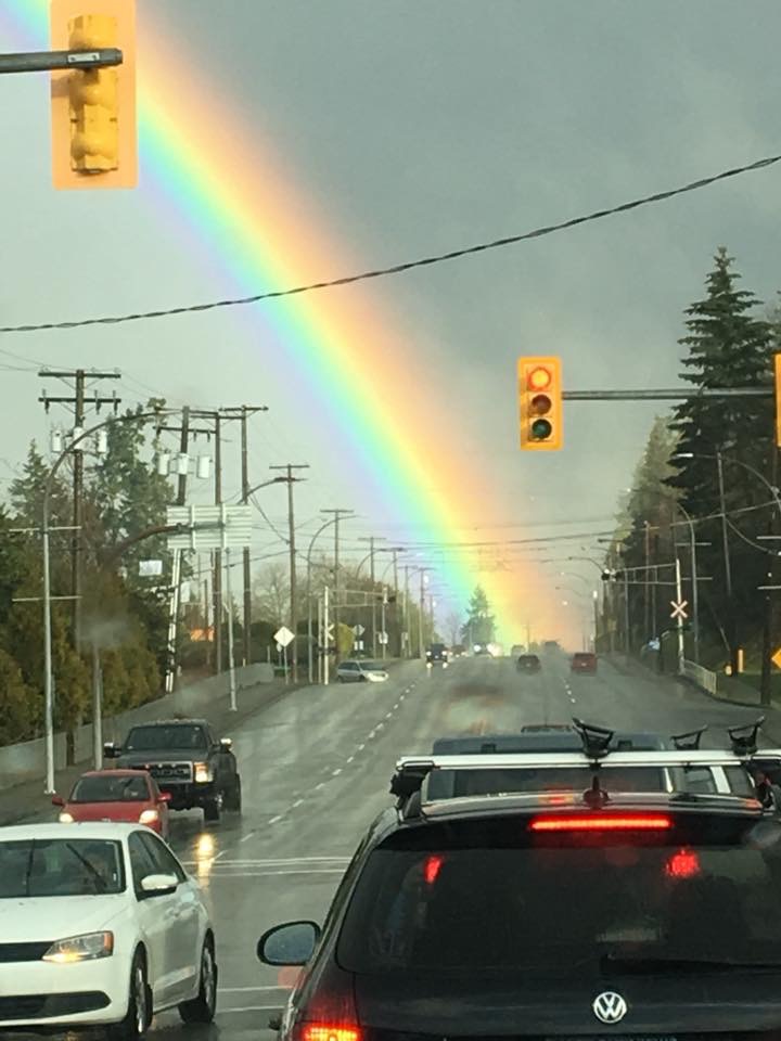
Powerful Rainbows between showers. Post your photos!
The rain is going to continue on and off through much of Wednesday too but fear not, there is a break hopefully coming on Thursday! In the meantime though and thanks to the low angle of the sun, we have had some fantastic rainbows today! I even saw it on my webcam! So, here are…
-

Good News! Best chance of snow is around Christmas! Bad News: It’s not a very large chance 🙂
We’re a week away from Christmas Eve Day! That means I’ve been getting some questions about whether we have a shot at seeing any significant white stuff at all between now and the day Santa comes. I’ll use this post to take a peak. So here’s the good news. We could get snow between now…
-
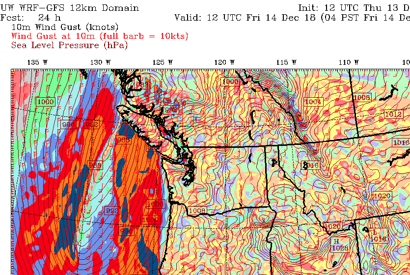
Friday Storm – Initial Post – Updates on #alberniwxstorm
You’ll see further updates through the Twitter thread and #AlberniWxStorm hashtag below! If you have any weather reports tonight or tomorrow, tweet them with that hashtag and they will appear here! Live Updating Twitter Thread We have a storm coming! Here’s the initial look and then you can follow the ongoing thread here or on…