
Data View Offline
An issue cropped up with the Data View overnight. That is why there is a large empty space in the website. The other data on the Almanac is still updating normally. I’ll post on Mastodon with updates on when the Data View will return.
Snow Tuesday Night and Wednesday – Heaviest South
It’s coming. The high resolution forecast is out for Tuesday night and Wednesday morning and it’s FUN.

These are pretty large numbers focused on the East side of Vancouver Island. The heaviest will be in the Cowichan and Shawnigan Lake areas and in higher elevations. Expect totals up to 10-15cm. There will be gradually less as you move up the Island. Only 2cm for Campbell River and Port Alberni.
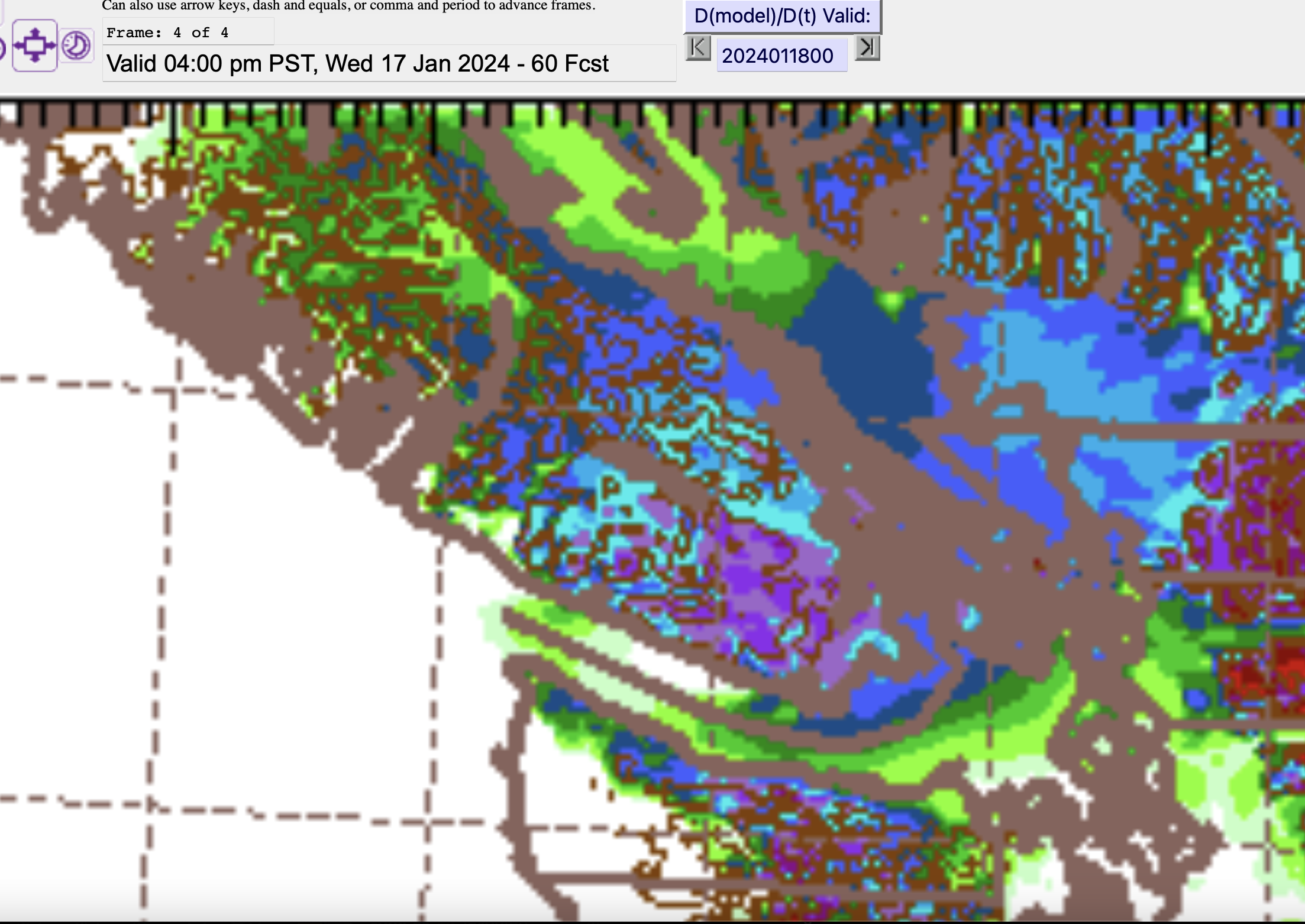
Thursday Snow – Port Alberni – Snow – Freezing Rain – Rain
The model may have shifted the timing of the Thursday event back a little. It is now expected to make landfall, starting with snow, in the mid-to-late morning. This is the 7-10AM period below as it just starts to get to the Island.

There is a major chance of Freezing Rain as well as snow and rain on Thursday. Plan accordingly (ie. please consider not travelling).
The model is now expecting the changeover to rain to happen late Thursday night. With this still a few days away both the timing and the nature of the beast can and probably will change so I’ll leave it there. For now we can focus on the Wednesday event.
Check out the Youtube Podcast
It still generally applies and you’ll get some information on why this Polar Vortex is happening as well.
Join the Signal Channel
If you’d like a relatively private place to chat about the weather, in Port Alberni or on Vancouver Island and you use the Signal app, you can join our channel of weather nerds here.
Enjoy Winter while we have it! 🙂