

We’re getting a bunch of precipitation on Saturday. That’s a definite.
The question is what kind. The model has the snow (in green below) staying in the higher elevations and the rain (in greys and blacks) in the low lands including Port Alberni. This is the picture for the start of the storm around noon Saturday.
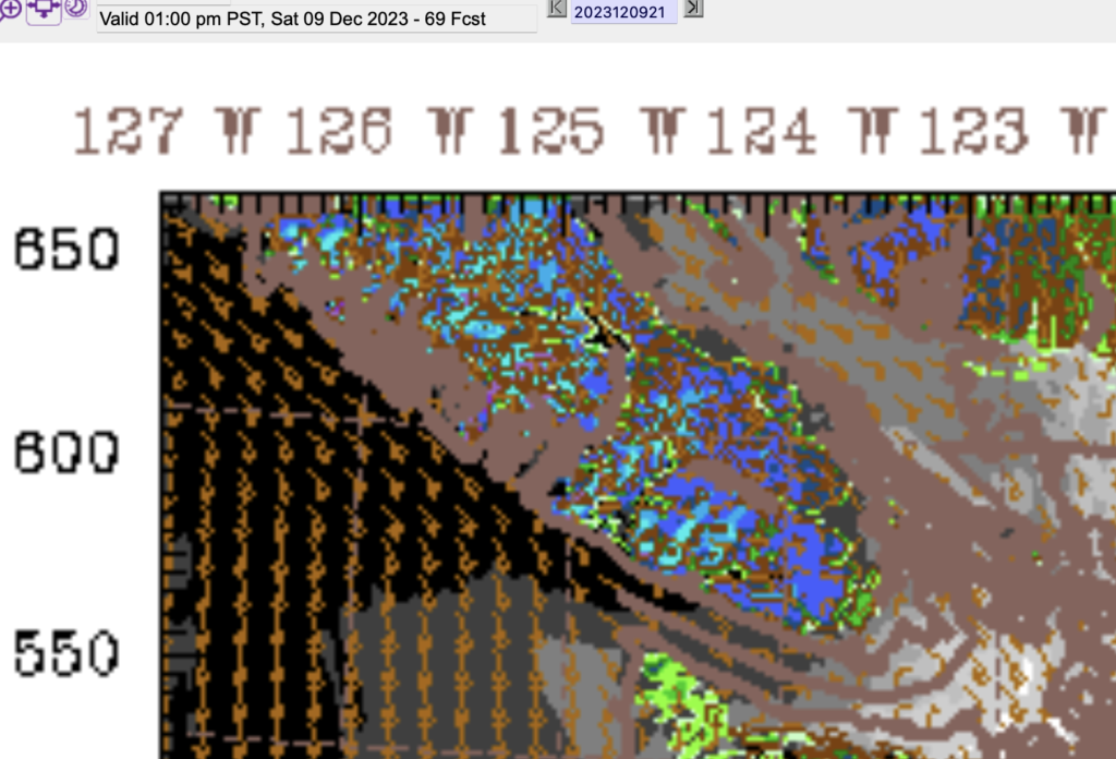
We might get some wind with this on Saturday as well. Looks like strong southeasterlies off of the coast. It is expected to cool off Friday night down to just above freezing. Without a real cold snap though I think it is unlikely we’ll see any snow accumulations. It’s more likely that this will start as rain Saturday morning, and then possibly shift to wet snow as the precipitation intensifies. It may or may not stick on the lawns but it will make the roads slick, especially on the Hump and Sutton Pass.
The model expects It will warm up by Saturday evening and showers will persist through to Sunday morning but most of Sunday should dry out. A good day to get those last Christmas Lights up!
If there was a snow contest, sorry, there would be no winners this weekend! :).