

Winter is here. Snow predictions.
It finally came. Winter is here and now It’s going to get progressively colder for a few days with the coldest day looking like Friday at around -10ºC.
There is snow likely, but this time I would expect it to be only on the east coast as northerly and easterly outflow winds run across the water and create snow.
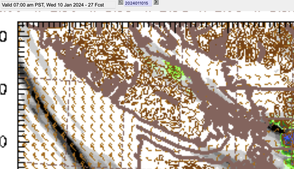
In fact the first chance of “strait effect” snow will be early Wednesday morning. Above is the picture for 4-7AM Wednesday. The green area is around Nanaimo.
Notice there are also some bands of grey indicating showers. We will only be starting down the temperature scale so some areas will still see this as light showers while Nanaimo and other places with colder air will see light flurries.
They will dissipate by noon.
Colder Thursday and Friday – More light snow

Very early Thursday morning you can see on the map above another area of snow over the Strait. This looks aimed toward the Nanaimo or Ladysmith area. Again, light snow only, but it will be much much colder. Windchills down to -10ºC on the East coast. Expect anything that falls will probably stick.
The most interesting time is Thursday afternoon. As you can see below, there are strong north and northwesterly winds and patches of snowfall (in green) all over the Island from Nanaimo to Courtney, Duncan and Port Renfrew.

There is grey indicating rain over Port Alberni but given the very cold air, I expect this to fall as very light flurries.
Things get potentially serious on Thursday night. Expect heavier snow in the Ladysmith and Duncan areas and possibly up to Nanaimo as a strong outflow develops out of Howe Sound.

By Friday all areas of the Island should be in the -5ºC to -10ºC range and possibly lower with the windchill.
Bundle up out there!