

New Podcast Out
You can see it below, please do like it and subscribe to the channel.
Forecast First – Mostly dry weekend
As I mentioned yesterday, the forecast looks mostly dry but some areas, like the West Coast will see rain.
More details in the YouTube above but the summary is:
- West Coast and North Island showers/rain Saturday
- Possible showers in Port Alberni and Bowser/Courtenay.
- Mostly Dry all other areas Saturday
- Mostly dry on Sunday in all areas, possible pockets of showers. Warm.
- Monday possible showers in Victoria but short lived.
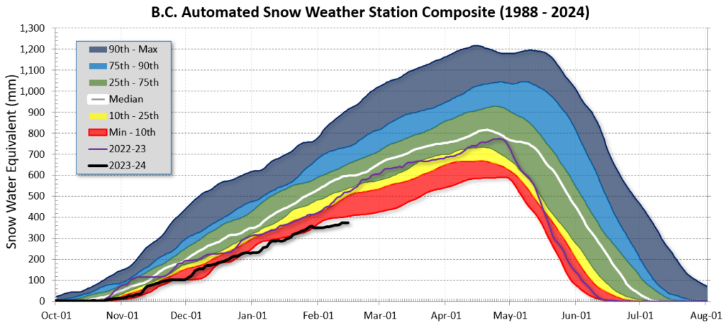
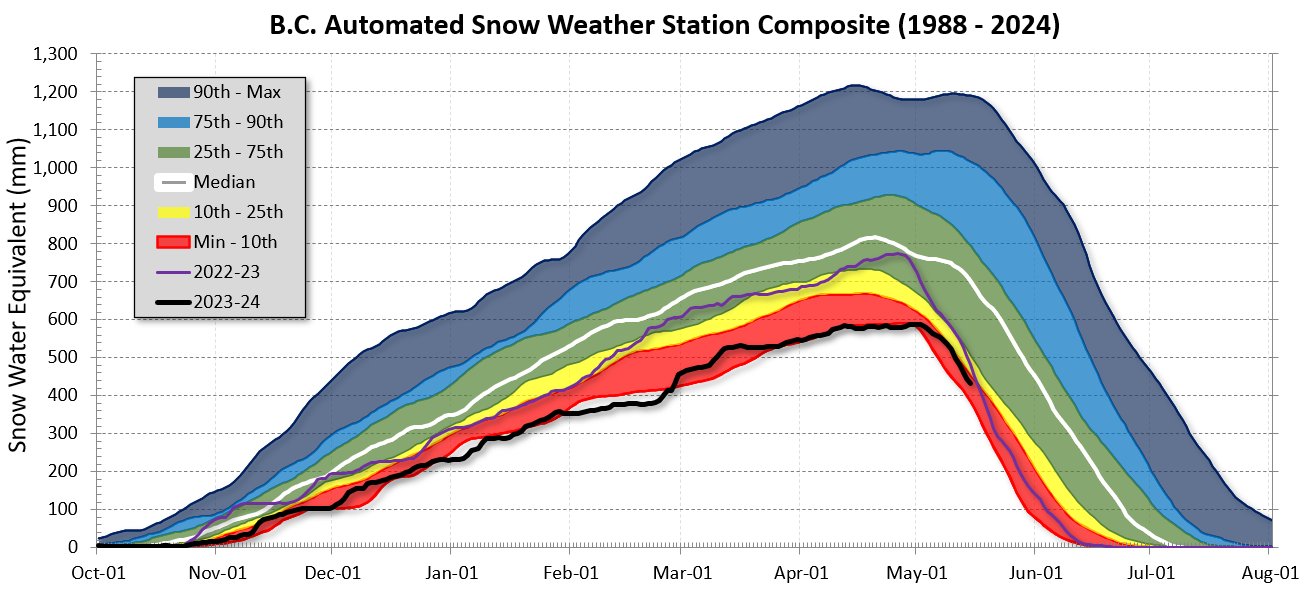
Very Concerning Snowpack – BC Wide and Island
The February 15th Commentary is Out from the BC River Forecast Centre.
We have an extremely low snowpack. Below is the graph for the entire province showing 2023/24 at below the 10th percentile for this time of year. Worse than 2022/23.
The picture on the Island is even more bleak. Check out the current snow measurements. The percentage of snow for this time of the season at the stations in the table below are:
- Wolf Creek 1400m (North Island)
- Jump Creek (South Island between Nanaimo Lakes and Cowichan Lake) 1100m
- Heather Mountain (Northwest end of Cowichan Lake) 1100m
- Mt. Arrowsmith (South-East side) 1400m
- The bottom line is the average for Vancouver Island


If you’re wondering where these stations are here’s a map:
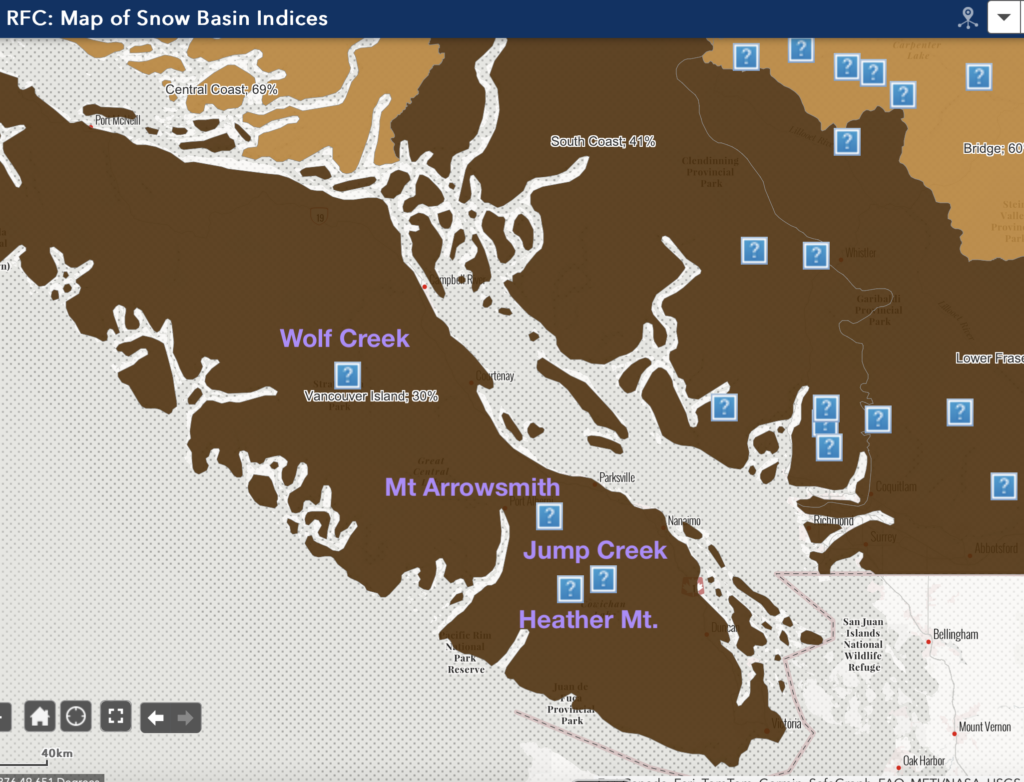
Unfortunately you can see the Wolf Creek station, in Strathcona park, has the highest amount of snowpack with just over half of normal (55%). Mt. Arrowsmith, which is at the same elevation, is at 40%. Jump Creek is 0%, no snow at 1100m. Heather Mountain is at only 21% also at 1100m near the same area.
This is obviously a major concern for water supply on Vancouver Island and the general water needs of our forests, lakes, rivers and food supply.
So while we might be hoping for spring… perhaps what we should be hoping for is another round of cold, snowy weather. The snowpack could use it!
Have an excellent weekend. I hope you’re able to enjoy it with family and friends.