
Category: General
-

Drying out today and staying warm and dry until Friday
Congratulations! You made it through the dark times! It seems we have finally emerged from a long series of rainy weather systems. Monday has started damp but that should be the final bit of rain we see until at least Friday afternoon as you can see in the graph below. It should also get progressively…
-

Showers for a couple days then rain coming for weekend.
After a pleasant Tuesday we are headed back to a showery pattern Wednesday and through the rest of the week. Showers will begin before 7AM this morning and continue on and off for the whole day and evening. Total accumulations will be up to 16mm. Accumulations for the rest of the week are sparse in the Valley,…
-

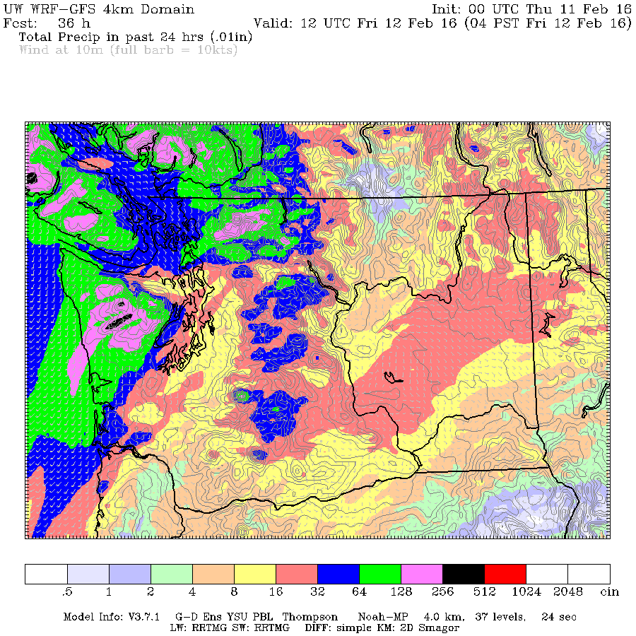
Heavy rain, up to 40mm to sweep through Monday Afternoon. Nice Tuesday.
We are just on the edge of the rain this morning as South Vancouver Island gets it a little more than us. Here is the radar proving out last nights UWash forecast below almost exactly. That should give pretty high confidence that what the model forecasts for the afternoon is very likely to be true,…
-
Rain to start around noon. Not end for rest Fovember.
OK not really. 🙂 A front should sweep over the Island and start to deliver showers and rain in the around noon and 1PM timeframe today as you can see below: It will intensify through the afternoon and evening with a peak around 6PM and possibly another peak around 9PM before it gradually tapers off…
-
Tuesday could set new heat record. Rain and warmth for rest of week as East freezes.
We got up over 12°C yesterday which was near a record. If the Airport hits the forecast high of 15°C today we will break the station record for the day. It may be a little warmer in town. It will all depend on the fog moving out nice and early so we get lots of sun…