
Author: Alberniweather
-

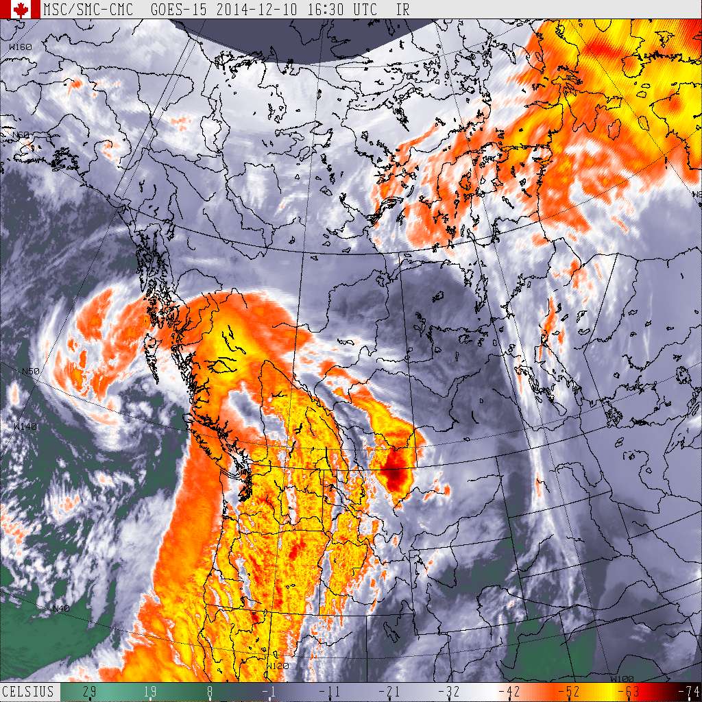
Updated 9:00PM Thursday Round 3: Deep Low to our south bringing more rain maybe wind
Updated 9:00PM – Waiting for the storm We’ve had very little rain today (in comparison to the previous few days) and only a little bit of wind so far. The low is almost exactly following UWash and it should be directly overhead very soon if it is not already. Beautiful little swirl on the satellite picture.…
-
Update 5:30PM Wednesday – EVACUATION ON TSESHAHT – RAIN STALLED
UPDATED 5:30PM – Rain stalled. Sounds like Tseshaht currently has enough bags and help! I will update if more is needed! The rainfall warning is continued. The rain has stalled over us and will take longer to taper off. Not good for flooding areas. There is currently an evacuation and sandbagging effort happening right now…
-
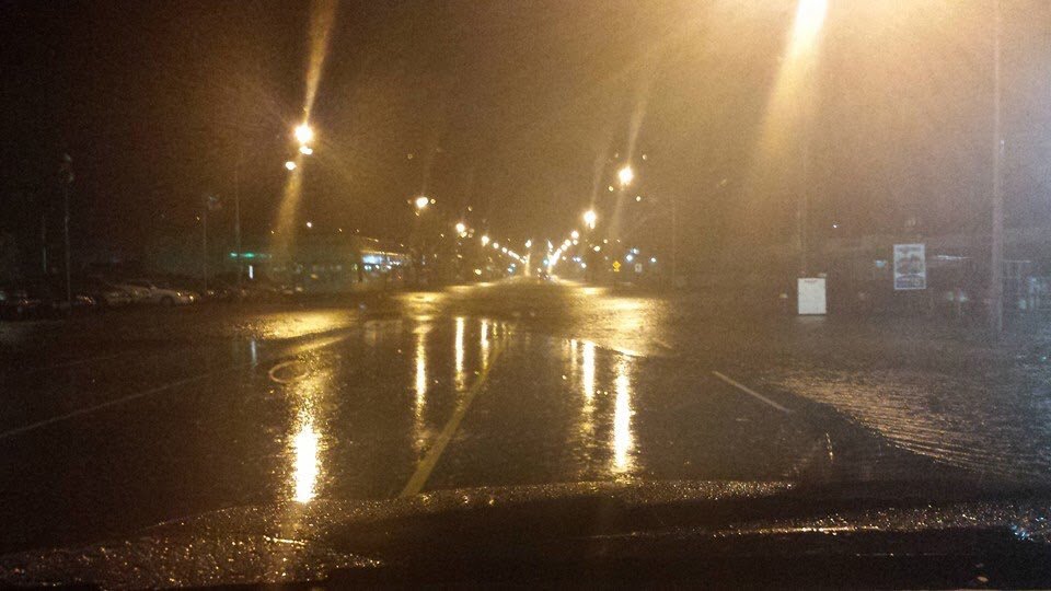
UPDATED 8AM Tuesday : 103kph gust! Very large series of storms on the way. Flooding Possible. Stay tuned.
UPDATE 8AM It’s roaring out there! We got a gust of 103kph at 7:28 this morning! This should be the last hurrahs of this storm. Another hour or two. We are currently just under 100mm of rain for the storm total. Rainfall Warning Back – Rainfall totals 80-110mm. 3rd Ave flooding. DriveBC is…
-
Mostly rain all day.
We can expect up to 16mm between this morning and Saturday morning. The showers will continue into Saturday morning but should hopefully clear Saturday afternoon and evening. It looks like we might get a break on Sunday before another front comes through on Monday morning. Happy Weekend everyone!
-

Difficult Thursday Forecast – Possible Freezing Rain or Snow and Rain
I’m glad I waited through the morning a bit for the morning models to finish. The forecast for tomorrow is not uncommon, but still a difficult one. California Calling While not nearly as torrential, the rainy weather that has been soaking parts of California is moving north and pushing our cold air out of the…