
Author: Alberniweather
-
Watch for snowfall on roads overnight Sunday into Monday
The cold Arctic outflow winds have begun: Arctic outflows are now 20km/h gusting 50km/h in the Squamish area. #BCStorm Pam Rocks in the middle of Howe Sound 44km/h gusting 59km/h. — Jason Ross (@Squamishweather) December 29, 2014 And there are pockets of wet snow developing on the East coast including highway 4. @alberniweather @Squamishweather Just…
-
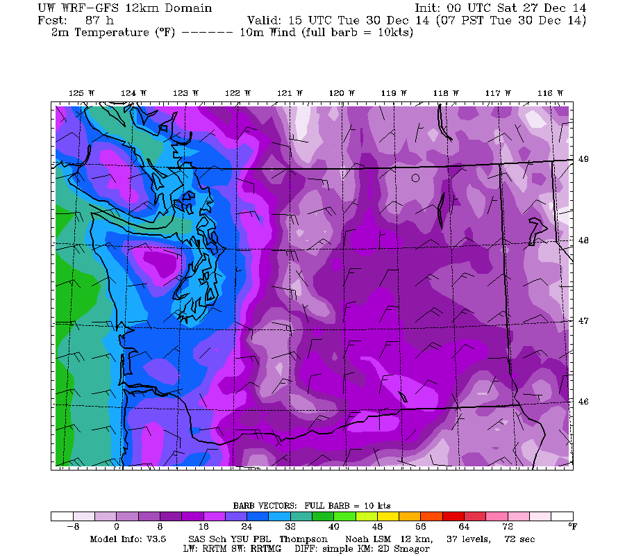
Here comes the Brrrrrrr to end 2014…. To Snow, or not To Snow? That is the question.
In addition to the possibility of a few flurries tonight, especially at higher elevations (think: The Hump, Sutton Pass) Environment Canada has issued a Special Weather Statement about a cold snap likely to come our way soon: 9:47 PM PST Friday 26 December 2014 Special weather statement in effect for: Inland Vancouver Island Cold Arctic…
-
Merry Christmas!
A very very Merry Christmas to everyone from my crazy family to yours. 🙂
-
Happy Winter Solstice – earthquake swarm – half webcam on fritz
Hi all, Hope your preparations for Christmas are going well. Today is the first day of Winter! That means it is also the shortest day of the year and from now on the days (or at least the afternoons for now) will be getting longer! Yippee! We don’t have any Wintery weather in the forecast…
-

Update 8AM Saturday: East Side Wind and Rain Warning – 30-60mm Rain coming by Saturday Afternoon — Hope for Christmas?
Update 8AM: The heaviest wind and rain is yet to come, but there are no warnings posted for our area. There are warnings for the East side of Vancouver Island. 80kph and 50mm expected. Happy Last Minute Shopping! 😉 Sorry for the late morning post, I wanted all the models to be out before…