In addition to the possibility of a few flurries tonight, especially at higher elevations (think: The Hump, Sutton Pass) Environment Canada has issued a Special Weather Statement about a cold snap likely to come our way soon:
9:47 PM PST Friday 26 December 2014
Special weather statement in effect for:
- Inland Vancouver Island
Cold Arctic air arriving Sunday.
A strong ridge of high pressure from Yukon will advance southward towards the British Columbia coast on Sunday morning.
The ridge will spread cold Arctic air along coastal regions bringing temperatures down to 5 to 10 degrees below seasonal normal values by Monday. The ridge will also create strong pressure gradients along the coast and generate intense northeasterly Arctic outflow winds through mainland valleys and inlets beginning Sunday morning. The freezing temperatures are forecast to persist for several days.
The most interesting part of that statement is the “intense northeasterly Arctic outflow winds through mainland valleys”.
This could very well set up some sort of “Strait” effect snow for the east side of the Island, but it is too soon to say for sure yet.

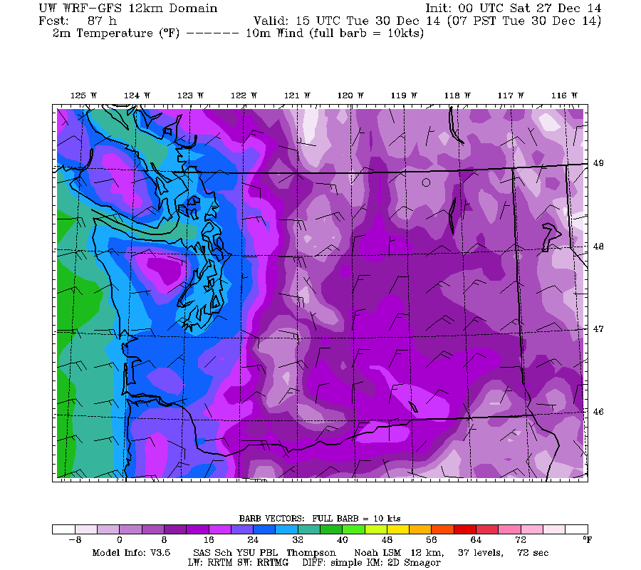
The UWash models are predicting temperatures just below freezing Sunday night and Monday and getting near or below -4ºC Tuesday morning (above) but that looks to be the coldest morning.
Cold weather doesn’t automatically mean snow. UWash has no snow predicted for the entire week.
However, the Canadian “GEM” model does have a little tonight and more later in the week (it also predicts the cold to be a little deeper and last longer)

We’ll see what happens.
At least with the strong outflow winds we might have a shot at the fog drying up so we can enjoy the inevitable clear skies. But without those winds, we could see heavy fog, be careful, especially with icey roads likely as well.
It will also mean stagnant air though, so if you have a wood-fired heating system, you will want to try to limit your emissions and try to hold off any backyard type burning until the weather changes back.
Happy Weekend!
P.S.
Webcam Updates:
My webcam system has been giving me a headache over the Christmas break, but I think it might be nearing good spot. I’m hoping to have it up and running normally again by the end of the night tonight or by Sunday at the latest.

