
Author: Alberniweather
-
Don’t expect much if any rain this week. Expecting Records from May.
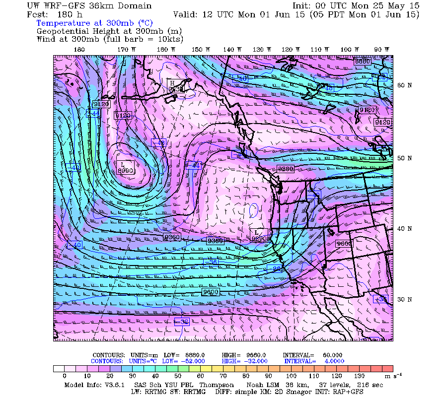
Contrary to the official forecast which seems to give hope of showers early this week, the UWash model is not nearly as optomistic. Here is the 72hr, 3 day, total expected for our region. As you can see, from Monday 5AM to Thursday 5AM, only a few millimeters (0.08in) of rain is expected to fall…
-
Will we hit 30°C officially today?
The forecast is calling for a high of 29°C at the Airport. Will we get one more and hit 30°C either in town at Alberniweather or maybe even officially? Only time will tell. If you wanna have some fun, pop a final high for the day for Alberniweather Or at the Airport in the comment…
-
Heat Continues to Tuesday – Open Burning Ban in Effect – Think about Water
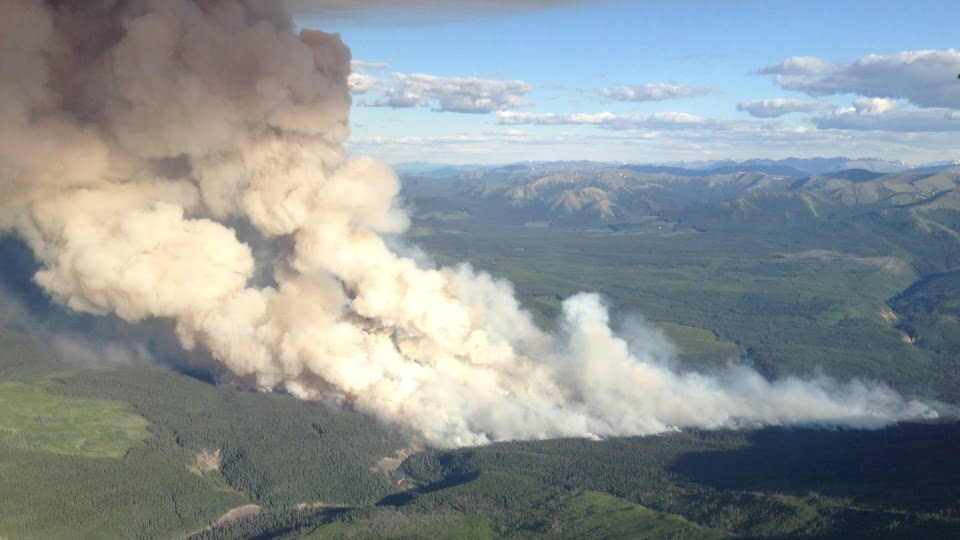
Open Burning Ban in Effect in and out of City (the banner image is of a wildfire in Alberta) The forecast remains hot and dry through the weekend until at least Monday or Tuesday. And the Forest is hot and dry too. Our area is currently at Moderate fire risk level as is most of the…
-
Perfect Weather for Bike to Work Week! And Record Low Arctic ice.
You really can’t ask for better weather for bike to work week. It should be cool in the mornings with morning low cloud. Nice and cool for your morning bike commute. Then you will have a hot ride home, especially Tuesday, Wednesday and Thursday when temperatures should get over 25ºC. Hopefully your bike ride home…
-

Nearly 30ºC on Wednesday – Warm Weekend – And Water Conservation Measures at Great Central
We set a short term record yesterday with an official high of 28.8ºC at the Airport. Alberniweather got up to 29.5ºC and many anecdotal reports had temperatures over 30ºC in the City. You can expect more of the same today even though high cloud will shield some of the sun’s rays. There is a possibility…