
Month: March 2016
-

Storm has Passed and a Solar Eclipse like you’ve never seen
You need to see this solar eclipse… so make sure you click through! The storm has now passed. There may be some lingering light showers through the day but the heaviest of the rain has definitely ended. Due to a filled up hard drive I had some data issues yesterday, of course, but they have…
-
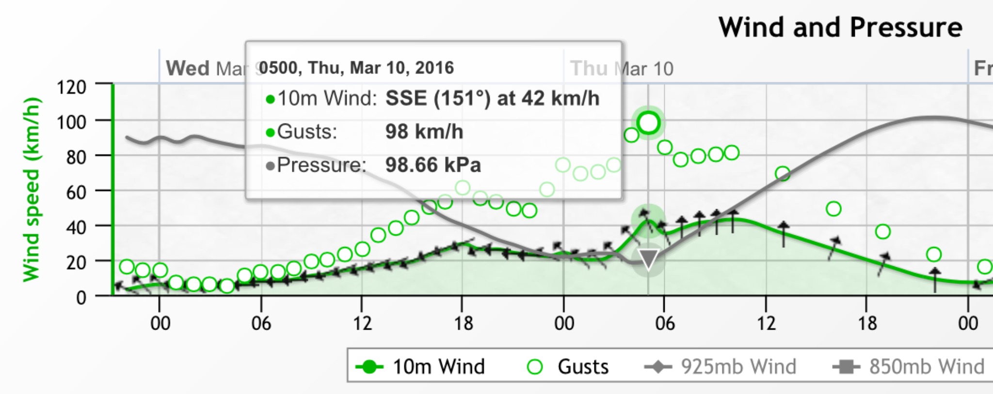
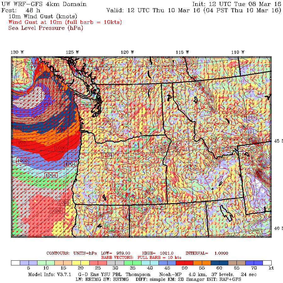
POST UPDATE 5:30AM Thursday – Winds should back off
Update 5:30AM. Good news! EC has ended the wind warning and the models have all backed off on their wind predictions for the morning all but one are predicting winds below 70kph. 10:30PM Update – UWASH MODEL SHIFTS STRONGEST WINDS SOUTH Unfortunately, the latest run from the University of Washington model, which…
-
Showers Tuesday. Potentially dangerous Storm on Wednesday
It’s going to rain or drizzle most of the day today as a weak system moves through. It should clear a little after 4PM. Total accumulation for the day is only 8mm. The more drastic system will occur on Wednesday night and Thursday but the wind may miss most of the South Coast. For rain, the totals…
-
Monthly Summary February 2016 – Records – El Niño and looking ahead to end of storminess.
An Above Average February dwarfed by 2015 but still well above average. While it wasn’t quite as extreme as February 2015, this February did deliver one possible all time daily record for high temperature. See down in the records section for more on that and the incredible (and probably false) reading from 1916! We continue to…
-

Stormy Weekend. Wettest Friday but possible wind Saturday.
As I type this on the bus into Nanaimo there is a beautiful orange hue to the eastern sky obscured by clouds. Red sky in morning, sailor’s warning. This is a day that that old adage will probably be valid. Here is the rain situation over the next 3 days. 4AM to 4AM Fri/Saturday, Sat/Sunday and…