
Month: January 2015
-
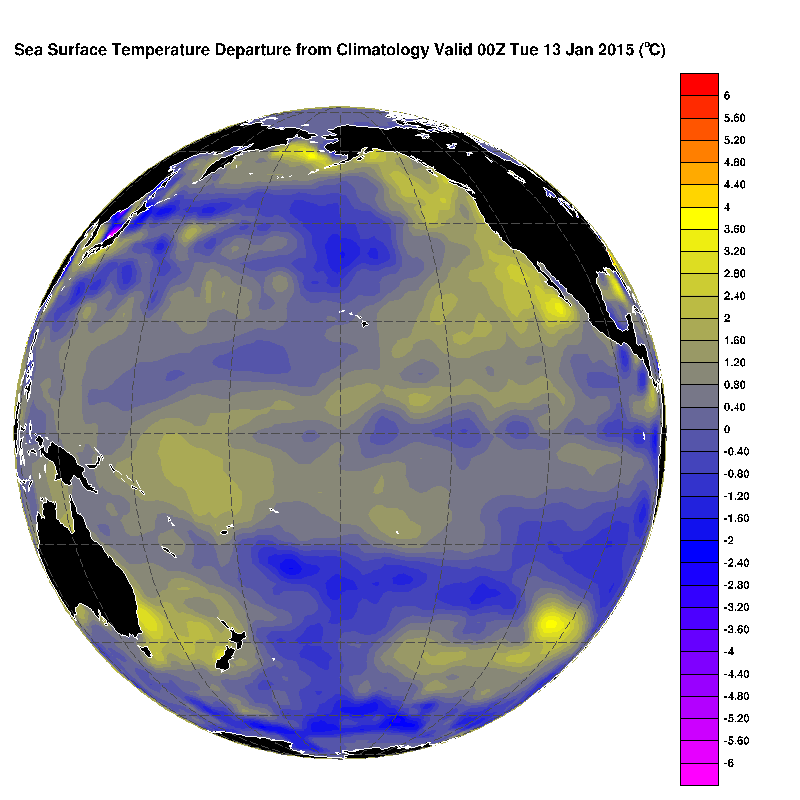
World logs warmest year despite long Canadian Winter – Local Oceans in Spotlight
It’s official. THE U.S. N.O.A.A., N.A.S.A., Japan Meteorological Agency, and Berkeley Earth Surface Temperature (BEST) project have all declared 2014 the warmest in their records stretching as far back as the 1850s. The 5th major global analysis record at the UK Met Office is expected to announce the same shortly. Because of the differences in analysis techniques and datasets, the…
-
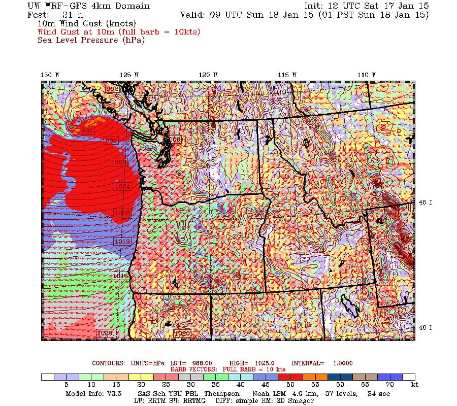
Update 10AM – Deepening Low on the way. Strong winds and rain possible.
Update 10:15AM. My poor roof can’t handle much more. After the big storms in December with 100kph gusts, the meager 50-60kph gusts are causing some severe flapping of our shingles. Update 10AM: We’ve achieved a second peak wind gust late this morning of 61.1kph at around 9:30AM. The first peak was very early this morning around…
-
Fog Should Burn Off to Sun – More Rain coming
The fog should burn off this morning. Elsewhere on the Island it is clear and beautiful. When I walked out the door the sky was actually just barely covered in a light fog and you could easily see the moon shining through and Mt. Arrowsmith in the distance. However, things quickly cooled and caused the…
-
Rain Thursday morning and through the day – Wet Weekend
The rain should begin by early Thursday morning. The rain should build through the day with the heaviest rain coming in the evening between 3 and 5PM. It should then taper off by late Thursday night and be dry and cool on Friday morning. Total rainfall for the event: no more than 50mm There is…
-
Quiet Start to Week – Comox Boil Water Advisory enters 2nd Month
Nothing happening until Thursday It looks like a quiet week ahead on the weather front. There is no rain forecast in the UWash model for the next 3 days as a ridge of high pressure deflects oncoming fronts to our North. On Thursday there a system is slated to break through. Thursday and Friday should add up…