
9:30AM Monday – Final Update to this post
I will make a brand new post with information starting from todays press conference. In the meantime I have posted some notes on Mastodon from interviews on the radio this morning. We are not out of this mess yet.
- Loading Albernieather Cameron Lake Fire feed
9AM Sunday Update
Note: I will start a new post for this topic on Monday.
It has been relatively quiet this weekend so far both for the fire and news around it but I suspect that will change today and Monday.
The Fire: 254 hectares. Map updated


BC Wildfire says the cool weather has brought the fire down to smoldering with some open flame and has helped them build containment lines! I suspect the increase in size and new map outline is how they have created those containment lines. So let’s hope the fire stays inside those lines. There are some parts of the fire that are not accessible due to the terrain though so it won’t be 100% surrounded. We’ll see. Sunday and Monday will be the test as relatively hot and low humidity conditions will return briefly. Highs to 29°C and 32°C are expected. Let’s hope for the best.

The Detour: the Ministry announced yesterday that piloted convoys for Commercial vehicles would begin Sunday and continue “until further notice”. Two convoys will leave every day in each direction.
- Commercial vehicles are restricted to legal weight limits (63,500 Kg) – no over-weight or over-size loads will be allowed on the detour.
- Westbound from Lake Cowichan: 5 am and 3 pm
- Eastbound from Port Alberni: 10 am and 8pm
The route remains open and recommended only for essential traffic including personal and commercial vehicles. Please drive carefully.
There are plenty of stories mounting of multi-hour journeys to the East side of the Island! I know one person who had to pick up someone at the Nanaimo airport. It took them 10 hours round trip!
The general consensus seems to be that the road will be closed until at least next weekend and possible two weeks. It will all depend on the fire and the condition of the slope.
Air Quality: The Air has been clear and good with very little smoke from the fire since the rain. The winds may turn to the north today and Monday particular in the late night and mornings which would drag some smoke down if fire activity picks up but we should continue with afternoon inflow southerly winds that will push any smoke away from Port Alberni.
Business Support: If you are a business in Port Alberni struggling due to the closure of the highway reach out to the Chamber of Commerce. They have put out a message to businesses offering support during this time. The visitor centre has also been very busy.
Finally the MoT has added some more nice pictures to their Flickr gallery!

Good luck and stay safe out there!
7:15AM Saturday Update
It rained! At least in Port Alberni. And more than expected. We will have to wait to see if BC Wildfire mentions rain on the fire itself but there is a good chance and what is for sure is Friday will have provided a much cooler and higher humidity environment for them to get a handle on the fire.

It is 12°C currently and 97% relative humidity at Alberniweather. We have received a surprising 10mm of rain since midnight plus a couple yesterday! The most we’ve had in weeks! (See Almanac or click graphs). It is the most since we got 12mm on May 5.


While the wind did shift around to the North, the rain obviously lessened the smoke and filtered out much of what may have been in the air, so our Air Quality is great this morning.
Obviously this is all good for the fire and, given the forecast on Thursday, a welcome surprise.
BC Wildfire posted a good update in their Response section yesterday on how they have been building lines around the fire, protecting the Grove and limiting the fire’s spread where they can. I recommend reading it. It starts toward the bottom of the fire page.
The page has not been updated yet today so the area remains at 208ha and the fire is classified as out of control. I am hoping we will see some containment today!
The detour route through Cowichan opened on schedule last night at 9PM. Last nights rain will help the dust but might make for more washboard/potholes. Drive carefully. And yes, deliveries and trucks are getting through!
The rumour mill has the Highway reopening in as much as 2 weeks. Let’s hope last night’s rain shortens that period.
Finally, it will be cloudy today and Sunday is now forecast as a 29°C day instead of over 30 so that is more good news for the fire.
Have a good Saturday. Stay safe.
1:00PM Friday Update
Good news and bad news has filtered through today!
Good news: It was drizzling earlier this morning in Port Alberni and a 40% chance for rain remains today rising to 60% tonight. On Saturday there is a 40% chance of rain and cloudy before the heat returns on Sunday and Monday. Hopefully this is the opportunity the BC Wildfire Service needs to get a handle on the fire. The latest update has the fire at 208Ha and it remains out of control.

I’ve included the previous map outline below for comparison.

You can see that the fire has grown mainly to the East and South, away from both Cathedral Grove and other structures like Cameron Lake Resort, the Railroad and cabins. Today’s cooler weather should help knock down the fire.
According to yesterday’s Fire Weather update provided by BC Wildfire:
“On Friday the US subtropical moisture spreads further north bringing showers beginning late Friday morning or afternoon for the Fraser zone, and moving up to Pemberton/Sunshine Coast zones during the afternoon and Friday evening…. No measurable rain for the Cameron Lake fire.
Temperatures will be similar to Friday with highs in low 20s (which means cooling for Pemberton/Fraser zones). RHs should still be somewhat elevated.
Sunday should be dry and warmer as an upper ridge lies across Mid Coast and the surface ridge over Haida Gwaii sharpens up. N-NW win pattern with some light outflow winds in the morning over the mainland inlets. Highs rebounding into the upper 20s with RHs trending down.
For Monday, sunny and hot conditions will prevail with the upper ridge lying across the Island. Highs in the low to mid 30s with minimum RHs dropping back in the teens.”
The good news is that while there is a chance for lightning in the Eastern Fraser Valley, there is no such chance on Vancouver Island.
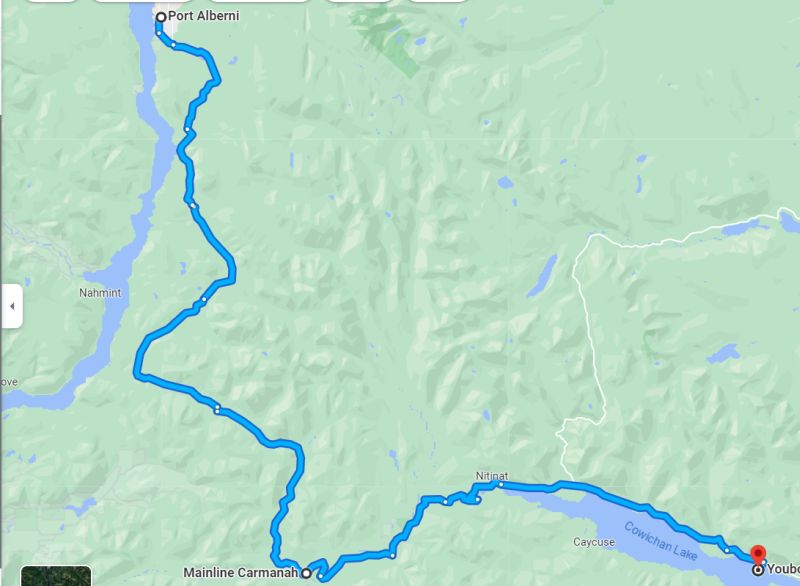
The Ministry of Transport has provided a new, better map for the detour route on their Road Advisory page for the incident.

Just a note from someone (me) who has driven that road a lot in my life. The section between Checkpoint 2 Franklin Camp and Checkpoint 3 Nitinat is the worst in terms of road conditions. You will notice there is a paved section, but don’t be fooled! This section was paved before I learned how to drive 30 years ago and it has never been improved. It is extremely wavy/lumpy and will wreck your suspension if you go too fast. If there are places where the pavement can be avoided, I recommend it.
Also, don’t worry Port Alberni, the food and gas is coming! 🙂


That’s it for now. Stay safe out there. The Air Quality remains good and should be good as long as the prevailing winds continue from the south.
6AM Friday update
The biggest news on the fire today is likely to be the temporary closure of the detour route. From the Ministry of Transport page:
The detour route will not be available on Friday, June 9 starting at 1PM and will remain closed until 9PM. This is to accommodate a vehicle recovery in order to prevent serious environmental impact. We understand the inconvenience this will cause but there are no other viable options.
Obviously this is going to cause some headaches but it can’t be avoided.
Good news: Air Quality is good this morning.

Winds should continue to be southerlies today and keep the smoke mainly out of the Valley. The other good news is it will be cooler today and Saturday with a slight chance of rain this afternoon. It will be cloudy tomorrow. Let’s hope we get lucky! The heat and dry weather will return Sunday with a high of 30 expected and winds may shift to the north. We’ll keep an eye on that. It will be warm Monday too but then it looks like we might cool off for a longer stretch next week. Again, fingers crossed!
There are no updates on the fire itself, currently listed as 180ha and out of control. It was also mentioned that it remains 4km away from Cathedral Grove and does not currently threaten the grove.
One of the Fireboss float planes working the fire had to stop for some repairs to its landing gear yesterday.
345PM Thursday update
BCWildfire has finally provided an updated size as of 3:30PM today of 180ha (440acres). That is up from 140ha yesterday.
They have not changed the outline of the fire since the drawing was initially released so we don’t really know where the growth has occurred.

They have been working with larger aircraft today as a ConAir RJ85 has done work today.

The Ministry of Transport has created a Travel Advisory page for Highway 4.
It says: “Highway 4 is CLOSED in the Cameron Lake area (Koen Road to Cathedral Grove) due to wildfire. Damage to the road and instability of the slope above the highway means this closure is likely to last beyond the fire itself.”
They also have a Flickr album of pictures from the fire, highway and road to Lake Cowichan.


That’s it for now! Stay safe out there
and please, don’t panic buy or horde food and goods. Supplies are coming through Lake Cowichan and there are other avenues for emergency provisions by air into both AVRA and Tofino Airports. We will be just fine. 🙂
8:00AM Thursday update
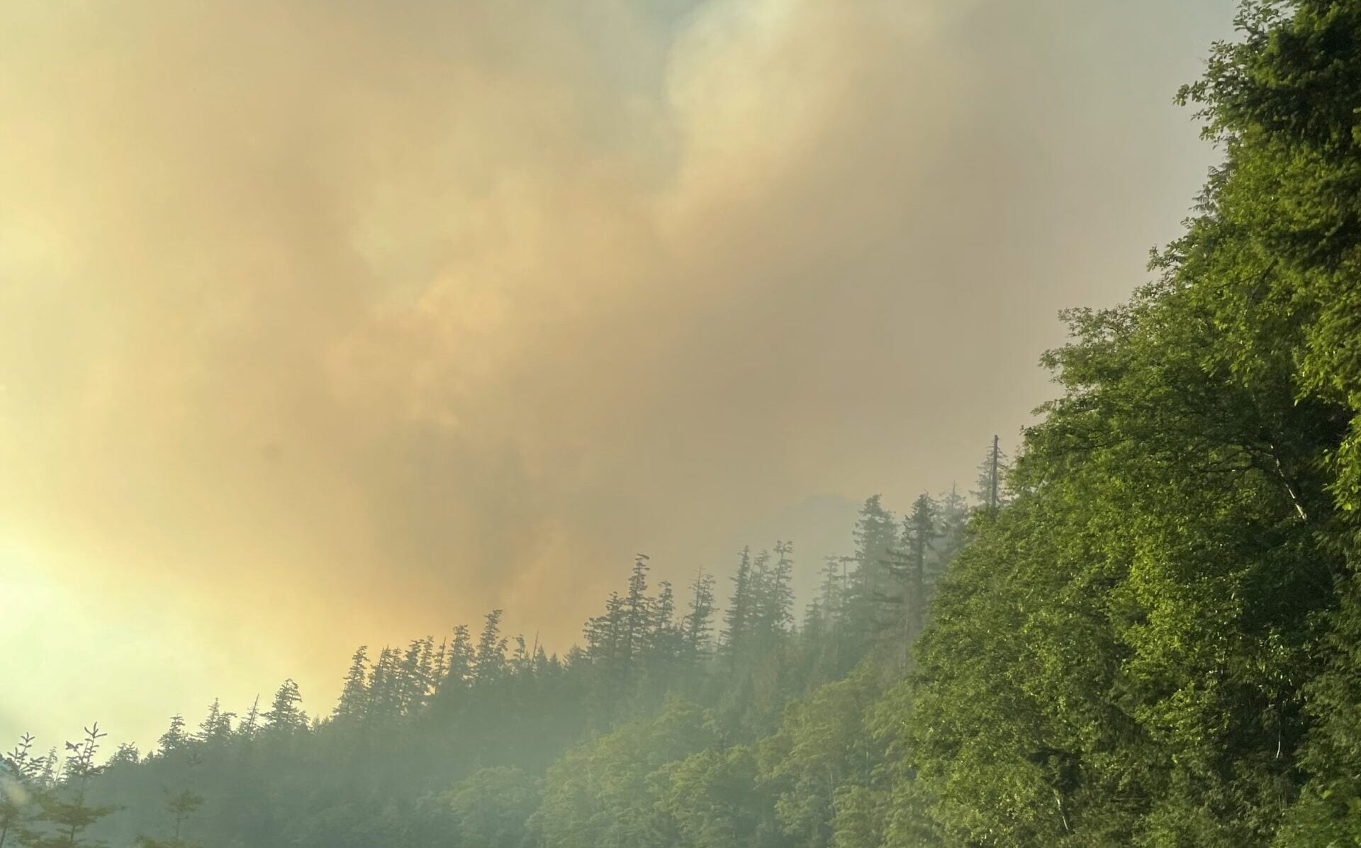
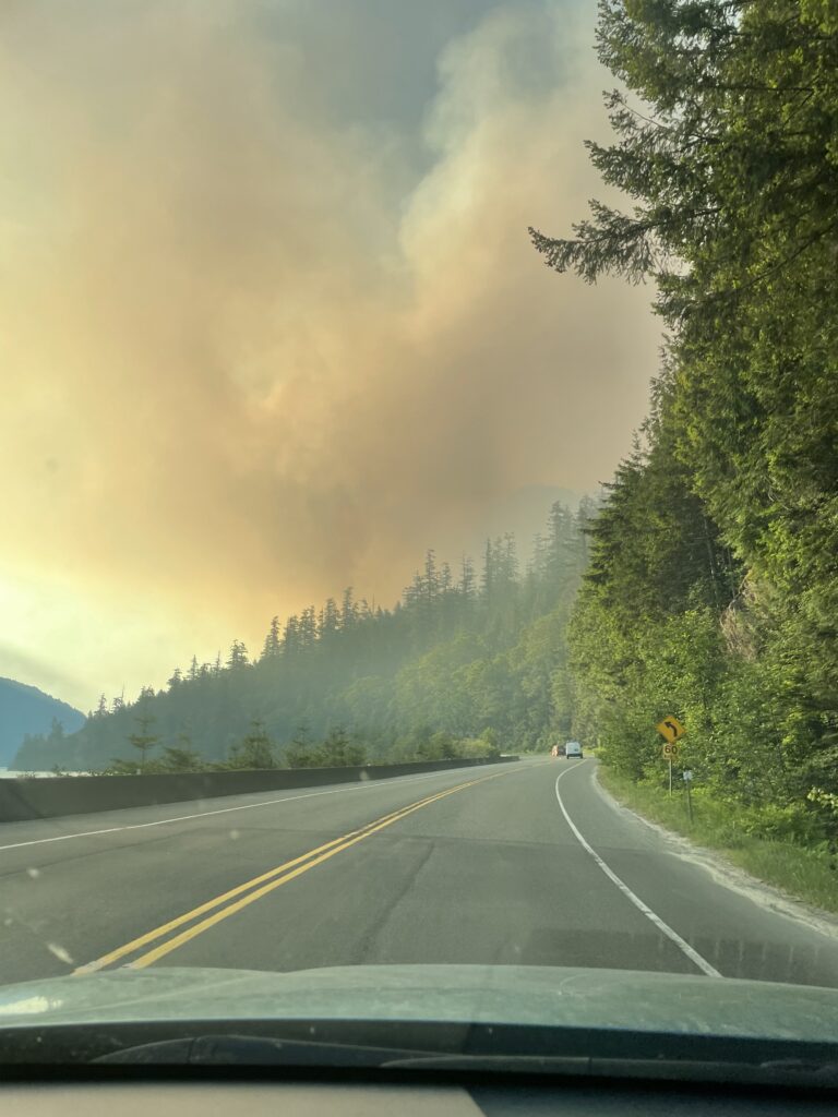
Here is a view of the smoke plume this morning. Dare I say it looks a little diminished? Let’s hope.

Some good news: Air Quality has greatly improved for Port Alberni thanks to the shift in wind yesterday afternoon. Also, there are no reports of accidents on the detour through Lake Cowichan and multiple reports of freight traffic making it through on that route.
Please, if you choose to go on that route, ensure it is for essential reasons only and drive carefully. Be courteous to others.
There are no updates yet on the condition of the fire or road. Judging by the smoke plume it might be a little diminished after the cool night and all the work of firefighters. Let’s hope so. Rumours abound but I try not to post those here. 🙂
Size remains reported at 140ha and map outline has not changed. It is listed as Out of Control.
I may go up the hump today and take some closer pictures of the smoke if permitted.
Finally, there is a petition advocating for an alternate route to be made permanent. Given the use of Lake Cowichan as a detour it seems pretty obvious that’s the first option. Time to pave it and extend Highway 18 from Cowichan to Nitinat, Bamfield and Port Alberni. Then it could extend to Comox Lake, Cumberland and Courtenay. A great route for multiple communities and would provide 3 routes for Port Alberni in an emergency.
Oh, and in case you still need the reminder, Campfires are banned starting today through October 31st unless lifted before.
Take care out there!
2:15PM – Detour Route Opened
The highway (DriveBC) remains closed next update 3PM. BCWildfire says “experts are engaged in assessment and decision-making for public safety on the highway.”
However, the ACRD Emergency ops team has announced the Ministry of Transport and Forests have worked to prepare the Lake Cowichan – Nitinat – Bamfield Road – Port Alberni route (The one I took last night) accessible for essential traffic. It is passable by a “passenger car or up to 13,500kg truck.”
The update from the Voyent Alert app is in the images below. I have copied the text below that.


The text reads:
“Highway 4 remains closed at Cameron Lake Bluffs east of Port Alberni due to a wildfire affecting the area. A detour route has been set up to route traffic from Port Alberni through to Lake Cowichan via Youbou and the Bamfield Road using forest service and industrial gravel roads.
The route is open to regular passenger vehicles and commercial vehicle traffic up to 14,500 kilograms. Route signage is in place and traffic-control personnel will direct travelers at key points along the route.
Drivers are encouraged to avoid travel on the detour route unless essential. For drivers who must drive for essential purposes, expect challenging terrain including narrow sections, sharp curves, single-lane bridges and dusty gravel roads.
There is no cell service along the route and there are no gas stations or washroom facilities available. Expect the detour route to take four hours.
The Ministry of Transportation & Infrastructure has prepared a map of the route available here. (Link is to image below)

“Drivers must be prepared: fuel up, bring extra supplies including food and water, plan to travel during daylight hours, be patient and drive with caution. Watch for and obey traffic control and emergency personnel at all times.”
That’s it.
That’s a big enough update. There is not much new information about the fire itself. Again, if you consider taking the logging, it should be a last resort. It will be long, bumpy, hot, dusty, and stressful.
Air Quailty remains not great in Port Alberni. If you are on the road to Lake Cowichan you may also go through thicker smoke there as it is more in line with the travel of the smoke.
Headlights on, windows closed, AC/fans on recirculate!
Take care out there.
12:15PM Wednesday update
The BC Wildfire service updated their information around 10:30AM. It is now listed as 140ha, up from 80ha last night, and 25ha Tuesday morning. No other information has been provided.
This region is being impacted or is likely to be impacted by wildfire smoke over the next 24-48 hours. The next bulletin update will be available June 08, 2023. The bulletin can be accessed online at https://www.gov.bc.ca/airqualityadvisories Wildfire smoke can be harmful to everyone’s health even at low concentrations. Continue to take actions to protect your health and reduce exposure to smoke. Be sure to check on people in your care and those around you who may be more susceptible to smoke. For more information on current air quality, visit www2.gov.bc.ca/gov/content/environment/air-land-water/air.
Accessed 11:59PM July 7 https://weather.gc.ca/warnings/report_e.html?bc45=
Environment Canada has issued a Special Air Quality Statement for Inland Vancouver Island. It states:
Air Quality in Port Alberni has improved a little since this morning but is still running over 30ug/m3.
Highway 4 remains closed due to the Fire. There was an update due at 12PM but it has not come through yet. The anticipation is that the closure will remain, possibly through tomorrow. I’ll update immediately if that changes.
The ACRD expects the road to remain closed and continues to operate the emergency reception centre at Echo Centre in Port Alberni. The Ministry of Transportation may be working on an alternate route. No word yet when or where.
James Anderson of Port Alberni created an excellent drone video showing the Alberni Valley in the smoke this morning. He has given me permission to share it on this blog. Check it out! (There is no sound)
9:45AM Wednesday – No BCWF updates – Road Closed
BCWildfire has not updated any information since 5PM yesterday.
Drive BC says Highway 4 remains closed. Next update at Noon.
There are multiple reports from people talking to flaggers that due to rockfall and trees over the road, the highway may be closed for two days or more.
Echo Centre in Port Alberni has hosted over 100 people stranded overnight. There are also students that have been housed in the ADSS gym. If you are stranded in Port Alberni and in need of anything, Echo Centre (10th Ave and Wallace) is the place.
Air Quality remains poor in Port Alberni. Best to stay inside. Or head west toward Sproat Lake where the smoke hasn’t quite reached.
It will be hot and sunny today and the rest of the week. Stay hydrated and in the shade. Check current conditions on the front page. If you don’t have AC at home, fans and blocking sunny side windows is beneficial.
If you’d like to see a video of Elk from my journey home through Youbou here you go.😆
The only alternative route between Port Alberni and the east island is the logging road between Lake Cowichan/Youbou and Port Alberni. It is 100km of active logging road. Speed limit is 50-60kph but I would recommend much slower for beginners. It is hilly and twisty. It is not too bad if you go slow but it will be very busy and it is an active logging road with fast moving trucks and LOTS of dust. There are some bumpy spots, especially between Franklin River turn off (to Bamfield/Anacla) and Nitinat. Drive carefully. Make sure your lights are on and decrease the air in your tires a little so they don’t pop. It is on Apple Maps but there is no cell service for about 80km. Signage is minimal. If you started in Port Alberni and you end up in Bamfield, you missed a left turn! Consider it a last resort.
I will update again when I hear anything new!
Update 7AM Wednesday – Reports of rocks and trees on road
The information from DriveBC and BC Wildfire is sparse and has not updated this morning but multiple reports from people near the fire indicate the fire may have caused trees and rocks to impact the road. If this is the case then it may be a long time before the road is reopened. Keep checking DriveBC for the latest updates. Their next scheduled update is 9AM.
The road remains closed.
If you are in Port Alberni, there is an emergency reception centre for people who are stranded by the fire at Echo Community Centre.
The weather forecast is not good today. We can expect more heat over 30°C and wind.
The smoke from the fire settled in the Valley overnight as well and the air quality is now quite poor. You can see current Air Quality here.

Update – 1:15PM – Big Fire Growth – Now with Air tankers, skimmers, helicopters
BC Wildfire has just announced the fire is now more than 4x larger than this morning, from 25 hectares to 109 hectares. They are putting air tankers, skimmers, and helicopters on the fire in addition to ground crews. The highway may be closed intermittently but is currently open to single lane traffic.


Here is a view of the smoke from the GOES-WEST satellite today. We can see that the northerly winds are moving it pretty much straight south without impacting the Alberni Valley or much of the East side of the Island. Bamfield, Anacla and Ditidaht might have some smokey skies.


Update – 12:35PM – Highway Single Lane Alternating – Will Continue Updating
Another update from DriveBC. The road is now single lane alternating traffic so expect delays going through that section of Highway 4.

Update – 11:45AM – Highway ReOpened – Will Continue Updating
It’s difficult to say how long it will stay open or how often it might close. I would avoid the highway if at all possible until the fire has been contained. Follow DriveBC updates here.
Update – 11AM – Road Closed – Will Continue Updating
Drive BC Reports that the road is now closed due to the wildfire.

BC Wildfire Update 7:30AM Tuesday
BC Wildfire has not provided much information over the past few days which is why you haven’t seen a post here. Their most recent update was this morning at 7:17AM. The fire has grown from 20 hectares to 25 hectares and is still considered Out of Control.
Response Text from BC Wildfire
Fire is in steep terrain, helicopter is bucketing to support crew operations. Two initial attack crews are assigned (8 Firefighters). Fire is highly visible from Highway 4 at Cameron Lake. Drivers are encouraged to use caution and focus on the road when travelling through the area. There is no threat to the highway or Cameron Lake resort areas. Boaters on Cameron lake should stay clear of helicopter bucketing dip sites. The CPR trail remains open at this time. Fire is under investigation but suspected to be human caused.

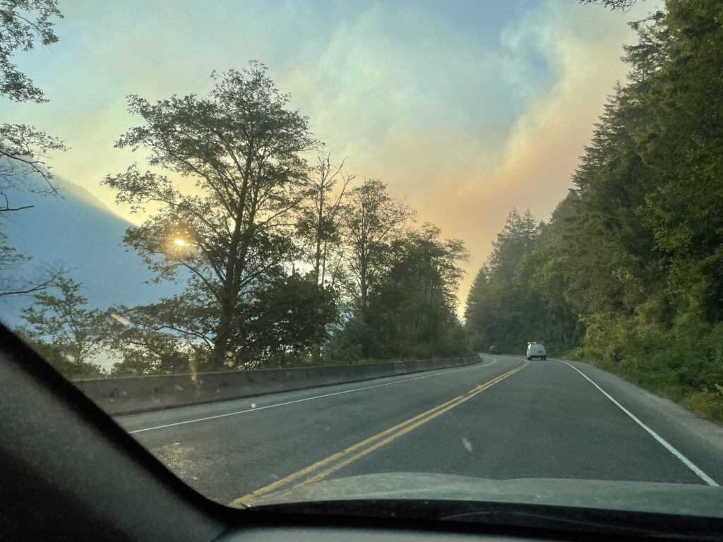
I drove through the area on Highway 4 earlier this morning and the smoke was heavy from the fire but was mostly moving away from the highway. This could change at any moment.
There was fire equipment being setup at the Beaufort Park rest stop and fire lines going into the bush. DriveBC has indicated that the highway could close at any time.
If you don’t need to travel on the Highway I would avoid it or postpone your plans until the fire is brought under control.
If you have any pictures or videos you would like to share feel free to send them to alberniweather@gmail.com or text 250-731-7930.

Smoke
I was expecting the smoke from the fire to move from the Cameron River valley into the Alberni Valley last night when the wind shifted, but it looks like for the most part it has stayed very close to the foot of Mt. Arrowsmith. There was some smoke on the west side of the Hump but Air Quality in town remains good this morning.

Wind – Hot Temperatures – Threat to Cathedral Grove.
There is a very strong Northerly breeze on the East side of the Island that should continue to push the smoke away from Port Alberni but may also cause problems with the fire itself. The wind might also shift when we get our afternoon high temperatures.
Expect temperatures to reach over 30ºC today, tomorrow and Thursday. Not good for knocking down this fire and preventing it from reaching into the Cathedral Grove area.