
Podcast Up – February 1 – Looking at River Levels and the Forecast
For those of you who prefer a video. Here’s the latest podcast companion to this post.
Please do Like and Subscribe.
My intention is to always have a podcast with a blog post but I might not always have a blog post with a podcast. Follow or bookmark (no login required) @Alberniweather on Mastodon too.
Atmospheric River delivered about 115mm
The river has mostly left our region, we have been left with pockets of rain that will linger for the next couple days before we dry out completely on Saturday and Sunday.
Our biggest day at the station was Monday the 29th when we received 46mm. That was our top day for rainfall this January… total was 290mm. If you’re wondering, yes the Airport did set a record for the 29th. It received 76.9mm. I’ll have a monthly summary out for January in the next post where I’ll look into whether that was a record overall and how this month shapes up to other El Niño January’s overall.
As I showed in the podcast, river levels are still high but I some are already starting to drop. I would expect the BC River Forecast centre to update their messaging soon, if they haven’t already by the time this post is online, to remove the Flood watch.
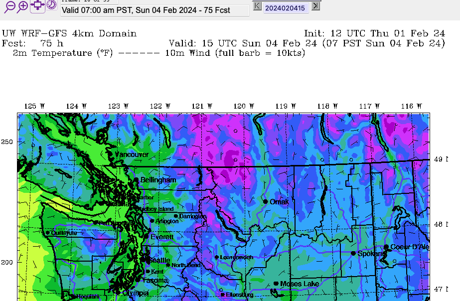
Expecting dry weather starting on the Weekend – Watch for Ice in the mornings.
Yes we could see the sun for more than 10 minutes! I am hopeful that there will not be too much fog. But we will get temperatures down around 0ºC every night from Saturday to at least Tuesday.
Precipitation on Tuesday – Cold Rain or Snow?
The mountains will at least find a little solace in the fact that we should get a little more ‘cold’ precipitation on Tuesday as a front sweeps down from the northwest Tuesday night and Wednesday. At this point it looks like only high-elevation snow.
