

Inland – West – East Side Vancouver Island Warnings
This is this evening’s model picture from UWash. This is not the super-high resolution version but it is inline with yesterday’s predictions. High elevation regions of the Island will get between 100 and perhaps more than 300mm according to the BC River Forecast Centre.
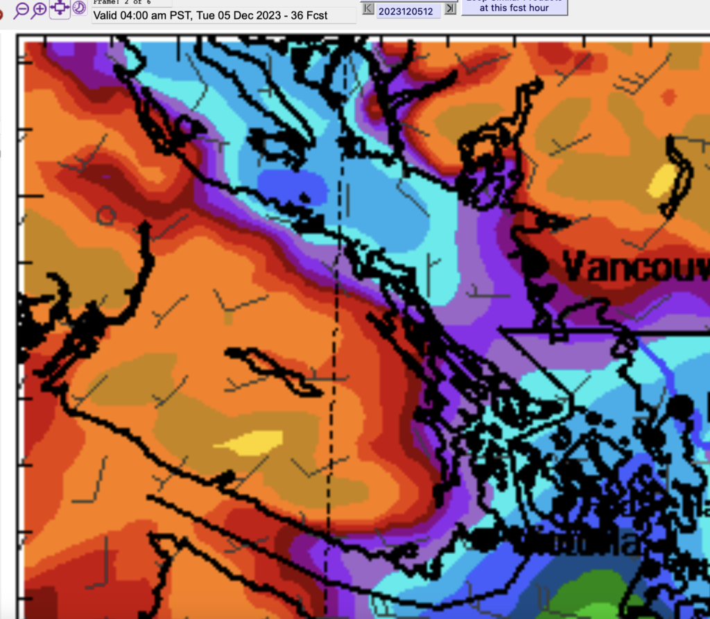

This model supports EC’s warnings for up to 70mm in the Courtenay/Qualicum area , up to 100mm in Inland VI including Gold River and Port Alberni (likely higher in Gold River) and up to 150mm on the West Coast.
The BC River Forecast Centre has a High Streamflow Advisory for most of the Island. This may be upgraded to a Flood Watch depending on how things go so keep a lookout on that link.
If the high resolution model shows anything significantly different tonight I will update this post but it should be pretty stable at this point.
Timeline – Begins after 7AM Monday – Ends 3AM Tuesday
The storm should make landfall with rain across the Island by 8AM Monday morning.

The strongest “pulse” looks to be around 2PM with another around 7PM. The rest of the time between Monday morning and early Tuesday morning should just be steady showers and rain.
Watch the Webcam – Timelapse and Monthly/Season Summary Coming – Christmas Lights
Feel free to watch the webcam. If you can’t see it on the main page, check it out on youtube.com/@alberniweather. I just uploaded the first monthly timelapse from back in October!
I’m working on the November and Autumn Summary and will also include the November Timelapse as well. All in 4K.
Oh ya! I’ll see if I can update the Christmas Lights page as well! IF you have suggestions for addresses, drop me a comment, email, or message on Mastodon.