
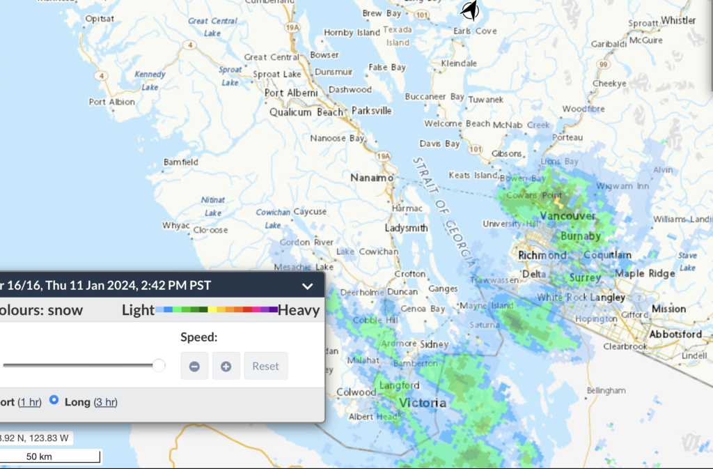
It begins – Vancouver and Victoria
As confirmed on Social Media reports (#bcstorm on Mastodon), snow has begun in Vancouver, especially eastern sections, and also in Victoria on the Saanich peninsula.
The winds have picked up and it’s driving two northwest to southeast lines of precipitation as the Polar Vortex takes hold and temperatures drop. One over Vancouver, and one over the Saanich Peninsula stretching back toward Cobble Hill and Lake Cowichan.
Nanaimo Next?
The UWash model has the precipitation this afternoon dissipating as the sun sets on Vancouver Island.
However, by Friday morning, a new patch of snow pops up between about Ladysmith and Parksville. This is the 4-7AM picture below.

The strongest flurries are in the early morning. It appears to move north as it diminishes later Friday morning. Ending in the Qualicum/Bowser area in the 11AM-1PM timeframe.

Amounts are *very* hard to predict. These could be flurries, or this could be significant snowfall. It is likely to be very localized. Small areas with snow, and some completely dry.
The last picture around noon looks like some snow could sneak over the Beaufort’s into Port Alberni. It looks minimal but it might stick anyway since it is so cold.
Extreme Cold – Friday then gradually warmer through Tuesday
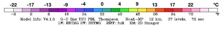
This is an impressively cold picture for Friday morning. The picture below suggests temperatures in the Vancouver Island mountains and in the Fraser Valley and Squamish down below -20ºC. Port Alberni gets off a little easier with “only” down to -10 to -13ºC or so.

The good news is Friday appears to be the worst day and then we gradually warm back up above freezing by Monday or Tuesday.
Polar Vortex
What’s a Polar Vortex? Wiki has a good article.
Why is it here? A look at the Jetstream gives us the answer.

If your reaction to the picture above is “I have no idea what’s coming or going”… that’s exactly it. The ‘normal’ pattern is for the jetstream to move in a mildly wavy way from west to east (left to right). What we are seeing here is a very chaotic jet that is bending and weaving producing cut off lows (the little circle to the bottom left) and, more importantly, allowing very cold air to spill down from the North (the green and yellow areas with the many diagonal barbs).
The same type of wavy, chaotic pattern that gives us a disrupted Polar Vortex from the North in winter also gives us big incursions of hot air from the South, the Heat Dome. We actually *want* the Polar Vortex. But we want it to stay where it belongs over the Pole! The weakened jet stream allows it to escape.
The general agreement is that this confused jet stream pattern is a result of the rapidly warming arctic which reduces the temperature difference between the North and Mid Latitudes. That difference (some might say “temperature slope”) is what the jet stream “rides”. No slope, weird jet stream, big disruptive patterns!