
Nothing like California
While parts of California have received upwards of 400mm of rain in a couple weeks, we’re not nearly at that level, but the next couple days will feature some long duration rain and a small bout of Atmospheric River conditions.
By Thursday morning we have full rain on the Island and a string of rain and moisture stretching down the coast pointed in our direction.

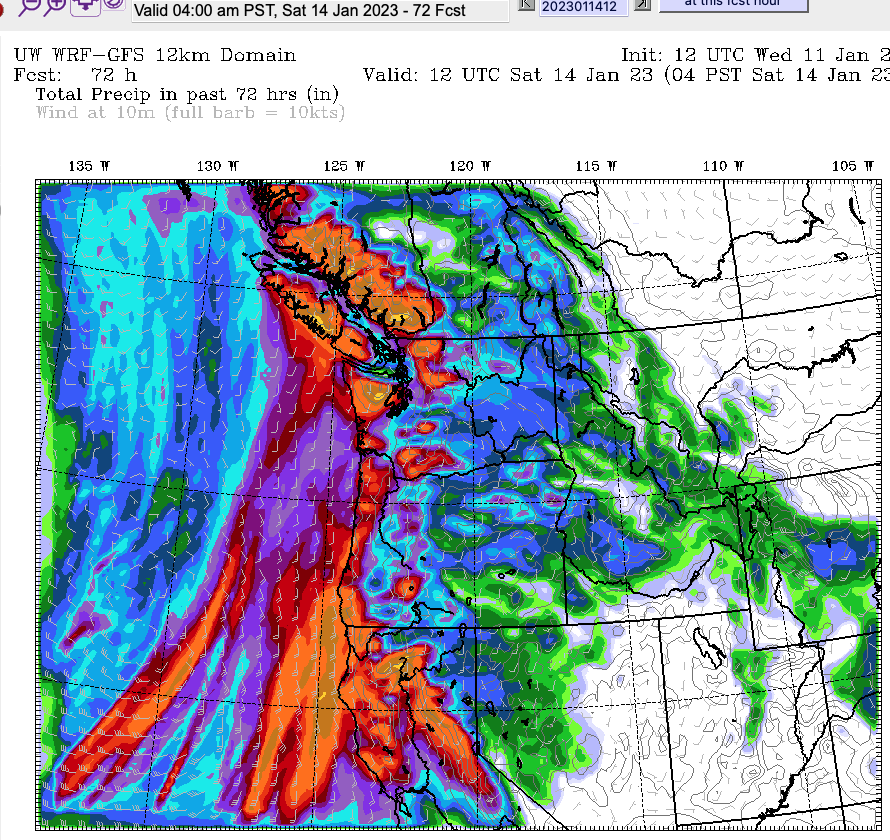
72 hrs (3 days) Outlook – 100-200mm for us, and them
Over the next 72hrs, from 4AM Wednesday to 4AM Saturday, you can see the accumulation below:


You can see in that image that both California and Vancouver Island (and the Sunshine Coast) are going to receive roughly similar amounts of rain in the same period to Saturday morning. It’s pretty normal for us, around 100-200mm maximum. But it’s not far from normal for California. It will continue to cause serious flooding, mudslides and dangerous conditions all over that state.
Timing
Expect it to start raining Wednesday night with the strongest precipitation Thursday morning. It might ease off a little bit in some areas through the day Thursday but expect it to intensify again on Friday morning before backing off Friday night. We should get a break on Saturday and most of Sunday but we’ll be back into the same pattern early next week.
Stay dry out there!