While we haven’t broken any records and likely won’t in the next week, it is going to feel pretty consistently hot and might even hotter as a ridge of high pressure locks in and intensifies. We may break records on Thursday and Friday.
You can see this process in the UWash jetstream forecast.
Here are the jet stream predictions for this morning, Wednesday afternoon and early Friday.
As you can see there is a bit of confusion in the jet this morning as it reorganizes itself around a high building off Southern California but by Wednesday afternoon it has settled into a strong loop through southern Alaska and by Friday it has shifted slightly to the east clearing the way for very hot air to flood northwards into our area.
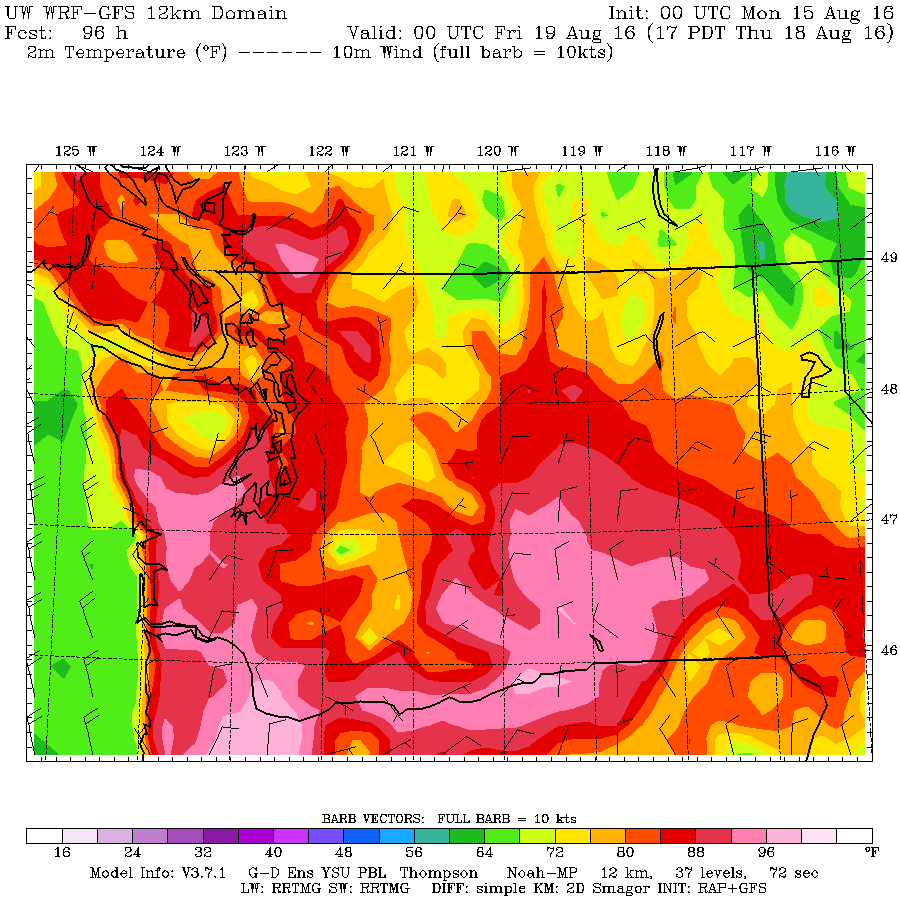
The low resolution, long range temperature forecast demonstrates the effect this will have after Wednesday. We will stay in the low 30s Monday and Tuesday, Wednesday but Thursday and Friday may be very hot indeed. Reaching to the 35°C/96°F range.
Monday. High 20s/low 30s
Tuesday. low 30s
Wednesday high 20s/low 30s
Thursday things get really hot. Note the Fraser Valley has some pink areas indicating up to 35.5°C (96°F). The Alberni Valley is often a little hotter than the Lower Mainland.
It backs off a bit Friday but still hotter than the beginning of the week.
Comox Main Fire is knocked down but got large.
The Fire out Comox Main appears to be in good shape this morning though it almost double in size again yesterday. It is now 5.8 hectares, or 3.5 Martin Mars large.
This is what it looked like at the end of the day on Sunday thanks to hard work by ground crews to get it contained and under control. Pictures from Charles Hubbard on Facebook.

No doubt they will be keeping a very close eye on the remnants of the fire as the heat builds and things dry out even more.
The fire danger is now officially High again and Extreme on the South Island. If the forecast above validates then we should see Extreme conditions creep north and east into the Interior.
The BC Wildfire forecast has the danger rating hitting Extreme in the Alberni Valley on Wednesday the 17th.
 The Monday fire weather forecast should be out in a couple hours.


