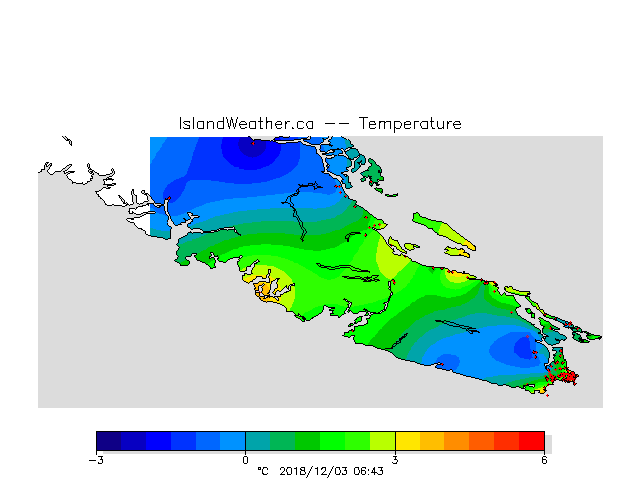
The image is from islandweather.ca this morning. Northern parts of the Island are in the -2 to -3°C range this morning. Cowichan is -1°C. We have among the warmest likely thanks to our blanket of fog. It is currently 2.5°C at Alberniweather and 1.6°C as of 6AM at the Airport.
The fog should lift around noon or maybe 2PM 😉 . When it does it will reveal a nice partly sunny sky.
The wind will be the story most of today as we get our first outflow coming from the Interior. You can see the wind coming out of Howe Sound this morning on the forecast maps.


The wind will shift to northwesterly this afternoon which should keep the fog at bay and create a windchill down to -4°C overnight and tomorrow morning.
Tuesday should be sunny and cold. Wednesday looks quite chilly, particularly on the east side as a strong northwesterly develops over the Strait. Brrrr. But it will keep it clear and sunny at least.

And now here is the big question…. when we get a cold snap like this… we often get the chance of snow on the transition back to rain. So?
There is no precipitation in the forecast until Saturday night. Below is the precip forecast (rain or snow)

Here is the same time, for potential snowfall.

No Snow.
Now this is still 5 days out so could certainly change… but at this point, signs are pointing to no winner for the snow contest yet. And if you look at the 16 day outlook… if we don’t get any snow out of this cold snap, we are unlikely to see any anytime soon!

Happy Chilly Monday!

