
I will be busy at the City all day tomorrow so wanted to get this out after the night model run and before tomorrow morning.
The UWash model is pretty firm that we will get precipitation starting between 5AM and 8AM tomorrow. It will be moving fairly quickly as you can see by the series of images.
3AM-5AM

By 8AM the rain has moved well onshore but totals in Port Alberni are only up to 1mm.

The model actually has us in a rain shadow for the rest of Thursday and overnight. There might be some wind in the evening too. It doesn’t have rain returning to most of the Alberni Valley until between 8AM-11AM on Friday.

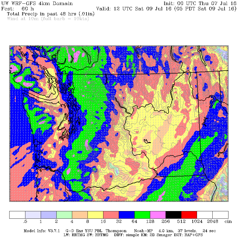
The total precipitation for the two days is only 8mm. But notice in the chart below that the West Coast mountains are predicted to get between 32-64mm. (pink) between Thursday and Saturday mornings.

This could lead to high streamflows in places like the Somass, Taylor and Kennedy and other rivers and streams between the Inland sections and West Coast of Vancouver Island. Please be cautious if you are near any streams.
I will end the post there. There is some pretty interesting weather being predicted for Saturday that at this point looks like it will mainly affect the I5 corridor and Lower Mainland but we’ll take a closer look at that on Friday.
Have a great Thursday! The greens in the garden will love this rain.