
Category: General
-

Borecast – Same weather continues.
Not much to say really… There are more clouds in the forecast than previous but still quite pleasant. It might be sunny again on the weekend. There does look to be a change coming on Monday or Tuesday but the forecast out that far is changing. At this point it just looks like a bit of rain.…
-
Cool foggy mornings, but otherwise warmth and sun continues.
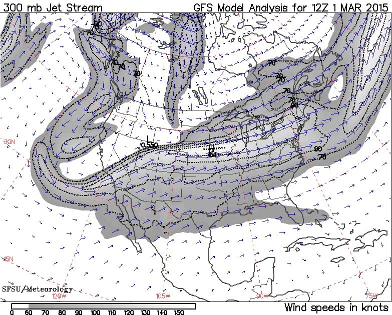
We remain locked into this bipolar continental pattern. The two images above show the jetstream. Our slight change of weather yesterday was in part due to the jet shifting a little to the west/left and positioning the southward flowing stream over top of us. That backward flowing jet is supposed to break down and it…
-

Glimmer of snowpack hope? But return to cool mornings/warm afternoons
The good news is the rain yesterday fell as snow up in the mountains. Even though it hasn’t shown up on the graph just yet, just maybe, this is a start on a bit of a snowpack. The hourly data shows the 28cm of snow fell on Jump Creek over the evening and last night.…
-
Showers by noon. More Thursday night. No snowpack help. Warm Arctic Cold Continent
The streak of foggy mornings and clear afternoons is coming to an end today. By noon we should have some light showers falling in the Valley. Light showers over the central island between 11-12. The showers should last through the evening and end before Thursday morning. However, there will be another slightly stronger pullse of…
-
Fog/Sun mix continues – Showers Wednesday afternoon
The fog and sun combination that we have seen for the past few days should continue for a couple more. We had some record breaking warmth on the weekend thanks to the Sunny afternoons! On wednesday afternoon a weak front will move down from the north and deliver around 8mm of rain to the area…