
Category: General
-
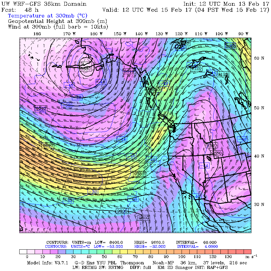
Next up: Jet Stream and Atmospheric River. Special Weather Statement Issued
It has been a glorious Family Day afternoon once the fog lifted! I hope you were all able to soak up those rays of sunshine, because in the next 24 hours it’s going to be soaking in a different way. Here is the text from the Special Weather Statement just issued by Environment Canada for…
-
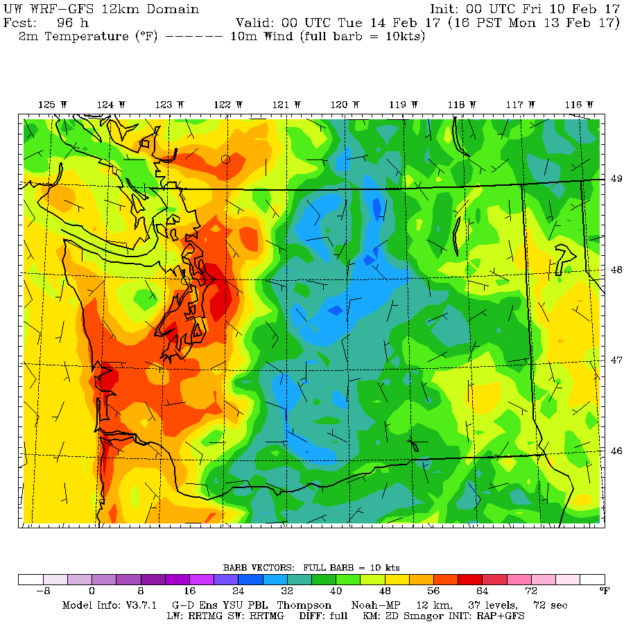
Showers Friday, Saturday, Sunday to wash away the snow
Short post! Phew! The next three days will feature on and off showers and much warmer temperatures and some possible sunny breaks. Hopefully this means most of the snow will be history by the end of weekend. On Monday we can expect another rain system and temperatures over 10°C. That’s it! Have a great weekend…
-

Final UPDATE 7:30PM Winter Storm Warning ended – here are the Details on when and where.
7:30PM Friday – Winter Storm Warning is now ended. Still plenty of rain on the way to wash this mess away…. new post Friday morning. 6:15AM It is currently drizzling or raining. The moisture aloft has now all switched to rain so snow should be done but rain andnfreezing rain now the problem. SD70 is…
-
Update 4:15PM Tuesday – WINTER STORM WARNING FOR WEDNESDAY
Update 4:15PM – Warning Issued and Timing Below is the updated Warning statement and some predictions on timing. The coles notes version is, drizzle or flurries should start around 3PM Wednesday afternoon. Then assuming we are between 0 and 2°C we should see snow, possibly heavy snow, starting after 6PM. The question this becomes how…
-

7:30AM Saturday Update WINTER WONDERLAND
The snow should stop falling later this morning. And then return tonight. WINTER WONDERLAND WEEKEND! https://twitter.com/alberniweather/status/827893394424815616 yes 10-15 cm additional snow forecast though snow may become quite wet tonight — ECCC Weather British Columbia (@ECCCWeatherBC) February 4, 2017 8PM Update more snow tonight The lates Environment Canada update says 10-15cm…