
Author: Alberniweather
-

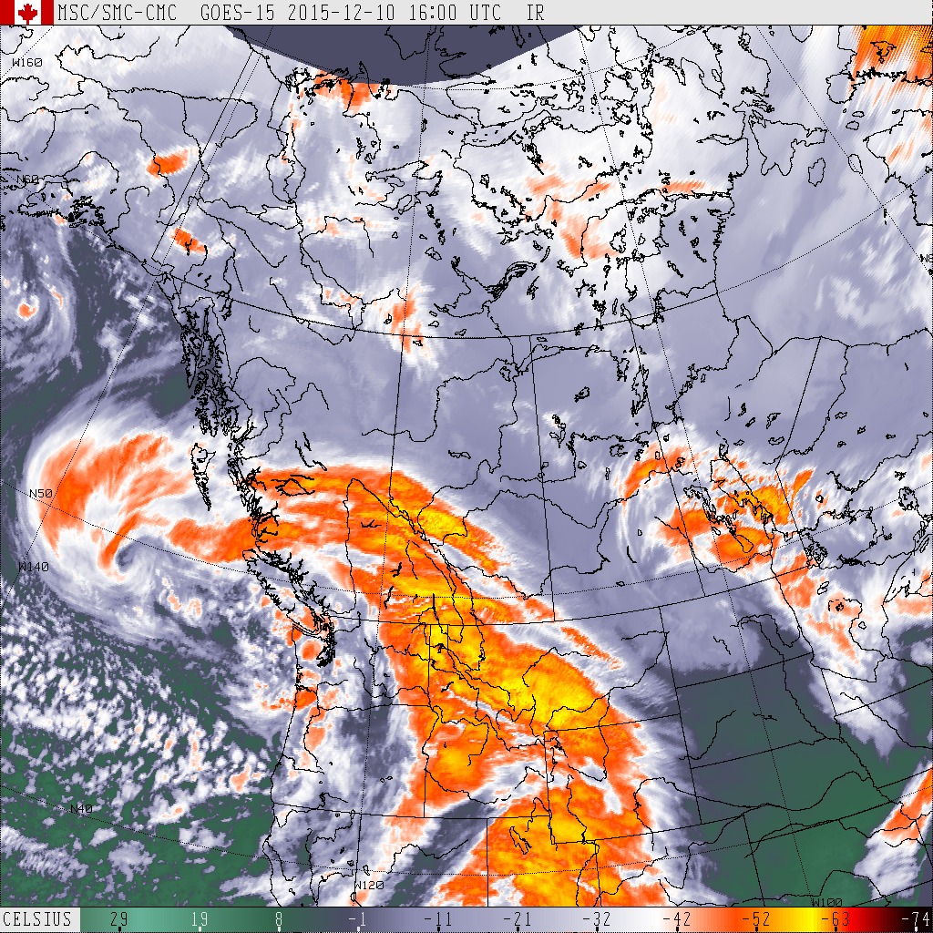
Final Update 8AM Sunday – Final Storm of December procession could be biggest.
Final Update 8AM Sunday – Warning Over. A look at wind around the Island. Environment Canada has removed the Wind warning for our area. Once again, yesterday has proven that predicting high winds in Port Alberni is exceedingly difficult. Our top gust at Alberniweather was only 38kph while Maquinna school got up to 58kph. Warnings…
-
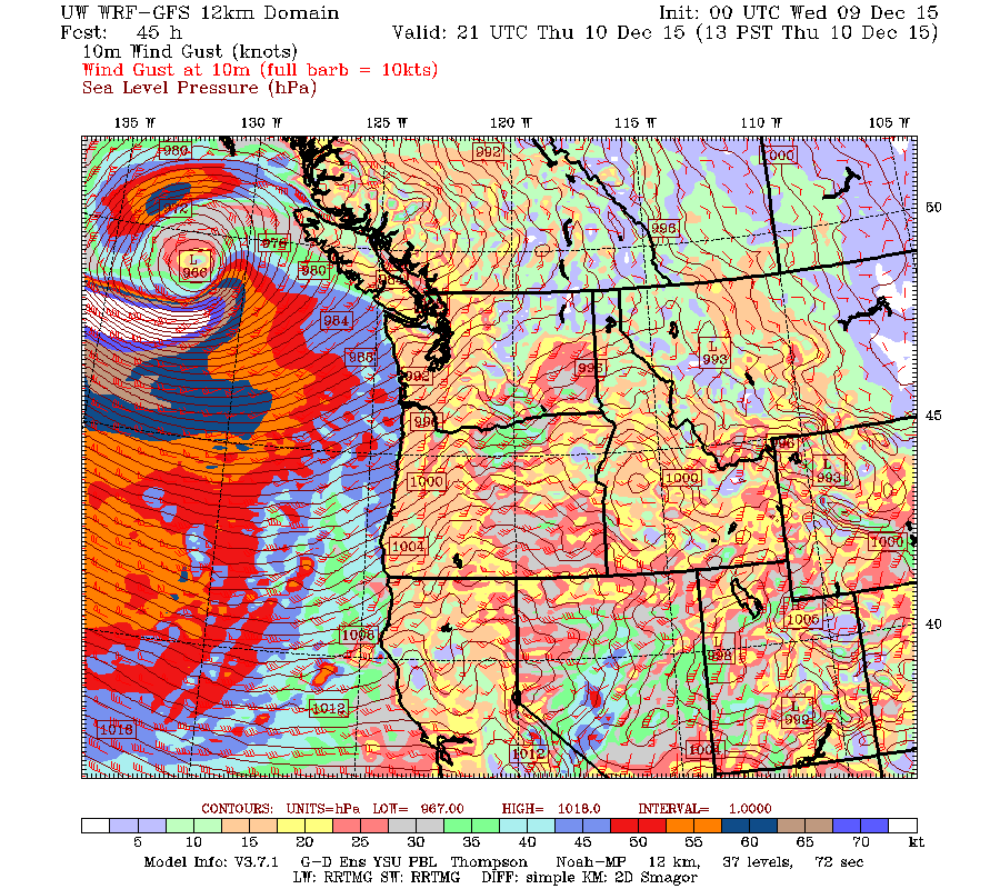
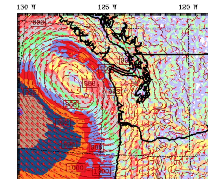
Windy out there! Watching the Low come in. Predicted Treefall on BCHwy4
Update 7:45PM the majority of the City is back online. Still a bunch of smaller outages around the Valley though. are you ready for a potential round two on Saturday? Update 5:45PM BCHydro has restored some power but big swath of port alberni city and valley eta now not on until 10PM. Update 4:50PM BC…
-
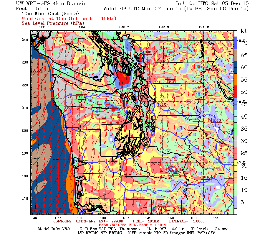
Rain tapering to showers. Thursday, Friday and Saturday rain or wind storm.
As you will see from the 24 hour image below, the intensity of the rainfall we have gotten used to over the past week is starting to back off. The next 24hrs has only 8-16mm of rain forecast. That said there is another bunch of rain coming through starting Thursday and lasting much of the…
-
Final Few Storms, Flood Watch Issued, Brush with a big one.
Flood Watch Re-issued for Somass River/Sproat/Ash. The Tseshaht First Nation continue to sandbag their properties along the river to try to prevent a repeat of last year. Hopefully the sandbags will only be wet from the rain, and not from any flood waters. If you would like to help, please head down to the Administration…
-
Final Update 9:30PM Sunday : Running post for Early December Storm
Final Weekend Update 9:30PM – Strong Winds and Rain down trees whip up sail past. River flows continue to rise. A break Monday. The rain began in earnest this afternoon and didn’t let up. The winds came too this time! Our strongest gust was 68kph at 7:40PM. We have received another 32mm today with most of…