Updated 8AM June 11 – Labour Day Lake Fire Out of Control but no growth – Nahmint Being Held – Air Quality Statement Issued

Updated 8AM June 11 – Labour Day Lake Fire Out of Control but no growth – Nahmint Being Held – Air Quality Statement Issued

Update 8:00AM Wednesday

I will post more updates on my SocialBC feed.

BCWildfire just released an update at 7:34AM for the Labour Day Lake fire. It remains at 5.7 hectares, same as last night, but is still classified out of control. 4 crews are working the fire with 2 air tankers and 2 helicopters listed in the response.

A screenshot shows stats on the right and map on the left. V70573 Out of Control Fire Number V70573 5.7 Hectares Discovered On June 10, 2025 Updated June 11, 2025 at 7:34 a.m. PDT Coastal Fire Centre
June 11, 2025, 3:04 pm 0 boosts 0 favorites

Update 5:30AM Wednesday

I will post updates on my SocialBC feed.

Good news and Bad News

Good: PM2.5 levels rose slightly overnight in but not to dangerous levels. The Provincial station at Alberni Elementary got up to 14ug/m3. Readings over 30 are considered fair-poor.

Winds shifted back to ENE so Nahmint smoke should move away.

Bad: new fire East of Port Alberni on the slopes of Mt. Arrowsmith now 5 hectares. Still listed out of control. ENE winds will push this smoke toward city.

Waiting for BCWF update.

Showing graph from Alberni elementary station with small spike in pm 2.5 overnight Current air quality readings look good in the city. New fire east of city near Labour Day lake and moriarity logging road
June 11, 2025, 12:25 pm 0 boosts 0 favorites

Update 6:50PM Tuesday

The wind has turned around to the south and wildfire smoke is definitely starting to move into or over the Valley. The mountains toward the are near obscured.

Air Quality at the local stations is still good but I would expect once the afternoon breeze enda this smoke will settle down.

Best to close the windows now to keep the fresh air in.

A picture of mostly sky shows blue clear skies above with the sun, sun shining brightly. In the bottom of the picture is a road with some houses in the distance. We are on top of the hill. There is a tree to the left partially cut off full of leaves. In the distance in front of ridges and mountain peaks as a noticeableorange haze from the Wildfire smoke. A map showing the area of Port Alberni shows seven air quality stations all showing blue values under 10 indicating good air quality
June 11, 2025, 1:48 am 0 boosts 0 favorites

Air Quality Statement Issued

An Air Quality Statement has been issued for the Inland Vancouver Island area including: Lake Cowichan, Nahmint, Port Alberni, central portions of Strathcona Park and Schoen Lake Provincial Park. The statement reads:

The Regions… are likely to be impacted by wildfire smoke over the next 24-48 hours. During a wildfire, smoke conditions can change quickly over short distances and can vary considerably hour-by-hour.”

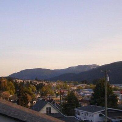
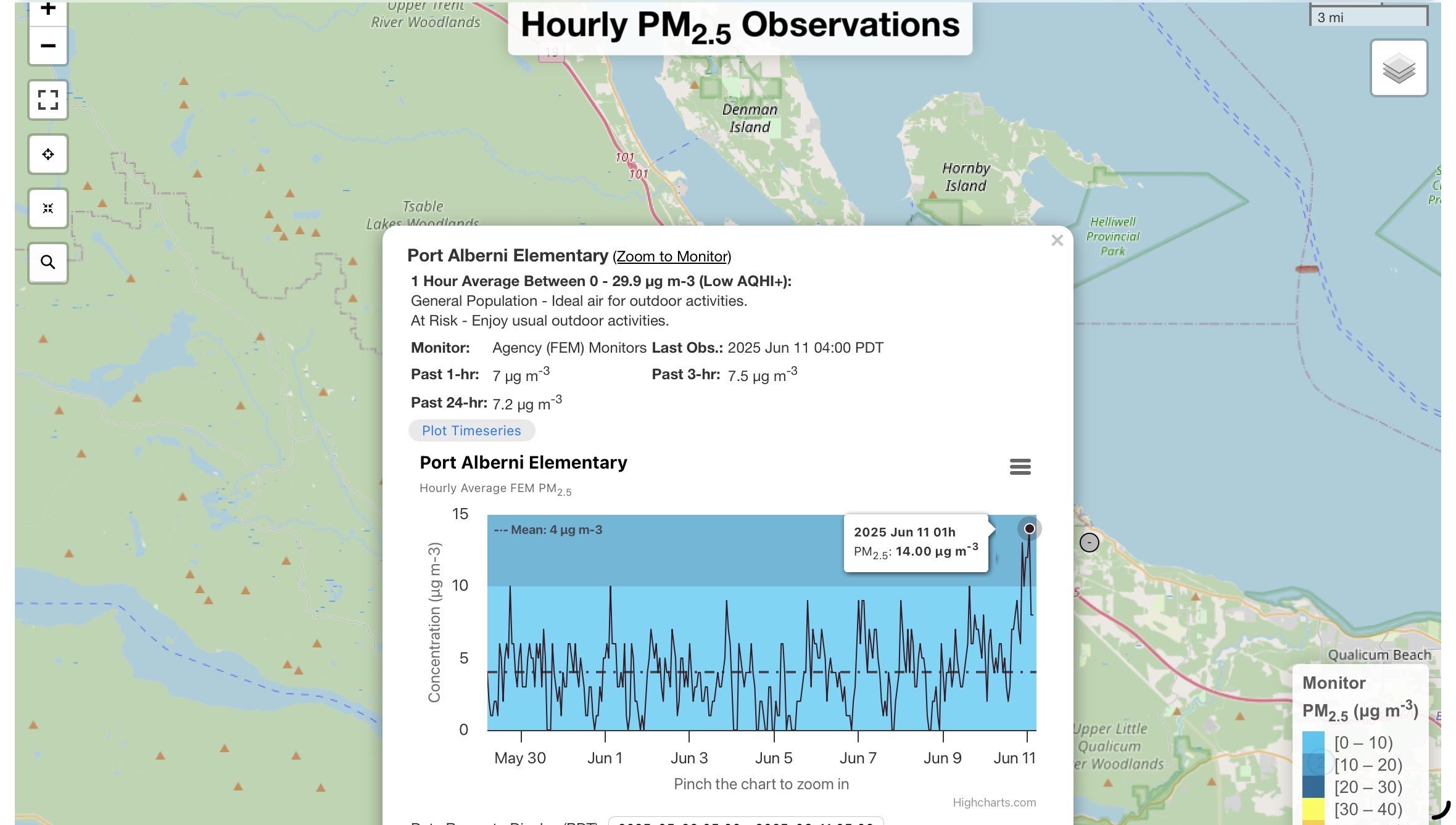
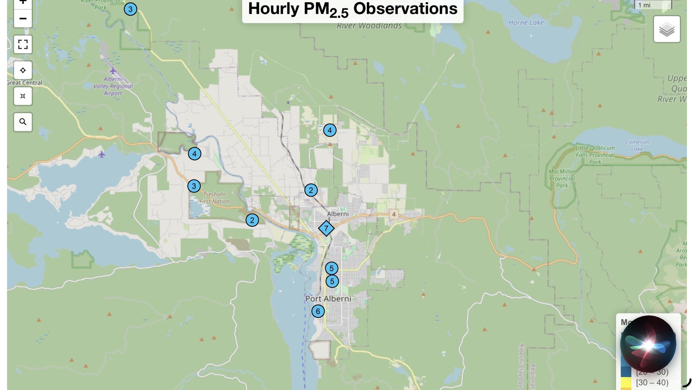
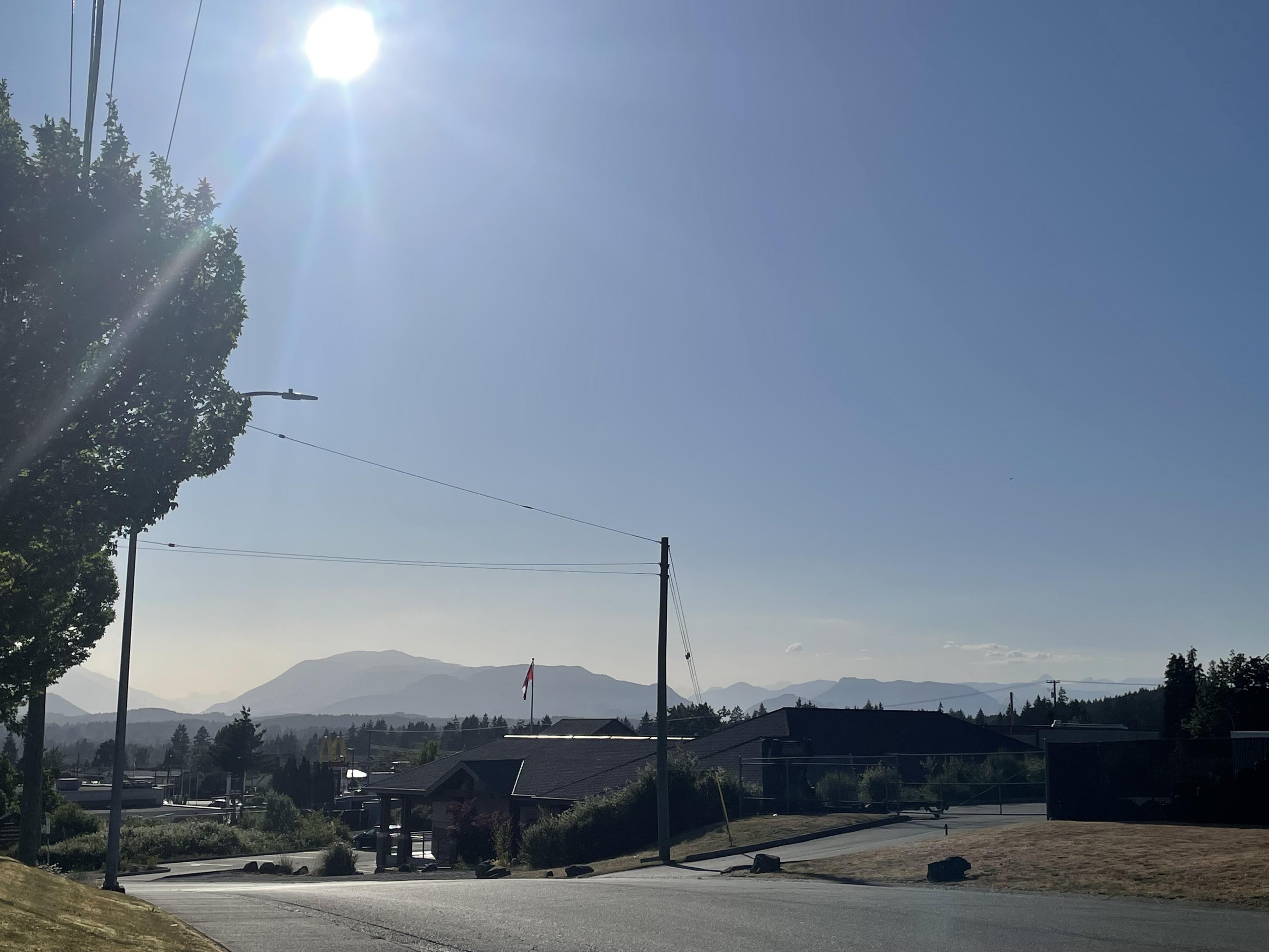
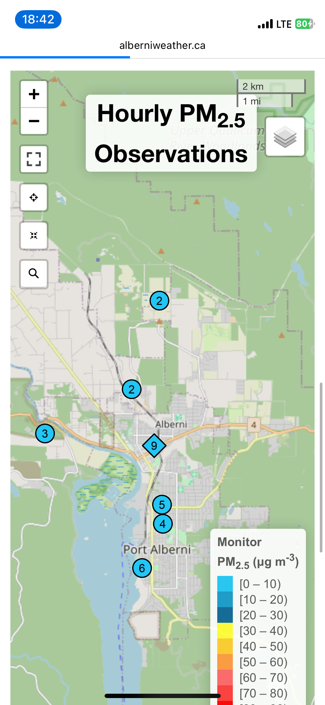
However, this is mostly precautionary at this point as Air Quality is good right now in the Alberni Valley according to AQ sensors in the area including here at Alberniweather. This could change if winds shift to the south, southwest or west.

Air Quality as of 11:40AM Tuesday June 10. Current readings can be seen on the Air Quality Page.
A screenshot
Temperature, Humidity, Wind and Rain values as of 11:40AM show northerly winds persisting. Dry conditions remain. This data is updating on the front page or the NeoView page.

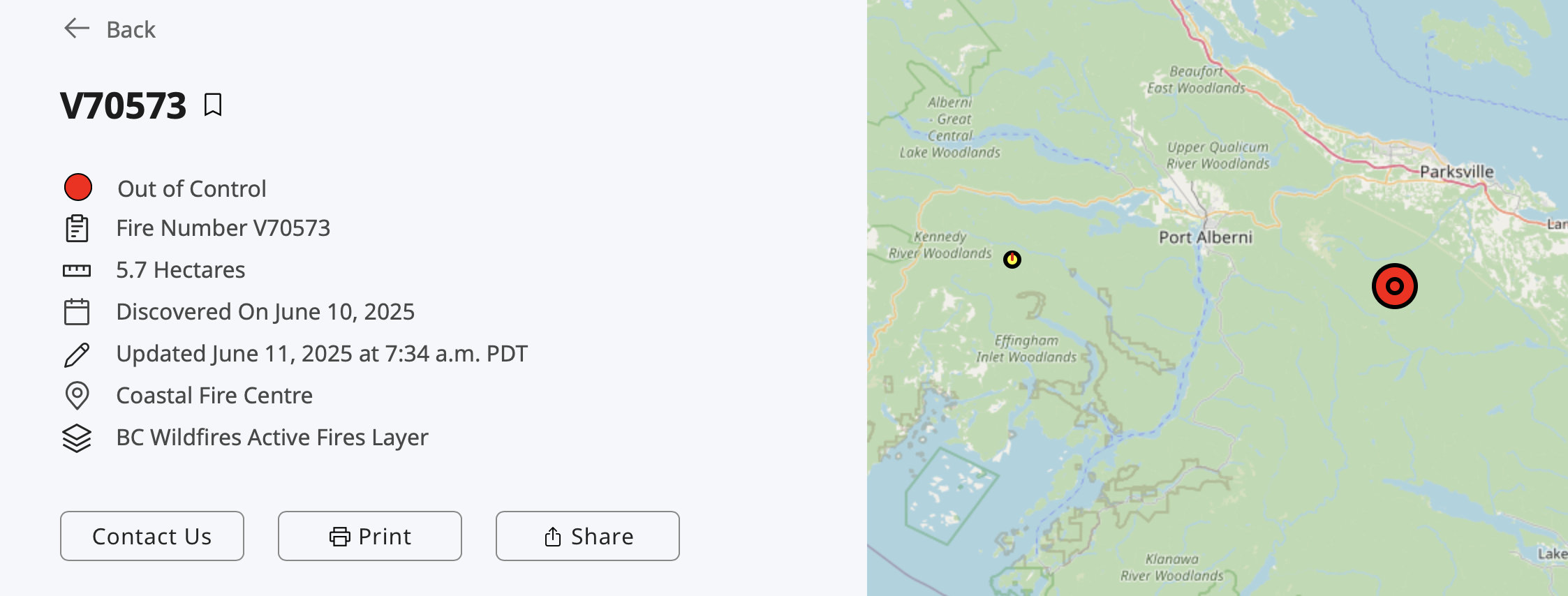
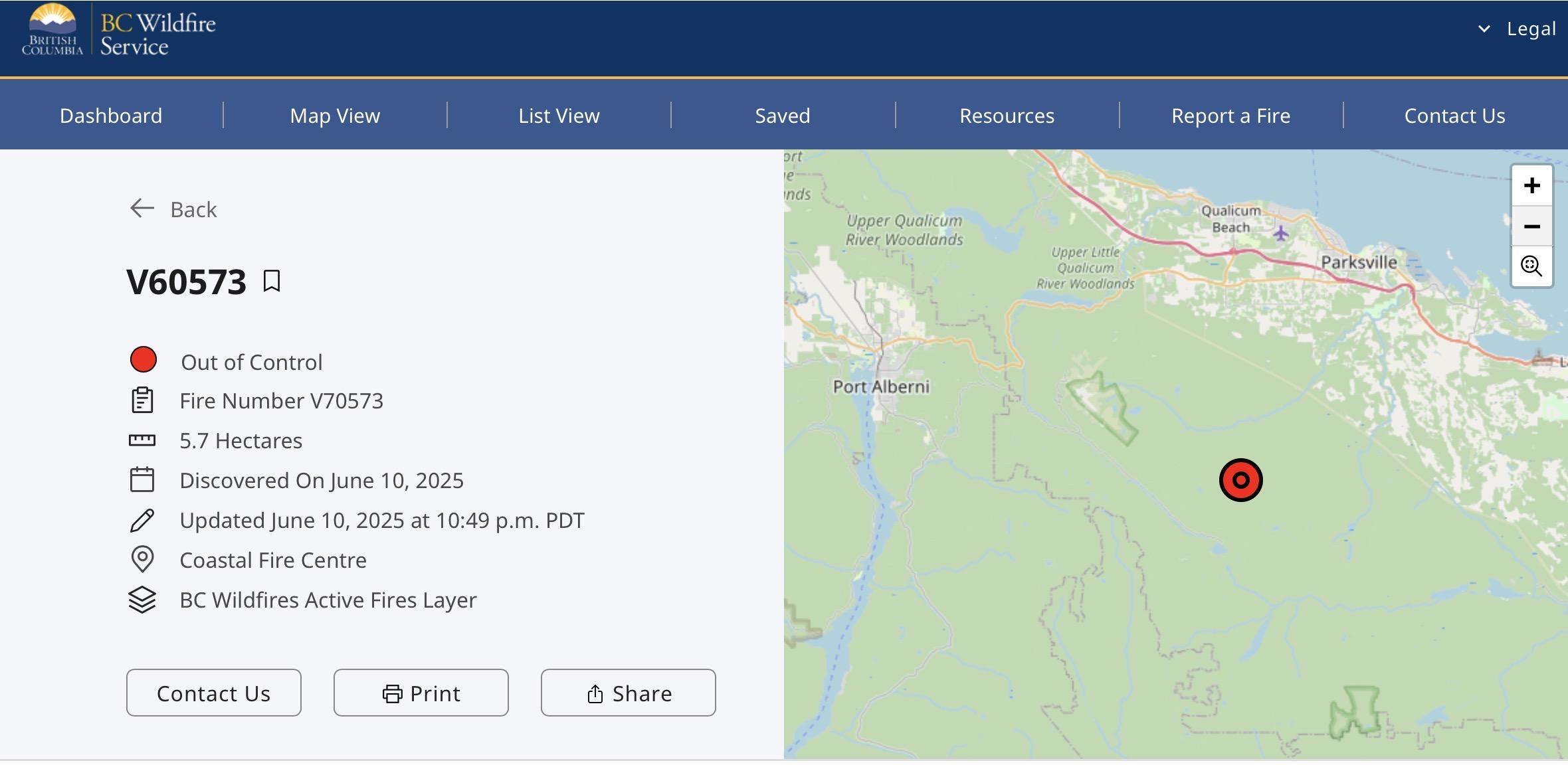
Wildfire 23 hectares

The latest update from BC Wildfire is now June 10. The fire remains at 23.51 hectares. You can see its status here including pictures from the air and various statistics on crews working the fire.

The most important fact is that is no longer “out of control”. It appears to have climbed straight up one side of Nahmint mountain after being started in or near a cutblock but now been halted.

A view provided by the BC Wildfire Service shows smoking areas around and inside a relatively fresh cutblock on the side of the very conical Mt. Nahmint.  The mountain is mostly covered by forest and there are other ridges in the distance with blue sky above.
A view provided by the BC Wildfire Service shows smoking areas around and inside a relatively fresh cutblock on the side of the very conical Mt. Nahmint.

As you can see in the screen capture below, the perimeter is about 1000m by 500m at its largest.

A beige coloured map area with an irregular area of green covering about 1/3 of the area from the bottom left to the middle. On the right and bottom is a red perimeter line roughly kidney shaped vertically oriented with a small yellow dot near the bottom right indicating where the fire started.  Underneath the red outline is the map scale of 1:11,700 and a bar of 0 to 500m. There is also a lat/long of 49.217 -125.221
A screen cap from the BCWildfire map.

There was another very small wildfire reported near Kennedy Lake yesterday but it no longer appears on the BCWildfire maps. The next closest is a small fire classified as Being Held near Upper Campbell lake.

Forecast mostly dry

While there is a slight change coming for Wednesday and Thursday with cooler temperatures, the likelihood of precipitation is fading. The model currently has very scattered activity mostly confined to the ridges and mountains on Thursday afternoon with a high of just 15. Otherwise, the picture remains dry and warm through the weekend.

Thursday precipitation outlook shows small patches of moisture in the higher elevations and along the east side of the Island.

About The Author


Posted

in

, , ,

by

Comments

Leave a Reply

This site uses Akismet to reduce spam. Learn how your comment data is processed.