This pattern of a northerly jetstream running over a ridge of high pressure giving all regions of the South Coast heavy fog is not going away.
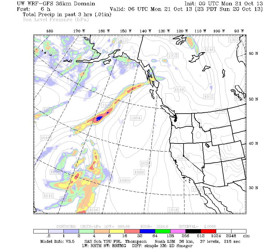
Here is the precipitation map for last night at 11PM.
You can see the ridge over us deflecting all of the active weather far out in the Pacific.
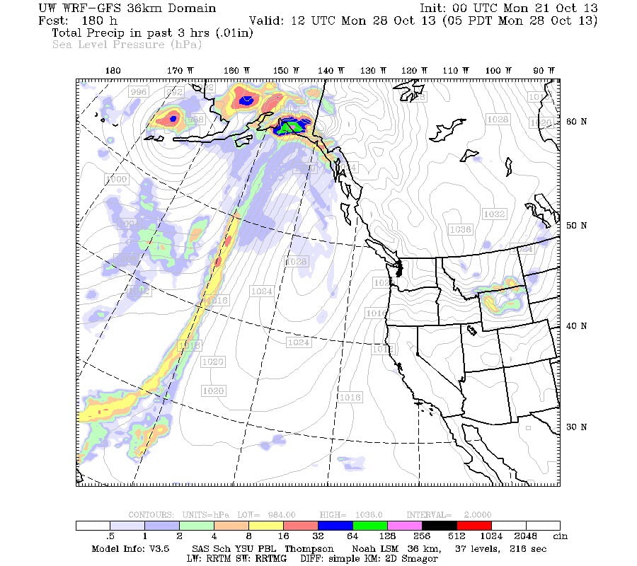
Now here is the image for next Monday morning the 28th.
It isn’t much different. In fact it shows the high pressure lingering off the coast a few hectopascals stronger than it is now.
Without any rain in the forecast before Halloween, there are going to be a lot of records set for low rainfall around the province. As I mentioned in my last post below. Port Alberni won’t be setting an all time record, the officially recorded amount at the Airport is 25.2mm, about double the record. However, that is only 12% of our normal 200mm.


