
Hot August fades into warm and wet September.
Happy Thanksgiving!
September sent us back into what felt like a pretty cool pattern. We actually set two short term low temperature records at the Airport at the end of the month and one short term rainfall record at the beginning of the month. Neither record beat the long term records. The lows in particular were way off historic lows (below zero!) for the days.
Other than those records the general trend was actually slightly warmer than normal temperature picture with a little more rain than normal (125%).
What may be more interesting is the outlook that, in the immediate, is looking very rainy and stormy over the next week or two and then getting into winter it is looking not quite as stormy as perhaps previous runs of the Winter models look. We also get our first look at Sprin 2017.
Read on below!
River and Drought Conditions
River streamflow conditions have not changed a huge amount. These are just snapshots of the day’s flow. You can see the month’s flow at each station on the BC River Forecast Centre site. It is still fairly dry on the south Island but we can see strong flows from the recent rains in Courtenay, Campbell River and Port Alberni.

![]()
The overall Drought Level picture has improved drastically. Here is the beginning of September’s picture:

And here is now:

The entire province is in drought level 1 which means it is good and normal.

It is worth noting from the chart above that Vancouver Island had the worst drought conditions in the province throughout the year. These were basically left over from the major 2015 drought. We now appear to have finally recovered from that drought.
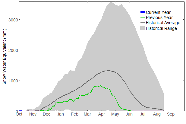
Snowpack Situation
No snow to speak of yet on the either the Jump Creek (South Island) and Wolf Creek (North Island gauges.
Last year we didn’t get any real snowfall on the gauges until mid-December. I don’t think that will be the case this year. We might see the first inputs into the snowpack at least on the North Island this week. We’ll see:
South Island/Jump Creek (near Nanaimo Lakes) elevation 1134m

North Island/Wolf Creek (near Gold River) elevation 1422m

16 day Outlook — Stormy.
Here are the 16-day GEPS consensus graphs from SpotX. We have a couple more days of clear skies. After that, we may be in for a pretty dark month of October! Temperatures stay mild. The minimums don’t get below 8ºC. By the end of the month we could also be looking at a total of 300mm of rain. Most of that is slated to come between this Wednesday and next Wednesday! Looks like a good chance for wind this week too.


El Niño/La Niña Discussion:
The latest El Niño status bulletin from the NOAA is still from last month. It should update later this week.
Three-Month N-America Forecasts
The Temperature anomaly for the next 3 months.
The November, December, January temperature outlook remains much warmer than normal across Canada and the US though trending a little less warmer than normal on the West Coast. As usual, the Arctic regions are the most extreme with temperatures between 2-3ºC above normal.
 Previous forecast for Sept/Oct/Nov

Precipitation Forecast.
The November/December/January forecast precipitation forecast as turned much drier than it was previously. Of particularly note is the Alaska panhandle north of Haida Gwaii. The could be an indication that the storm track is expected to shift away from its normal position where the lows head into the Central and North coast. Will they go here or perhaps way up into Alaska instead?

Previous forecast for Oct/Nov/Dec.

Global seasonal forecasts
Global Temp and Precip Spring, Summer, Fall and/or Winter forecast from current and last month runs. Only 1 of 2 seasons are within the forecasts in any given month.
This months forecasts: Winter 2016 and Spring 2017
Winter 2016 – Not as big Pineapple Express?
The latest forecast for the winter months has shifted a little back to the cooler end of the spectrum for the PacNW region and the El Niño area of the Pacific. There is still a lot of abnormally hot areas all over the northern hemisphere but the normal temperature area has grown a bit in the Pacific which woluld have the closest impact to us. The Eastern part of Canada looks very warm. But what about rainfall? Keep scrolling below…


Precipitation Forecasts
The strong signature we saw in last months Winter forecast that indicated perhaps a particularly strong Pineapple Express season has disappeared somewhat. Hawaii is still predicted to be wetter than normal as well as a small portion of the PacNW so that might still indicate we can expect a stormy winter. The La Niña/El Niño region are looking very dry on the equator.


SPRING 2017 FIRST LOOK
The first model runs are out for Spring 2017. Below is the Temperature and Precipitation forecasts for the globe.


North America looks not quite as overly warm as the winter months particularly in the North West parts of Canada. And precipitation is normal across the continent. This likely will ‘feel’ like a cool spring then since our most recent springs have been quite warm.
Sea Surface Temperature next 3 months
The last 3 predictions for Sea Surface anomalies show a gradual but brief return of the “Blob” ending in September/October. By November it looks like the blob has retreated to the north and more importantly, the Pineapple Express track is not quite as red hot so there might be less moisture there to gather compared to what previous models indicated. Look at the very warm waters off the East Coast of the US. Perhaps a slightly extended Hurricane season?


That’s it!
Monthly Timelapse Video
Monthly video unavailable see all days here:
https://www.youtube.com/user/alberniweather/videos
Daily records set this month at the Airport (and compared to other stations* for “All Time” since 1900)
Two new Airport lows, one rain.
- September 1 rain 24.6 mm: #1 is 35.6 mm in 1967 at Robertson Creek.
- September 29 low 1.7º C: #1 is -2.8º C in 1919/1950 at Beaver Creek.
- September 30 low 2.3º C: #1 is -3.9º C in 1950 at Beaver Creek.
*Short Term (since 1995) Airport Records are compared to the 30+ year weather stations of record since 1900 (1895 for rain) at Beaver Creek, Port Alberni “City” and Robertson Creek. Note that records pre 1950 may be more likely to over-estimate high temperatures.
September 2016 Minimum, Mean, and High Average Temp and Total Precipitation
See August’s and last September’s summary.
Alberniweather: 9.8º C, 14.4º C, 20.5º C, 69.8 mm
Alberni Elem. School : 9.4º C, 14.2º C, 20.5° C, 126.7 mm
Maquinna Elem. School: 9.8º C, 13.9º C, 20.2° C, 123.2 mm
Nick’s Station (Maquinna area): 9.8º C, 13.7º C, 19.0° C, 81.8 mm
Neptune Canada Station: 10.0º C, 14.3º C, 20.7° C, NA
Overall City Average: 9.8º C, 14.1º C, 20.2º C, 100.4 mm
Environment Canada Airport* : 7.8º C, 14.1° C, 20.3º C, 82.4 mm
Normal 1981-2010 (Rbrstn Creek): 8.0º C 15.3º C 22.4° C 61.4 mm
Differences from Normal
City Temperatures:
+1.8° C, -1.2º C, -2.2º C
Official Temperatures:
-0.2º C, -1.2º C, -2.1º C
City Precipitation:
+39.0 mm (163.5% of normal)
Official Precipitation
+21.0 mm (134.2% of normal)
Days of Precipitation for September 2016*
Amount : Normal Days : Days This Month
>= 0.2 mm: 10.3 : 16
>= 5 mm: 3.6 : 6
>= 10 mm: 1.8 : 2
>= 25 mm: 0.52 : 0
Comparison to recent months of September at Alberniweather
MOST SIMILAR ALBERNIWEATHER SEPTEMBER TO THIS MONTH? September 2015
- 2015: Similar warmth and more rain in 2016. See September 2015 Summary Here .
- 2014: Cooler than 2014 similar rain. See the September 2014 Summary Here.
- 2013: Warmer 2013. Very rainy 2013. See the September 2013 Summary Here.
- 2012: Warmer 2012 nearly no rain.
- 2011: Warmer 2011 less rain.
- 2010: Slightly warmer 2010. Less rain.
- 2009: Slightly warmer 2009. Less rain.
- 2008: Very warm 2008 and same rain.
- 2007: Similar rain and warmth.
- 2006: Much warmer and much rainier.