Forecast Issued 4:00 PM PST Thursday 21 February 2019 - Thursday night: Cloudy. Periods of snow beginning late this evening. Amount 2 to 4 cm. Wind up to 15 km/h. Low minus 1. Wind chill minus 3 in the evening. Friday: Periods of snow ending near noon then cloudy with 40 percent chance of rain showers. Snowfall amount 2 to 4 cm. High 6. UV index 1 or low. Friday night: Cloudy. Flurries beginning late in the evening. Amount 2 cm. Wind up to 15 km/h. Low minus 2. Wind chill near minus 4. Saturday:Flurries or rain showers. High plus 4. Saturday night: Clear. Low minus 4. Sunday: Sunny. High plus 5. Sunday night: Clear. Low minus 5. Monday: Sunny. High 7. Monday night: Clear. Low minus 5. Tuesday: Sunny. High 6. Tuesday night: Clear. Low minus 5. Wednesday: A mix of sun and cloud. High plus 5.
The rain will start today in the afternoon. You can expect it to be pretty heavy overnight and to last through the day Wednesday. We will get a break Wednesday night and then it will start up again on Thursday afternoon.
We have a long line of storms waiting to get us out there in the Pacific.
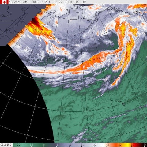
There isn’t much chance for snow from this storm train, but skiers and snowboarders should rejoice. There will be a lot of fresh powder up there if you can get up there between the blizzards.