
We’re going to get another bout of heavy rain tomorrow…. but I’m looking beyond that now because if the models are accurate (and they’ve been consistent on this for almost a week now) we look to be setting up for another bout of cold and potentially snowy, weather.
Here are todays results from the Global Forecast System.
First the short range forecast including the rain tomorrow.
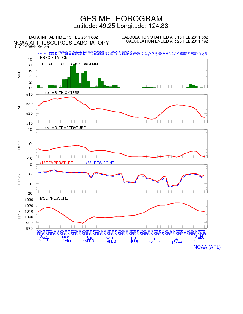
The bars are precipitation… notice the main shot on Monday through Tuesday morning.
What’s interesting is the break about 1/3 the way through…. if you look at the other graphs you’ll see that break marks a change. Particularly the 850MB chart shows the air aloft will turn cold and stay that way. That likely means some arctic air will be making its way here and any precipitation that falls after Tuesday could fall as snow.
Here’s the following week up until March.
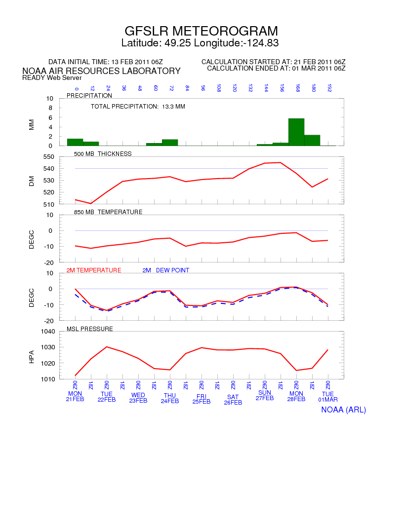
If that model pans out… everything between Tuesday and March 1 could be snow!
Whatever happens…it’s setting us up to be below freezing for a couple weeks.
Comments
14 responses to “Definite change coming”
O.K. something to look forward to! Anticipation is half of it for me.
Isn’t it though!?.. love the anticipation of weather to come…
You should check out yesterdays timelapse… it was a camera shaker. 🙂
http://www.youtube.com/alberniweather
checked it out………..lol………so cool to us weather fanatics! Showed it to son and husband 🙁 ….What do they know? Watching golf would be the only excitement around here, if I wasn’t around. They all think I am messed up. I got all excited seeing it again! Ready for the next bit of fun!!!!!!
Might get windy again tonight and tomorrow too.
EC posted a wind warning for US! That definitely means we WON”T have wind…..phoooey
JINX 🙂
ooo i love it when its chaotic
LOVE IT!!! YAY!
The Barometer is already lower than it was on Saturday, so the potential for strong wind is certainly there. It all depends on if it comes roaring up the Inlet or gets stopped by a mountain or two.
It’s been blowing in Ukee pretty good all morning. Raining too. We were gonna head for Toquart Bay for a campfire, but I kaibashed that idea due to the rainfall. Might go look at Long Beach This afternoon.
http://www.alberniweather.ca/images/csimcache/custombaromwinddownload.png
Wow, those are some pretty strong gusts here in North Port
Its been howling good here, and we have a 5 minute window of heavy heavy hail perhaps an hour ago.
I think we got hail as well!