Major mixed bag coming this week. Showers today, rain tonight and tomorrow possible sunny breaks and chilly air on Wednesday then back to shower with possible flurries on Thursday… Rinse and repeat.
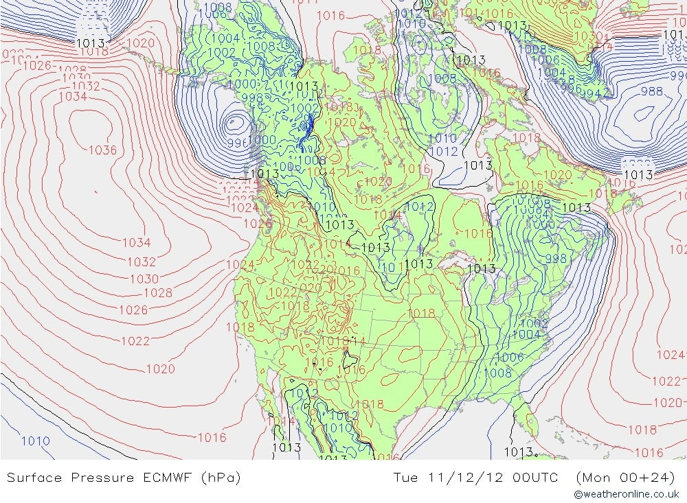
The European model is showing a steady pattern with high pressure over the North Pacific and low pressure systems sliding down the East side of it onto us.
Looks like Saturday we could be in for some stormy weather. More on that as the time approaches.
Starting to wonder whether there is any chance for a white Christmas. Well, the best chance is always Mt. Washington. 😉
But there does seem to be some thought that it could at least be cold enough for snow around the 25th. I’ll keep an eye on it and try to come up with something more concrete in the next few days.
Here are two interesting graphs I’ve seen today:
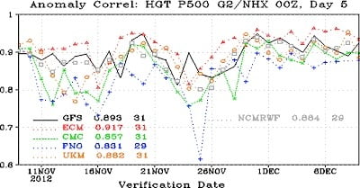
First from an excellent blog post by Cliff Mass on lack of funding and support for weather forecasting in the US (it is a worse situation in Canada). A ranking of global weather forecasting models. The Euro is significantly better than all, then the GFS(US), UKMet, CMC(Cnd), and FMC(frch)

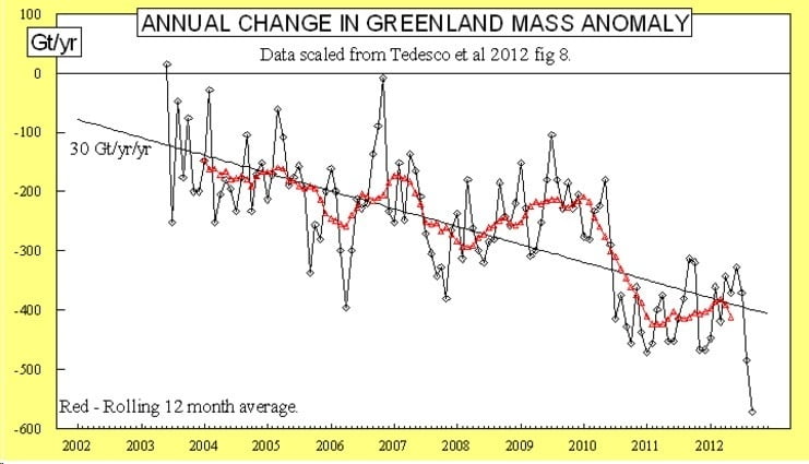
And the second graph is new data mentioned by the Arctic Sea Ice blog from a study on Greenland ice sheet melt. 2012 was a breakthrough year for total ice mass lost (the black line) in the past decade. All ice melting factors studied set new records.
The study indicates that conditions are worsening much faster than any of the current IPCC climate models are likely to predict as they are related to changes in weather patterns (the North Atlantic Oscillation) that have not yet been taken into account (and probably need a lot of computing power to be included) so sea level rises from Greenland are likely to be underestimated.
……….makes one think that Governments around the world but in North America especially are willingly flying blind over a cliff of their own making…….


Comments
3 responses to “A little bit of everything”
It still looks like Thursday has a chance of snow.
Wow, then I looked at the GFS graphs and its forecast is for a whole lot of precipitation with the temperature staying right around the freezing mark up until Christmas.
Ya it looks like its not going to be quite cold enough for it all to fall as snow at sea level, but the mountains are going to get totally buried right through Christmas!