Update Thursday 8AM Very Rainy Wednesday – Possible Wind – Runoff in the Watershed

Flood Warning & Watches issued by BC River Forecast Center after last night’s #BCstorm FMI: http://bit.ly/KaF1ou http://twitter.com/EC_BCweather/status/692759365363826688/photo/1
Update 8AM Thursday – Rainfall Warning Ended.
Issued at 2016-01-28 15:13 UTC by Environment Canada:
Rainfall warning ended for:
West Vancouver Island, B.C. (081400)
Inland Vancouver Island, B.C. (081500)
Current details:
Significant rainfall is no longer expected.
Update 10PM – RAINFALL WARNING CONTINUED – Initial forecasts underestimate rainfall.
Here is the latest from EC:
Rain, at times heavy, is expected.
An intense Pacific frontal system is tracking over Vancouver Island tonight.
Parts of West Vancouver Island have already received 100 to 150 mm of rain. Over Inland Vancouver Island 60 to 80 mm of rain has fallen.
Another 40 to 60 mm of rain is expected to fall tonight. Rain will ease overnight with the passage of the front.
Heavy downpours can cause flash floods and water pooling on roads. If visibility is reduced while driving, turn on your lights and maintain a safe following distance. Watch for possible washouts near rivers, creeks and culverts.
Obviously the forecast has changed. Rather than peaking in the evening, the heavy rain has continued as likely to continue further into Thursday.
My rain gauge on alberniweather unfortunately appears to be stuck or not functioning, however, Alberni Elementary has recorded 49mm since midnight… about 45mm since 4AM and about 20mm since 4PM.
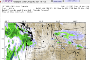
The latest forecast is out from UWash, it says we will receive up to 60mm in the 24hrs between 4PM Wednesday and Thursday. That means we will get 40mm more rain. However, as you can see below, the system is going to clear out before 5AM Thursday. So we will get that 40mm in only 7 hours or so. 50mm in 12 hours or 100 in 24hrs is warning criteria. So 40 in 7 easily falls into that category.
Be aware for localized flooding, pooling on the roads, and trees down due to the saturated ground. Streams are also going to be running hard.
Wet Coast here we come! 🙂
Update 4:30PM – RAINFALL WARNING ISSUED
3:52 PM PST Wednesday 27 January 2016
Rainfall warning in effect for:
- Inland Vancouver Island
Rain, at times heavy, is expected.
An intense Pacific frontal system moving towards Vancouver Island has brought heavier rain this afternoon. Parts of the region have already received 40 to 60 mm of rain during the day. Another 50 to 70 mm of rain is expected to fall tonight. Rain will ease overnight with the passage of the front.
Heavy downpours can cause flash floods and water pooling on roads. If visibility is reduced while driving, turn on your lights and maintain a safe following distance. Watch for possible washouts near rivers, creeks and culverts.
Please continue to monitor alerts and forecasts issued by Environment Canada. To report severe weather, send an email to pacificstorm@ec.gc.ca or tweet reports to #BCStorm.
Update 4PM – Rainfall Gauge Malfunction
After a heads up from a regular reader, I’ve done some checking and it appears the rain gauge is malfunctioning on the system. Rain is currently not being reports on either the my website or to island weather.ca so there has to be a problem either with the hardware or on the server.
Unless it is very simple like an unplugged cable I likely won’t be able to look into it until the weekend.
Thanks for your patience. You can see the nearest station for up-to-date rainfall measures at Alberni Elementary School. Current total is 27mm for the day.
Update 12:30PM – Video from Active Logging in the Watershed.
Update 7:15AM – Model comparison on rain, and wind. Outlier Canadian high res forecast 150mm would cause flooding. Wind possible.
I just went through the full set of models and in general the Canadian models are on the high side, the highest resolution Canadian says 150mm in the next 24hrs. Which is concerning. But most say around 90mm while the GFS says around 65mm in agreement with UWash.
Warning level for our Inland Vancouver Island area is 100mm in 24 hours (or 50 in 12).
There does seem to be consensus that we will have strong winds around noon and then again tomorrow.
Here are all of the models:


The evening UWash model is out and confirms that we will be having a very rainy Wednesday.
Here is the 24 hour total. Up to 60mm will fall between 4AM Wednesday and 4AM Thursday with an outside chance of more than that if you are nearer the mountains.
This is bad news for freshly logged places like this area in the Roger Creek drainage area. (6KM East of Franklin on Cameron Main). You can see Roger Creek were the grey deciduous trees are at the right of the picture.

There will be more runoff into the creek. If we get an extreme event beware of debris moving down Roger Creek closer to the City.
Back to the weather. The main force of the rain will begin before 4AM Wednesday morning and pick up steam through the morning and afternoon and should peak around 4PM or 5PM and gradually taper off by Thursday morning.
Thursday will be just a little showery and then it is going to rain some more on Friday and maybe get quite cold on the weekend. There is even a chance of flurries on Saturday night.
If you’re wondering where that sign is:


Chris, it looks like your rain numbers aren’t updating today.
Oh! I see that now. I wonder if it has to do with the spam scanner I had to run today. I will look into it. Thanks for the heads up.