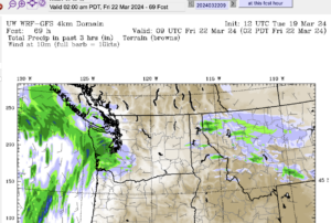
Updating all Day Tuesday – Snowfall warnings issued. 5-10cm on Island, more locally.

Final Update 5PM
Update 5PM: The snow should be mostly done now and we should just see rain except at higher elevations or where pockets of cold air have remained. The Special Weather statement is still in effect for our area even though the snowfall warnings have ended for the East Island.
Stay vigilant for changing conditions if you are driving. This will be the last update for today.
The main band of moisture is just starting to drop down across Vancouver Island as we see on the Satellite.

Moisture is starting to fill in the radar but hasn’t reached ground yet.

Environment Canada has released Snowfall Warnings for East VI and continued the Statement for Inland sections.
Check back to the top of this page for updates through the day. I personally think based on the latest models this may be a bit of a bust for most areas. But there is definitely potential for very messy driving conditions especially.
Take care out there.


