UPDATE 4: Sunday snowier than Saturday
UPDATE 4:
Last update of the night. In a strange twist… it appears that nearly all the snow today has been focused on Vancouver with a little in Victoria and Nanaimo but nothing of significance. Instead. We got a little sun, and above freezing temperatures. Not bad, I’d say. but it’s not going to last. The winds have finally turned back around to the North as the Low sinks down from Alaska and this means the real snow is on its way. The cold front is now over North VI and it should be over us, and produce snow, after midnight tonight. That means we should have some snow to wake up to tomorrow and there will be a chance of snow falling all day tomorrow.
UPDATE 3:
Well.. it’s snowing like crazy in Vancouver… and that might just be the way it stays for tonight! It’s actually fun to watch it on the radar. It’s like there is a bullseye on the City and all the precip is making a beeline there. Can’t really complain I guess, if you can put up with the unusually bitter southerly wind, the sun is nice.
UPDATE 2:
Looks like things are finally starting to pick up. The radar is showing snow coming down the Strait of Georgia from the Nortwest. With that kind of flow, it might get pretty ugly in Vancouver. 🙂 The wind just picked up in a big way here in town. It’s from the South, but it seems as though for now at least it’s not dragging in any warm air, and it’s sending the windchill down towards zero.
UPDATE 1:
It’s Upside-down world out there right now… just got a call from my father-in-law down in Victoria… it’s snowing there. And the sun is breaking out here…. go figure. It should build in over the afternoon.
Looking at the forecasts this morning, this afternoons snowfall will be quite light. It may not even be heavy enough to accumulate. The good news for the snow-wishers though is this overcast is going to keep the late winter sun from warming us up too much and we should stay plenty cool enough for there to be no chance of any change to all out rain.
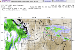
Judging by the Satellite and Radar we should see the first few flakes start to fall by noon, right on schedule. The greatest chance for accumulation won’t be until later this evening though in the 7PM-9PM hour. 5-10cm. Then it will back right off, remain cool, and we’ll be waiting for the next pulse Sunday afternoon. This should be a much stronger push, there will be much greater chance for real accumulation but also greater chance that a gust of wind pushes us into rain territory. It will be unsettled, we might even have snow falling and lightning like they did in the Gulf Islands earlier this week. If it all falls as snow tomorrow you can expect up to 15cm. There will be a chance of freezing rain.
Most of the action will be overnight tonight and tomorrow. What the mornings bring Sunday and Monday will be interesting to see. This whole week looks interesting… still good wind possibilities for Tuesday. That means warmth though, so expect if we do get that far without wet stuff, by Tuesday, there will be slush to contend with.
Have fun!


Hey Chris, its snowing with some wind over here in Langley, as we’re roadtrippin’ to support the Bulldogs.. looks like our trip home tomorrow could be interesting.
Interesting that EC has backed off on the snowfall warnings for the North Island. I’m glad to see that you still have confidence in the snow potential here though, because I’m thinking the amounts might be more at the lower end of the predictions now….
Interesting that EC has backed off on the snowfall warnings for the North Island. I’m glad to see that you still have confidence in the snow potential here though, because I’m thinking the amounts might be more at the lower end of the predictions now….
Nick. Have fun over there! GO DOGS!
Bill: Ya, if it doesn’t start up soon, we’re not gonna get much of anything today. Tomorrow was always slated to be the stronger of the two pushes so we’ll see.
O.K. I might survive……….not sure yet. The clouds are spilling over the Beauforts right at us here in Beaver Creek but obviously will appear as rain! On the upside, I am able to get some outside work done so I’ll forgive you until it starts to rain.
I had a phone message from a friend on Hammond Bay Road in Nanaimo – she says it’s been snowing there since 2 pm. It’s 4C here, so it’s gonna have to cool down some to snow tonight!
Hmmmm….(looking outside), no snow yet. The warmer air and lack of precipitaion has ruined all our fun! Looking at the satellite images I sure don’t see much more coming our way today beyond some light showers, and it’ll be too warm for snow:(
Hmmmm….(looking outside), no snow yet. The warmer air and lack of precipitaion has ruined all our fun! Looking at the satellite images I sure don’t see much more coming our way today beyond some light showers, and it’ll be too warm for snow:(