HEADS UP: In case of dissension in models, hope for the best, prepare for the worst.
I will update this forecast if this mornings run changes things significantly. Stay tuned….
We have precipitation coming at us for Sunday and Monday for sure, however, much like last weekend when the models didn’t all come into agreement until the day before, this weekend we again have disagreement and a lot of variability in the forecasts. It all comes down to our local ability to always hover just around the freezing mark. This is making it very difficult for the models, or anyone to confidentially predict whether each system that passes through will give us snow, sleet, or rain, and usually, it’s some combination of all three based on your local geographical and micro-climate conditions.
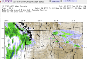
So, you can see the EC forecast at the top of the page as always, so I will give you the UW GFS version of the forecast. Note that last week, it was the GFS that came out the winner and folks in Nanaimo payed the price with over a foot of snow. This weekend might be a repeat.
Friday/Saturday dry
The GFS has the entire island dry. No chance of precipitation. If the fog clears away on Friday it predicts temperatures over 10°C but I would be surprised if we got over our high yesterday of 9.2°C. It should get near zero by Saturday morning and only warm to around 5°C through the day Saturday. This is key to the rest of the weekend.
Sunday/Monday snow or rain?
On Sunday morning there is slated to be cold air all across the Island.
That is going to set us up for a front to come through and give us light snow starting in the late afternoon.

The biggest difference from EC is they are changing this to rain very quickly. The GFS is holding on to the cold through until the front has almost passed Monday afternoon and once again, it will be the south east island and gulf Islands that seem to be in the bullseye.
Here is the total from 4AM Sunday to Monday 4AM. If this forecast holds, plan not to drive or for closures on Monday, especially in the Nanaimo area.
Again I think this is a worst case scenario. Around 15cm (5in) in Alberni, over a foot (30 cm) in Nanaimo. Last weekend, we did get the worst case and then some.
This could be especially bad for Vancouver as it will be a working, commuting day and if it does change to rain, according to this forecast it will be during the commute.


