Freezing temps to end Friday – Headlines – and Comets
This should be our last super cold morning. Beautiful isn’t it? (Click for full size)

Officially at the Airport we got down to -7.8° C on Wednesday morning and so far we are down to -6.9° C this morning. In town here at Alberniweaher we hit a slightly milder -5.3° C yesterday and -4.8° C so far this morning. We set short term records for cold since 1995 at the Airport Tuesday, Wednesday and Thursday. Wednesdays -7.8° C was the coldest official temperature for November 20 since 1977, but it wasn’t anywhere near the November record of -16° C set in 1985. I remember that day! I’m pretty sure David Gibson wore shorts to school at Alberni Elementary and we were jumping on the puddles trying to make them break! 🙂

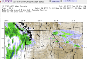
As you can see above, the freezing temperatures should break on Friday as the cold shifts to the East (it’s gonna be -28°C in Regina for the Grey Cup apparently!!). That will allow warmer ocean air to creep back in to the picture.
Contrary to what was printed on the frontpage of the AV Times yesterday, I don’t think we are ‘set to break records’ on the weekend. I actually told them only that we might get warm temperatures for this time of year that could get us into record territory. That would be quite the flip flop from our chilly record cold nights we’ve had the past couple nights. No worries though, that’s just the weather for you, tricky thing weather, and the rest of the article was great! If you are looking for the Climate Change in Port Alberni blog post it mentions, just click the red link at the top left of this page.
That said, the American GFS models have been consistent that there will be a brief push of warm air coming up along the West Coast on the weekend. The image below shows it should peak Sunday evening. You can see the 12°C line just over the south west portion of the Island. 12 would be enough for us to break a record.

But we will see, Environment Canada certainly doesn’t seem to be going along with that plan. The next days worth of forecasts should come into some sort of agreement.
And finally, Comets!
Here is a beautiful picture of Comet ISON which has gotten a ton of press over the past few days as it approaches the sun. It’s been of such great interest because scientists believe it is a comet that has never entered the solar system before, and may never again. It is currently only visible with a clear view of the low southeast sky at dawn. Something we unfortunately do not have. So we will only be able to enjoy it through pictures or by travelling to other parts of the Island with a less mountainous view.
The comet is supposed to reach its closest point to the sun (perihelion) by this time next week. There is uncertainty whether it will survive that journey, or be destroyed. If it is not destroyed, it should swing back around and will hopefully be a rising point in our sky right through Christmas.
For updates and some more great images of comet ISON, check out www.spaceweather.com.


The 12C line is at 925mb (2500ft or 800m) not at the surface. So what may happen is we get a strong inversion with fog. In order to get to 12 or above, the outflow from the high would have to very strong but the wind barbs and gradient just don’t support that. In fact we may not even get as warm as the forecast 6C.
paqqj
Just added a surface profile to todays post. You’re right, we could be stuck in an inversion. But the models have been very consistent on this warm air knocking on our door, including at the surface. We’ll see. 🙂
I know what I *want* to happen: I’d rather be raking leaves in a sweatshirt than a parka.