UPDATED: Chances for snow increasing… Wind coming
Mondays forecast changed a bit… check it out:
It has been an interesting past couple weeks. Our weather pattern has been pretty consistent with shots of rain and precipitation every few days. Slowly but surely though, perhaps just as a sign we are approaching the start of winter, the temperatures have cooled.
Last night there was a lot of mixed rain and sleet falling in the afternoon and evening. Still mostly rain, but it left that crystalline structure on the windshield that gives away its origins.
This weekend gets more interesting. (I will update the graphics again later this morning after the new model run) (Done).
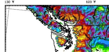
Between 4PM Friday and Saturday the high elevations of the Island are going to get buried in 1-2ft of snow.
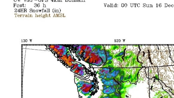
However, as you can see our little pocket stays free of snow, and the temperature map below shows we stay just above freezing.
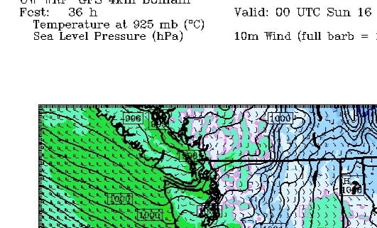
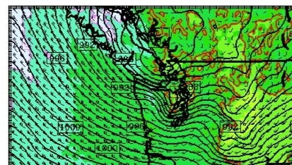
But just because we might not get much snow, doesn’t mean we won’t have some action. We should get some stiff breezes. Check out this map for Saturday morning 7AM.
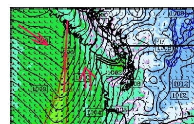
The weather front will be pushing through. You can see the southerly winds blowing hard in front of it. After it passes, the winds will shift to Northwesterlies which should make the rest of the day on Saturday feel pretty chilly. So while we shouldnt expect much on the ground between now and Saturday night there should still be sleet in the air and plenty of snow on Sutton Pass and the Hump. Stay safe Christmas Commuters! (Or better yet stay in town :)).
But we are not done yet fellow weather watchers… (Have I mentioned its killing me that I have no weather station to record all this stuff?).
Sunday night and Monday are looking colder, wetter, perhaps snowier, and definitely windier. Check out the low directly over of us Monday morning… This will mark the break between a blustery, southerly, Sunday night and a chilly, northwesterly Monday afternoon.
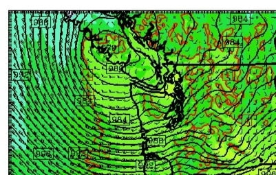
Not only is it looking windy on the West Coast, but also notice the white, below freezing temperatures hanging on on the East Coast. Updated: new imagery now has the cold pulling back before the storm arrives.
Now look at the 24hr snowfall maps through Monday morning… Oops snow on the ground?
Well.. Not quite. Still open in our little Valley though definitely snowy on the Hump. It could be an interesting commute.
But it might not last long because by 10AM we have a storm on top of us:
By 1PM Monday the storm has passed and the winds kick in from the Northwest again, dragging down cold air. BRR.
So the next few days should have a bit of everything. But let’s not stop there. What about Christmas? It is still too early to be confident but this graphic should get you going… 😉
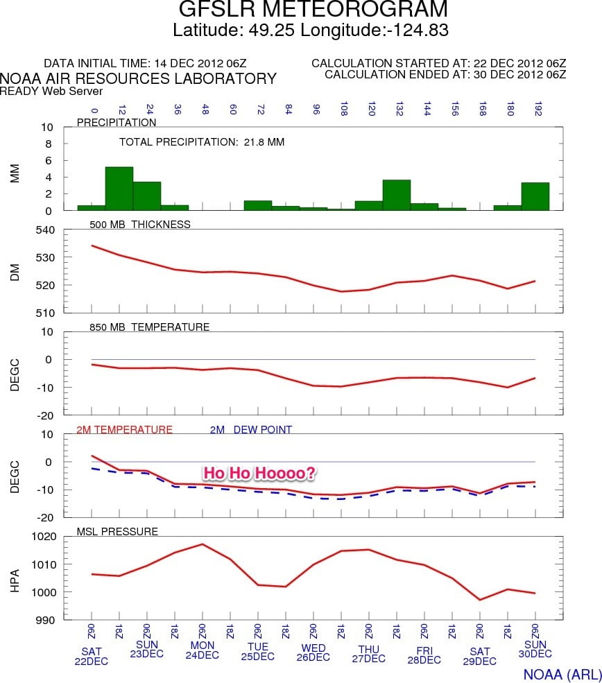
This is the forecast started last night for Christmas week:
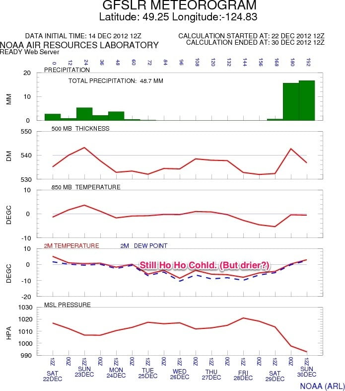
And now the updated forecast released this morning:
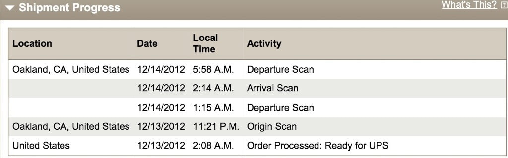
And finally, what about that darned weather station of mine. It’s going on a full month. The story is that Davis messed up last week and UPS sent the fixed station back to them. So it is now on its way again, this time by UPS Expedited (at no extra cost to me, thankfully) and it should be here promptly on Monday morning. I hope it gets here in one piece and I can have it installed ASAP (preferably not in the snow).


Great interpretation Chris! I saw that temperature slide next week and it could get real interesting. Not too much precipitation in the model, but just enough for a good white frosting, if the forecast “sticks”.
Thanks! Ya… I am waiting with bated breath for Christmas to creep into the short term forecast. But it does seem to be trending cooler but not too much drier. 🙂